MyTopo
Classic USGS Battle Mountain Oregon 7.5'x7.5' Topo Map
Couldn't load pickup availability
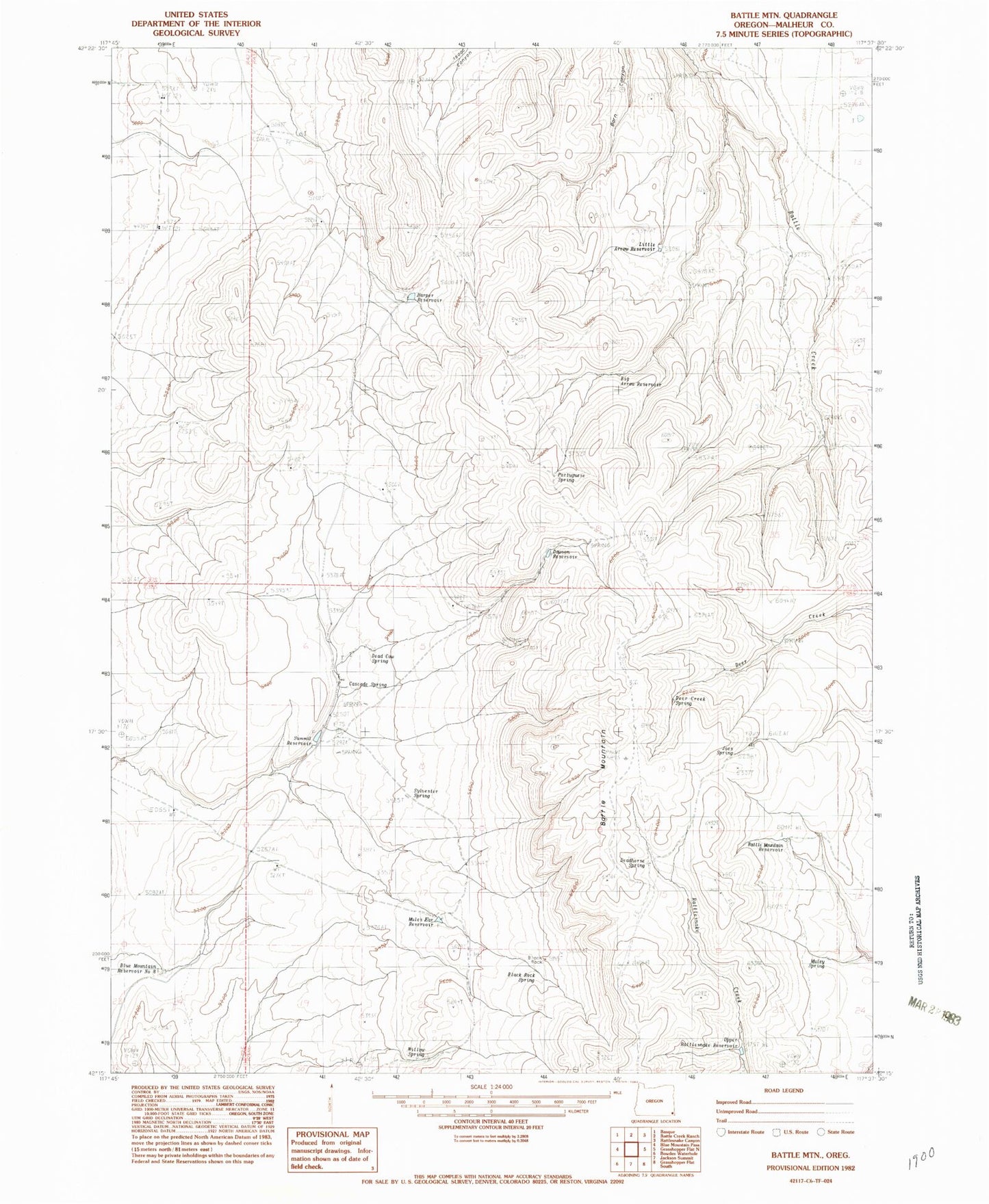
Historical USGS topographic quad map of Battle Mountain in the state of Oregon. Map scale may vary for some years, but is generally around 1:24,000. Print size is approximately 24" x 27"
This quadrangle is in the following counties: Malheur.
The map contains contour lines, roads, rivers, towns, and lakes. Printed on high-quality waterproof paper with UV fade-resistant inks, and shipped rolled.
Contains the following named places: Battle Mountain, Battle Mountain Reservoir, Big Arrow Reservoir, Black Rock, Black Rock Spring, Blue Mountain Reservoir Number 8, Cascade Spring, Dawson Reservoir, Dead Cow Spring, Deadhorse Spring, Deer Creek Spring, Harper Reservoir, Joes Spring, Little Arrow Reservoir, Mules Ear Reservoir, Muley Spring, Portuguese Spring, Summit Reservoir, Sylvester Spring, Upper Rattlesnake Reservoir, Willow Spring