
MyTopo
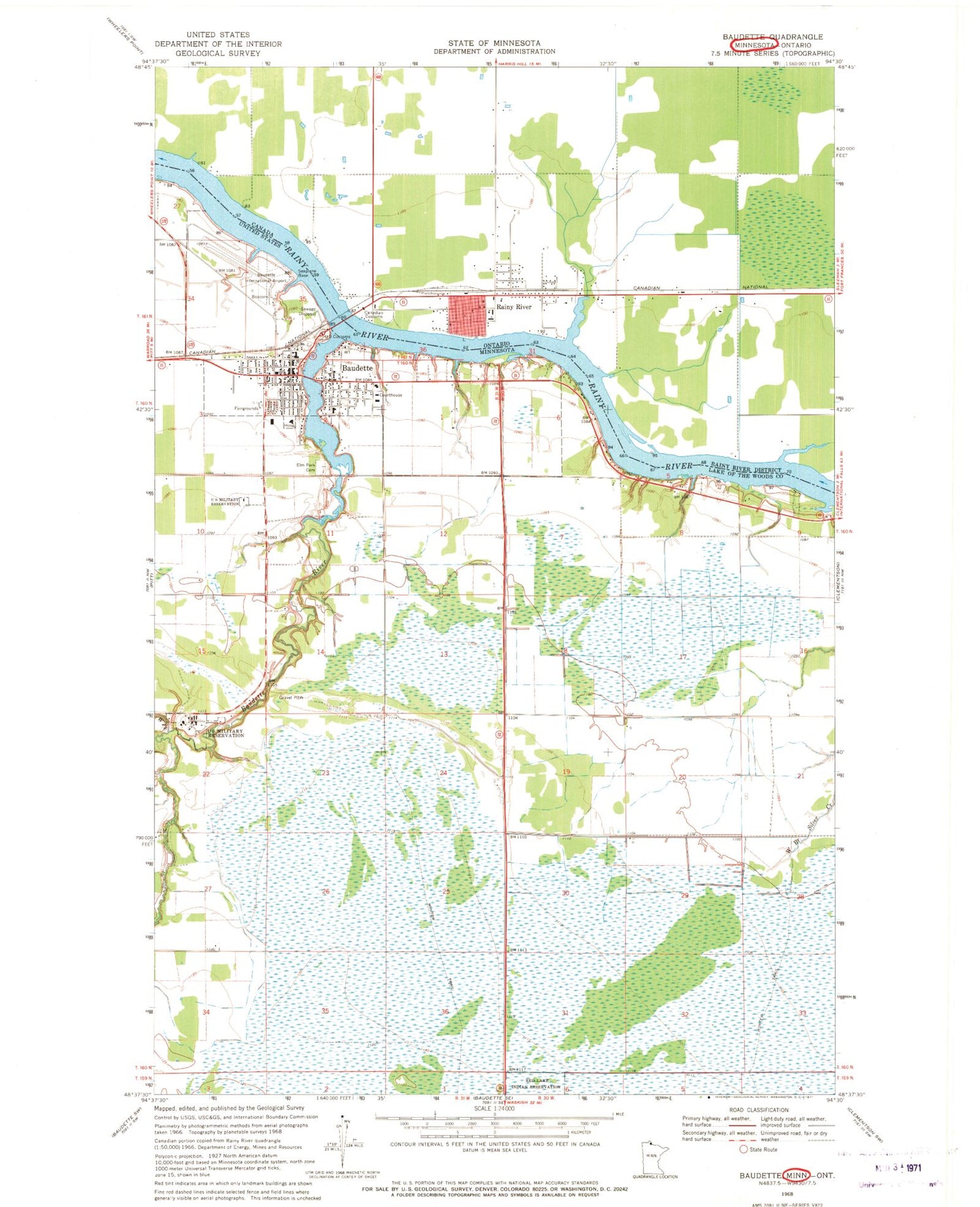
Classic USGS Baudette Minnesota 7.5'x7.5' Topo Map
Couldn't load pickup availability
Historical USGS topographic quad map of Baudette in the state of Minnesota. Map scale may vary for some years, but is generally around 1:24,000. Print size is approximately 24" x 27"
This quadrangle is in the following counties: Lake of the Woods.
The map contains contour lines, roads, rivers, towns, and lakes. Printed on high-quality waterproof paper with UV fade-resistant inks, and shipped rolled.
Contains the following named places: Altru Clinic, Baudette, Baudette Air Force Station, Baudette City Hall, Baudette International Airport, Baudette International Bridge, Baudette Police Department, Baudette Post Office, Baudette Public Library, Baudette Rest Area, Baudette River, Baudette Station, Baudette Volunteer Fire Department, Bethlehem Lutheran Church, City of Baudette, Corner Stone Assembly Church, Elm Park Cemetery, Evangelical Covenant Church, First Congregational Church, First Lutheran Church, Great Fire of 1910 Historical Marker, Judy's East Side Trailer Park, Kingdom Hall of Jehovah's Witnesses, Lake of the Woods Ambulance, Lake of the Woods Church of the Living Water, Lake of the Woods County Courthouse, Lake of the Woods County Fairgrounds, Lake of the Woods County Jail, Lake of the Woods County Museum, Lake of the Woods County Sheriff's Office, Lakewood Care Center, LakeWood Health Center, Massacre Island Historical Marker, Peace Park, Sacred Heart Church, Seventh Day Adventist Church, Spooner Post Office, Timber Mill Park, United States Customs and Border Protection - Port of Entry - Baudette, Unorganized Territory of District 1, West Fork Baudette River, Willie Walleye Statue


