MyTopo
Classic USGS Bauerman Ridge Washington 7.5'x7.5' Topo Map
Regular price
$16.95
Regular price
Sale price
$16.95
Unit price
per
Couldn't load pickup availability
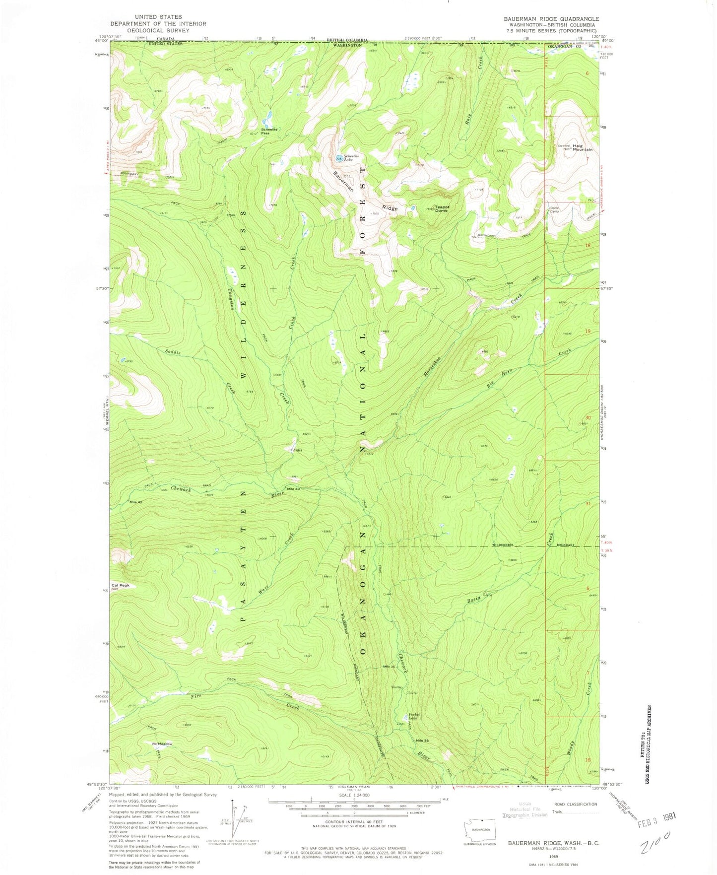
Historical USGS topographic quad map of Bauerman Ridge in the state of Washington. Typical map scale is 1:24,000, but may vary for certain years, if available. Print size: 24" x 27"
This quadrangle is in the following counties: Okanogan.
The map contains contour lines, roads, rivers, towns, and lakes. Printed on high-quality waterproof paper with UV fade-resistant inks, and shipped rolled.
Contains the following named places: Basin Creek, Bauerman Ridge, Big Horn Creek, Cinch Creek, Dome Camp, Fire Creek, Haig Mountain, Horseshoe Creek, Pocket Lake, Saddle Creek, Scheelite Lake, Scheelite Pass, Teapot Dome, Tungsten Creek, Vic Meadow, Wave Creek