MyTopo
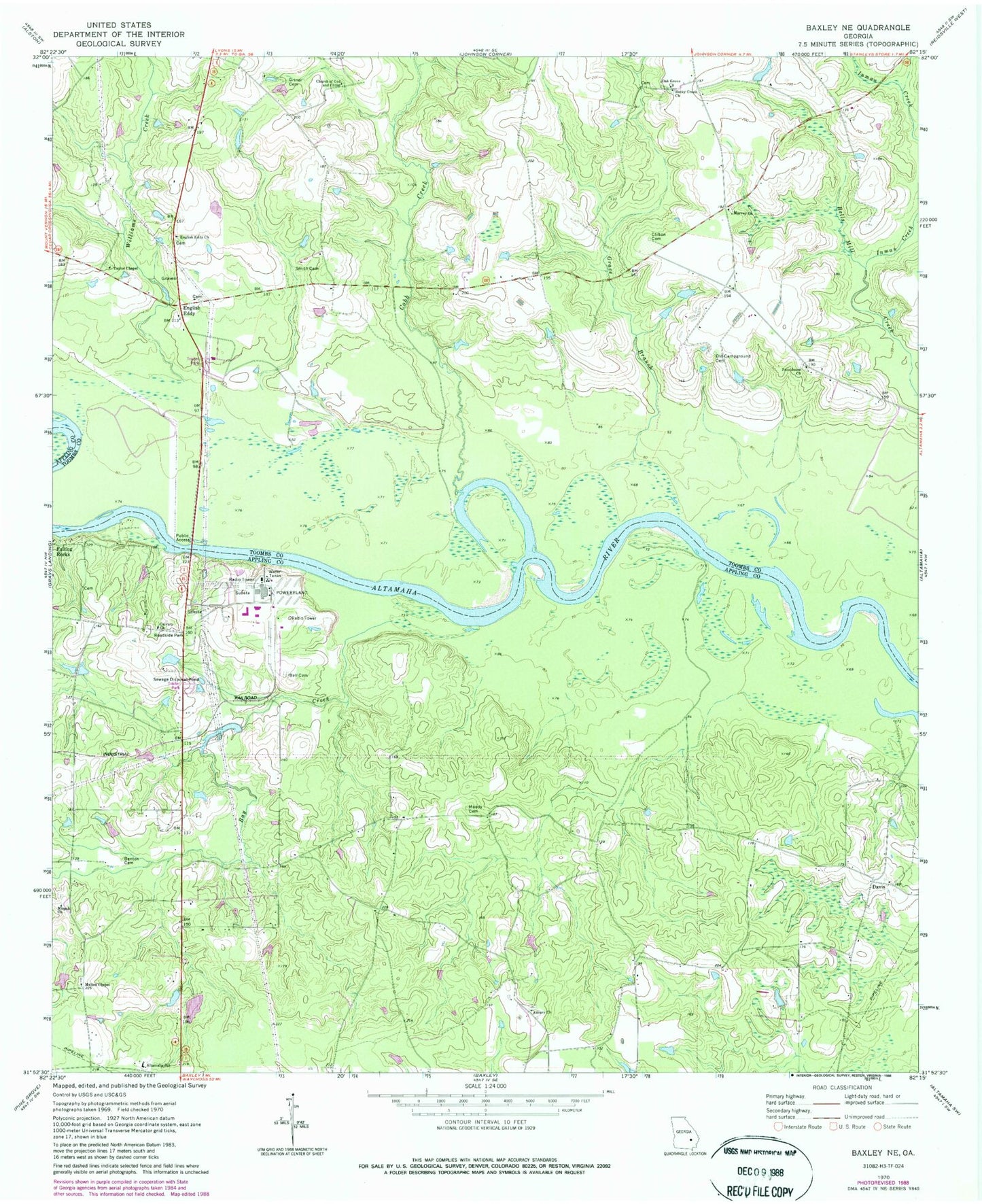
Classic USGS Baxley NE Georgia 7.5'x7.5' Topo Map
Couldn't load pickup availability
Historical USGS topographic quad map of Baxley NE in the state of Georgia. Map scale may vary for some years, but is generally around 1:24,000. Print size is approximately 24" x 27"
This quadrangle is in the following counties: Appling, Toombs.
The map contains contour lines, roads, rivers, towns, and lakes. Printed on high-quality waterproof paper with UV fade-resistant inks, and shipped rolled.
Contains the following named places: Altamaha Elementary School, Altamaha River Division, Appling County Fire Department Altamaha Station, Asbury United Methodist Church, Bay Creek, Bell Cemetery, Benton Cemetery, Calvary Missionary Baptist Church, Church of God and Christ, Clifton Cemetery, Cobb Creek, Corbetts Chapel, Davis, Deen Cemetery, Deens Landing, English Eddy, English Eddy Church, Falling Rocks, Georgia Power Plant Hatch, Grace Branch, Griner Cemetery, Hatch Nuclear Power Plant, Inman Creek, Joseph Simmons Alexander Senior Memorial Bridge, Lewis Lake, Lewis Lake Dam, Mann - Oquin Cemetery, Marvey Church, Marvin Yancey School, Meltons Chapel United Methodist Church, Mizpah Baptist Church, Moody Cemetery, Oak Grove Church, Old Campground Cemetery, Perrys Mill Bridge, Piney Bluff, Piney Bluff Ferry, Providence Church, Riverside Missionary Baptist Church, Rocky Creek Church, Sharpes Landing, Smith Cemetery, Taylor Chapel, Williams Creek