MyTopo
Classic USGS Baxter Tennessee 7.5'x7.5' Topo Map
Couldn't load pickup availability
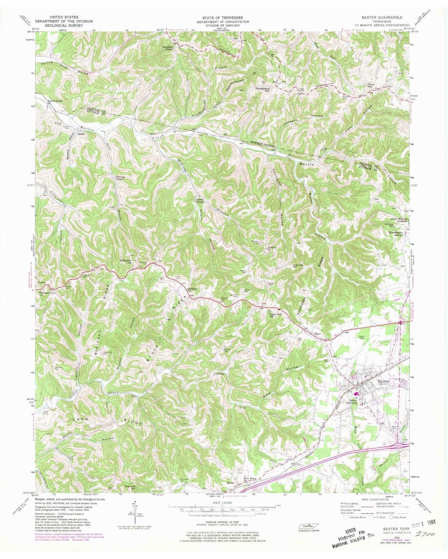
Historical USGS topographic quad map of Baxter in the state of Tennessee. Map scale may vary for some years, but is generally around 1:24,000. Print size is approximately 24" x 27"
This quadrangle is in the following counties: Jackson, Putnam.
The map contains contour lines, roads, rivers, towns, and lakes. Printed on high-quality waterproof paper with UV fade-resistant inks, and shipped rolled.
Contains the following named places: Albert Dyer Cemetery, Alcorn Hollow, Alcorn Hollow Branch, Allens Chapel, Antioch Church, Bartlett Cemetery, Baxter, Baxter City Hall, Baxter Division, Baxter Elementary School, Baxter Fire Department, Baxter First Baptist Church, Baxter Police Department, Baxter Post Office, Baxter Public Library, Baxter Seminary, Bethany Church, Boma, Boma School, Boyd Hollow, Boyd Hollow Branch, Brown Hollow, Brown Hollow Branch, Brown Ridge, Bruce Ridge, Bryant Cemetery, Bryant Hollow, Bryant Hollow Branch, Bryant Ridge, Buffalo Valley Division, Campbell Cemetery, Carr Ridge, Carrington Hollow, Carter Cemetery, Cedar Hill, Cedar Hill Baptist Church, Cedar Hill School, Commissioner District 8, Davidson Chapel, Dyer Cemetery, Dyer Ridge, Edmond Cemetery, Elrod Cemetery, Ensor, Flatt Hollow, Free Union Church, Gentry, Gentry School, Goolsby Ridge, Hatfield Hollow, Helms Cemetery, Hopewell Church, Hopewell School, Hughes Cemetery, Ivy Gap, James F Boyd Cemetery, Jared Cemetery, Johnson Hollow, Lafayette, Lafayette School, Leftwich Cemetery, Leftwich Hollow, Leftwich Hollow Branch, Little Puncheoncamp Branch, Maddux Cemetery, Maddux Chapel, Marlow Cemetery, Martin Creek Church, Mathis Cemetery, Maxwell Branch, Maxwell Cemetery, McBroom Branch, McReynolds Cemetery, New Home Church, Nichols Cemetery, Odd Fellows Cemetery, Philadelphia Church, Philadelphia School, Pippin Cemetery, Pleasant Grove Church, Puncheoncamp Branch, Putnam County Fire Department Station 32, Putnam County Fire Department Station 34, Robinson Cemetery, Robinson Ridge, Rodgers Cemetery, Rogers Cemetery, Sadler, Sam Flatt Cemetery, Shaw Branch, Skimiehan Cemetery, Smellage Cemetery, Stanton Cemetery, Stanton Chapel, Stanton Hollow, Stewart Cemetery, Thompson Ridge, Town of Baxter, Union Church, Union Hill, Union School, Upperman High School, Walter Cemetery, Wayland Lake, Wayland Lake Dam, Whitaker Cemetery, White Church, ZIP Code: 38545