MyTopo
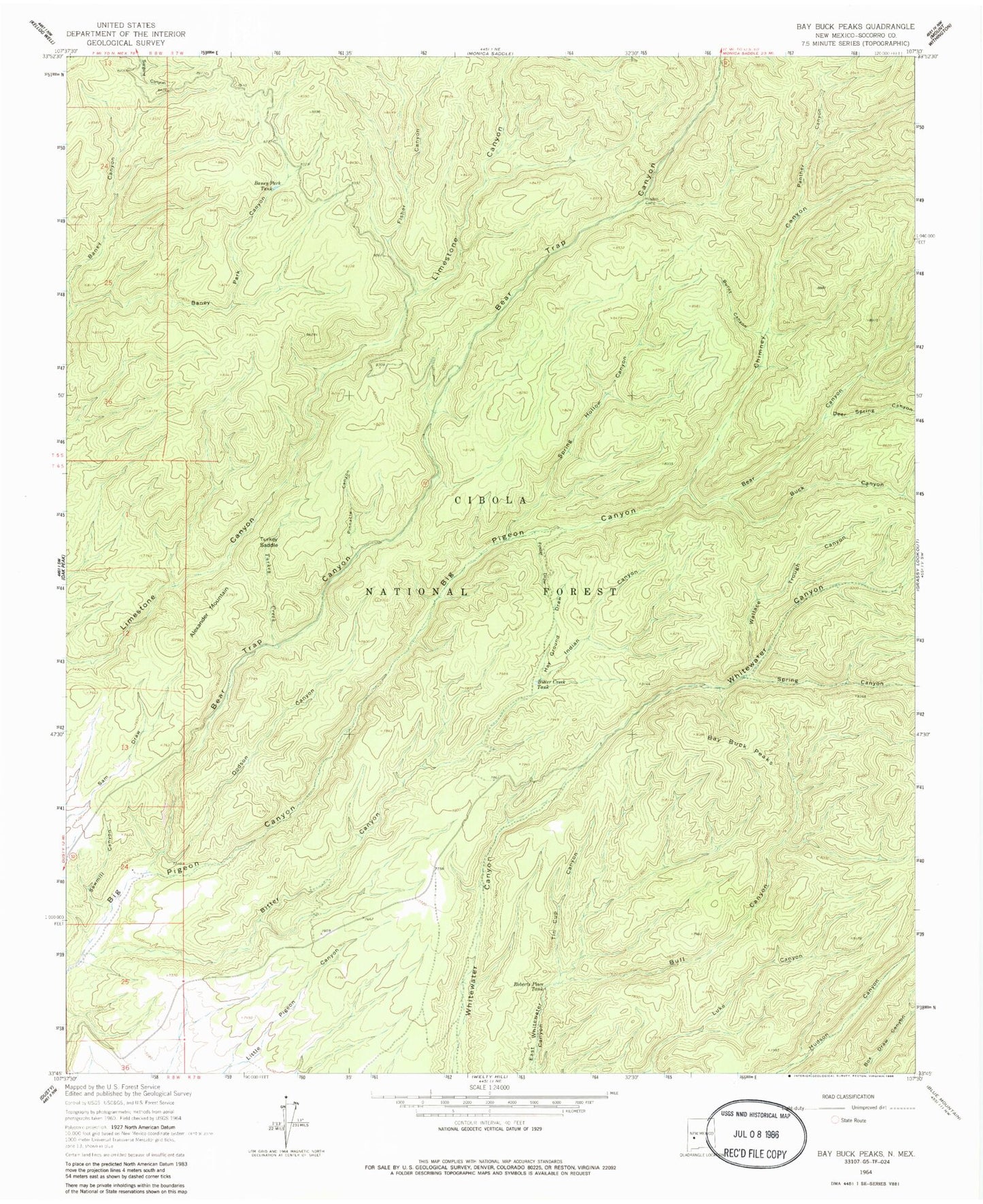
Classic USGS Bay Buck Peaks New Mexico 7.5'x7.5' Topo Map
Couldn't load pickup availability
Historical USGS topographic quad map of Bay Buck Peaks in the state of New Mexico. Typical map scale is 1:24,000, but may vary for certain years, if available. Print size: 24" x 27"
This quadrangle is in the following counties: Socorro.
The map contains contour lines, roads, rivers, towns, and lakes. Printed on high-quality waterproof paper with UV fade-resistant inks, and shipped rolled.
Contains the following named places: Alexander Mountain, Baney Park Canyon, Baney Park Tank, Bay Buck Peaks, Bear Canyon, Bear Trap Canyon, Bitter Canyon, Bitter Creek Tank, Buck Canyon, Bull Canyon, Burnt Canyon, Chimney Canyon, Deer Spring Canyon, Dodson Canyon, Fisher Canyon, Foster Draw, Hughes Campground, Indian Canyon, Panther Canyon, Pinnacle Canyon, Roberts Place Tank, Sawmill Canyon, Spring Canyon, Spring Hollow Canyon, Tin Cup Canyon, Turkey Creek, Turkey Saddle, Wallace Trough Canyon, Boulder Tank, Pigeon Tank, Mouth of Bear Ranch (historical), Trough Spring, Bear Trap Corral, Scrapes Windmill, Hay Ground Draw