MyTopo
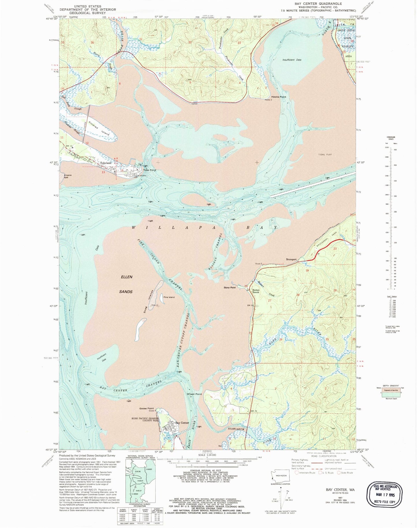
Classic USGS Bay Center Washington 7.5'x7.5' Topo Map
Couldn't load pickup availability
Historical USGS topographic quad map of Bay Center in the state of Washington. Map scale may vary for some years, but is generally around 1:24,000. Print size is approximately 24" x 27"
This quadrangle is in the following counties: Pacific.
The map contains contour lines, roads, rivers, towns, and lakes. Printed on high-quality waterproof paper with UV fade-resistant inks, and shipped rolled.
Contains the following named places: Bay Center, Bay Center Channel, Bay Center Cutoff Channel, Bay Center Post Office, Bayshore Recreational Vehicle Park, Bone River, Bruceport, Bruceport Park, Bush Pioneer County Park, Cedar River, Ellen Sands, Freshwater Creek, Goose Point, Hansen Creek, Hawks Point, Holton Ranch, Kindred Island, Kindred Slough, Niawiakum River, Norris Slough, North River, Pacific County Fire District 5 Station 2, Palix River, Pine Island, Pine Island Channel, Russell Channel, Smith Creek, Snag Islands, Stony Point, Teal Duck Slough, Toke Point, Tokeland, Tokeland Census Designated Place, Tokeland Marina, Venice, Wilson Point, ZIP Code: 98590