MyTopo
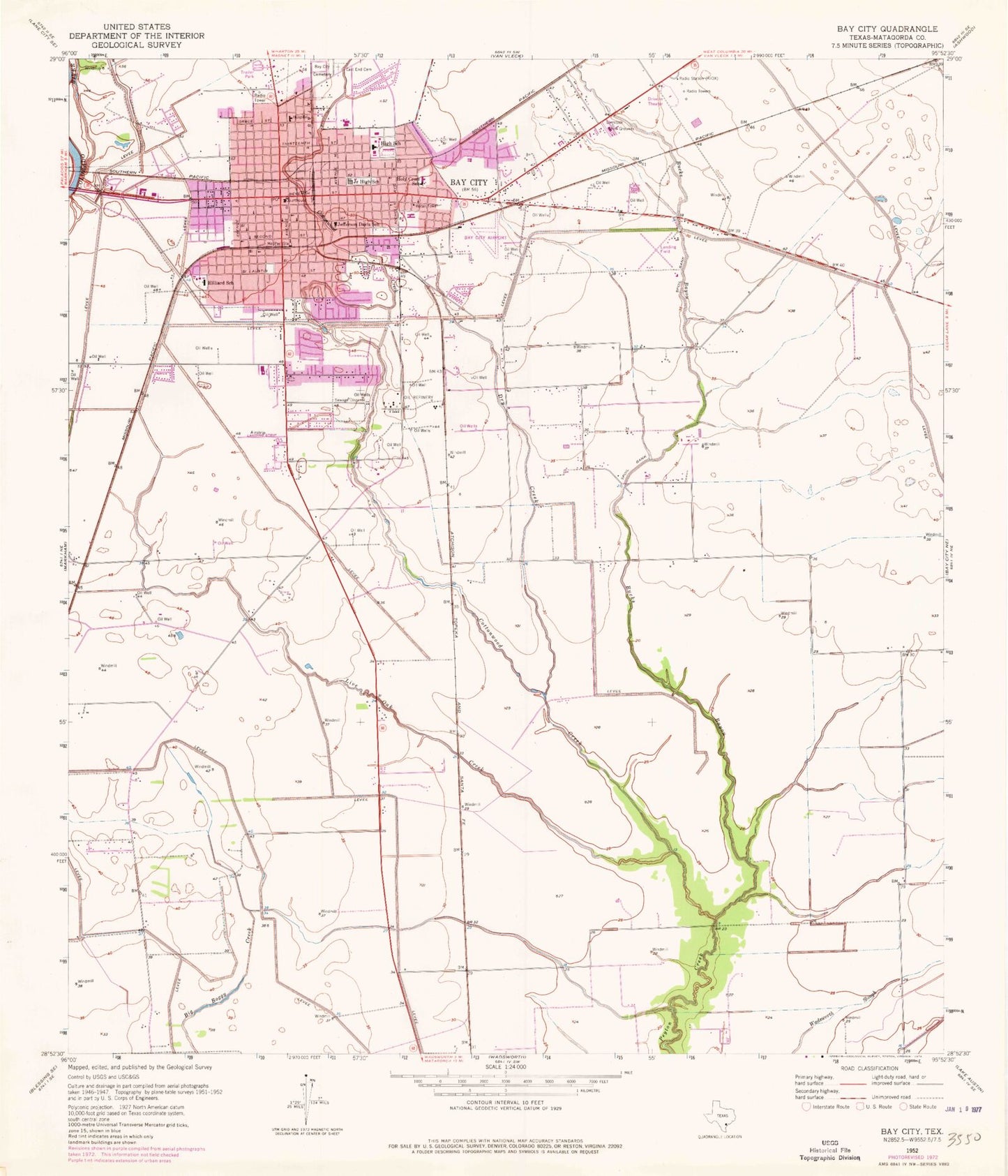
Classic USGS Bay City Texas 7.5'x7.5' Topo Map
Couldn't load pickup availability
Historical USGS topographic quad map of Bay City in the state of Texas. Map scale may vary for some years, but is generally around 1:24,000. Print size is approximately 24" x 27"
This quadrangle is in the following counties: Matagorda.
The map contains contour lines, roads, rivers, towns, and lakes. Printed on high-quality waterproof paper with UV fade-resistant inks, and shipped rolled.
Contains the following named places: Bay City, Bay City Fire Marshal's Office, Bay City Hall, Bay City Independent School District Police Department, Bay City Junior High School, Bay City Middle School, Bay City Police Department, Bay City Post Office, Bay City Volunteer Fire Department, Bucks Bayou, Cedarvale Bay City Cemetery, City of Bay City, Cottonwood Creek, Dry Creek, East End Cemetery, Fehmel Dusting Service Airport, Hilliard School, Holy Cross School, Jefferson Davis School, John H Cherry Elementary School, KIOX-AM (Bay City), KMKS-FM (Bay City), Linnie Roberts Elementary School, Live Oak Creek, Matagorda County Constable's Office Precinct 1, Matagorda County Courthouse, Matagorda County Emergency Medical Service, Matagorda County Jail, Matagorda County Juvenile Justice Alternative Education School, Matagorda County Museum, Matagorda County Sheriff's Office, Matagorda Regional Medical Center, McAllister Middle School, Pierce Campus Bay City Independent School District Public Information and Communications Office, Tenie Holmes Elementary School