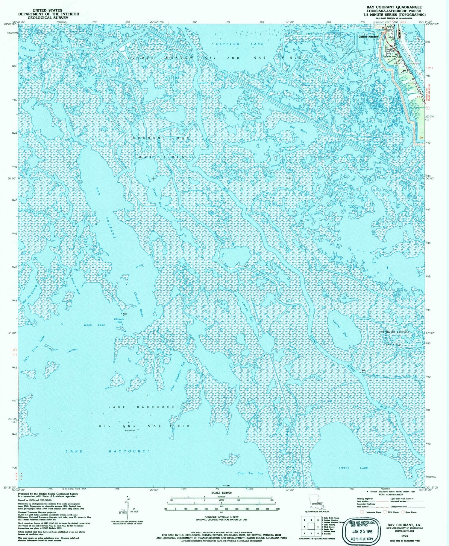

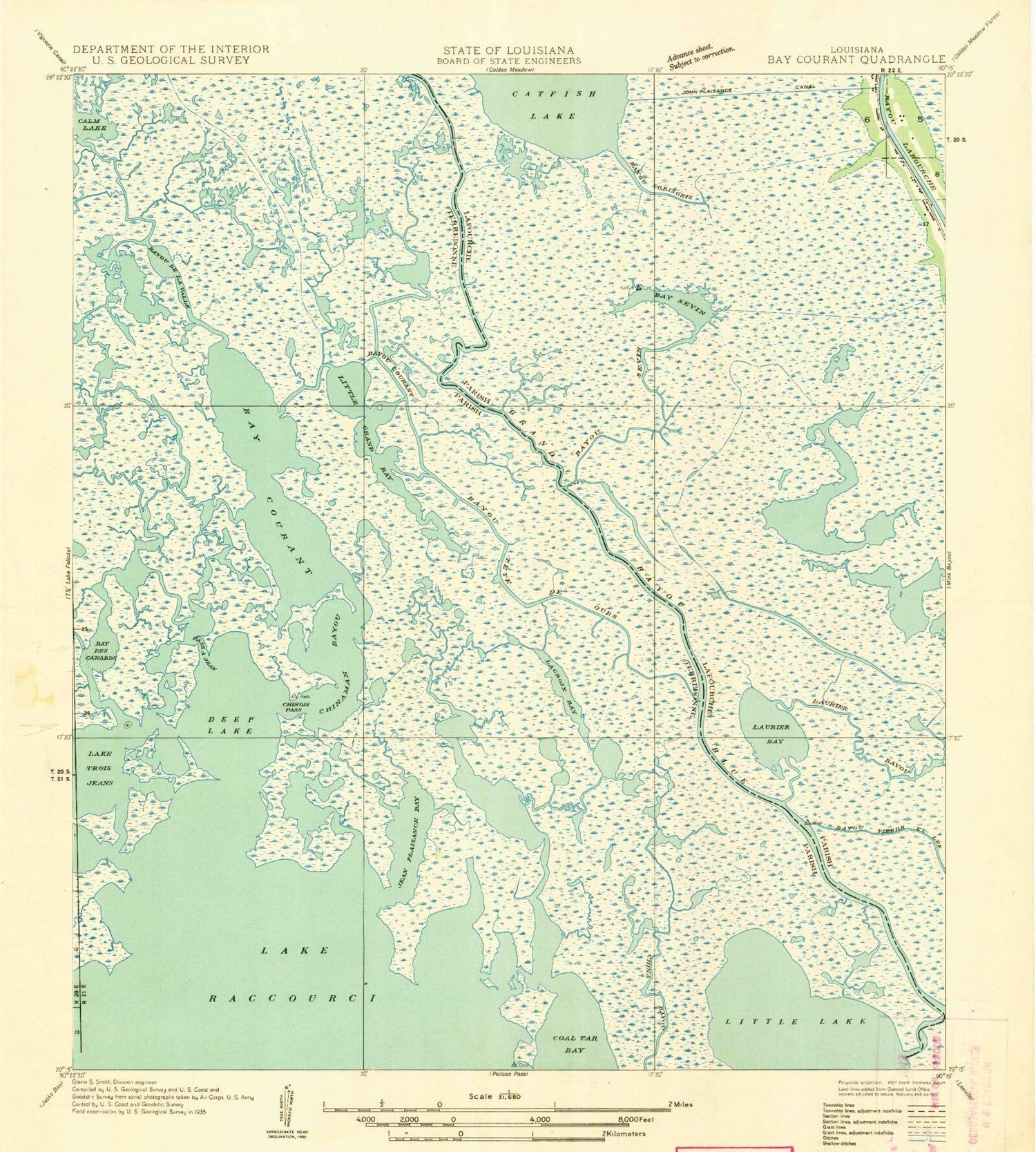
MyTopo
Classic USGS Bay Courant Louisiana 7.5'x7.5' Topo Map
Couldn't load pickup availability
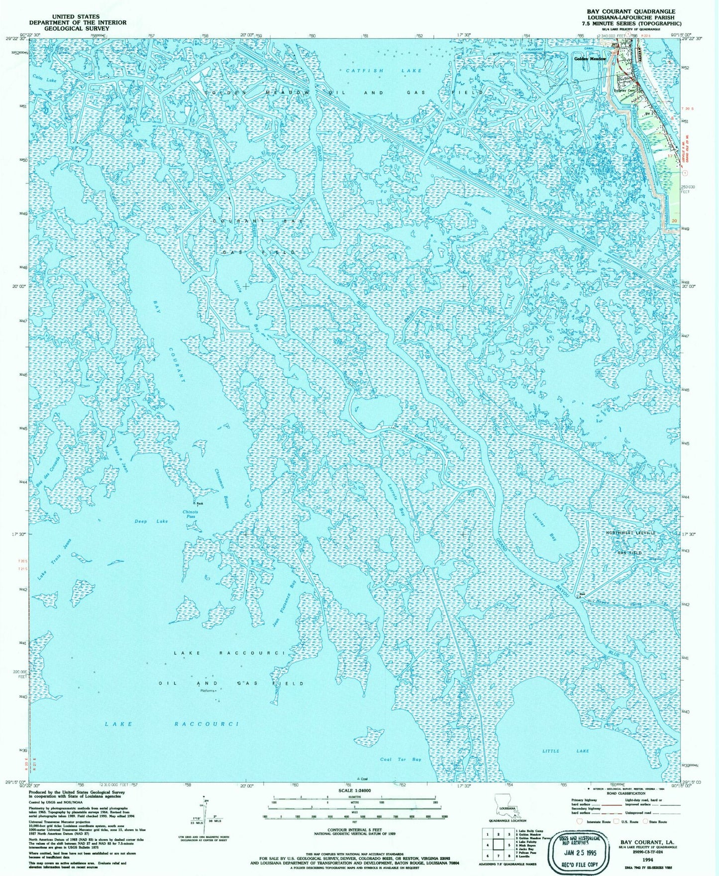
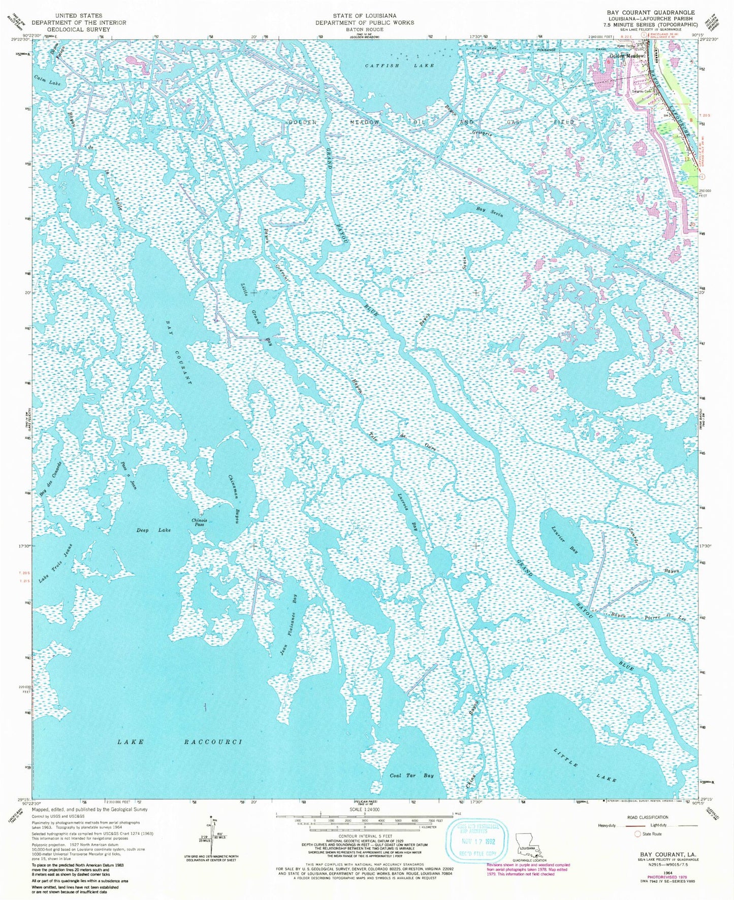
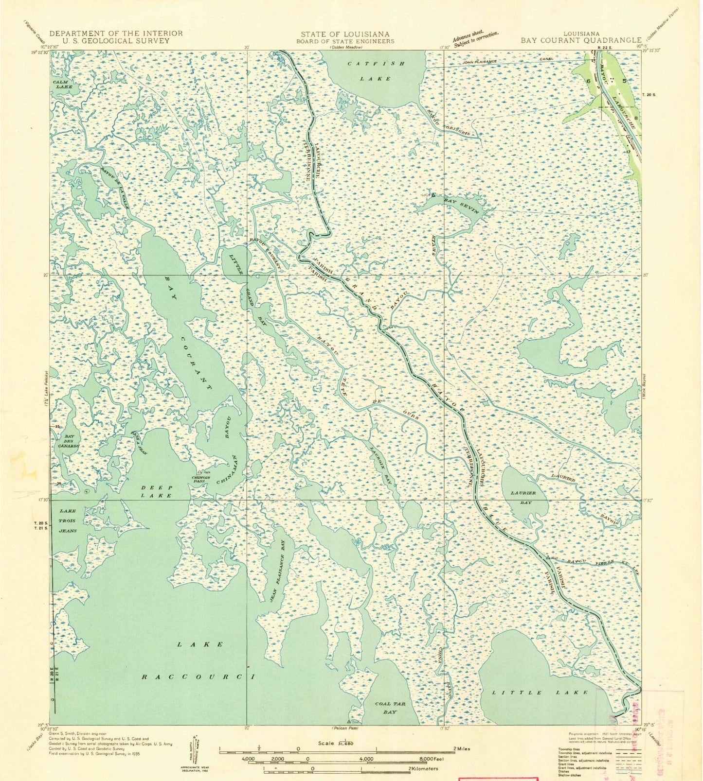
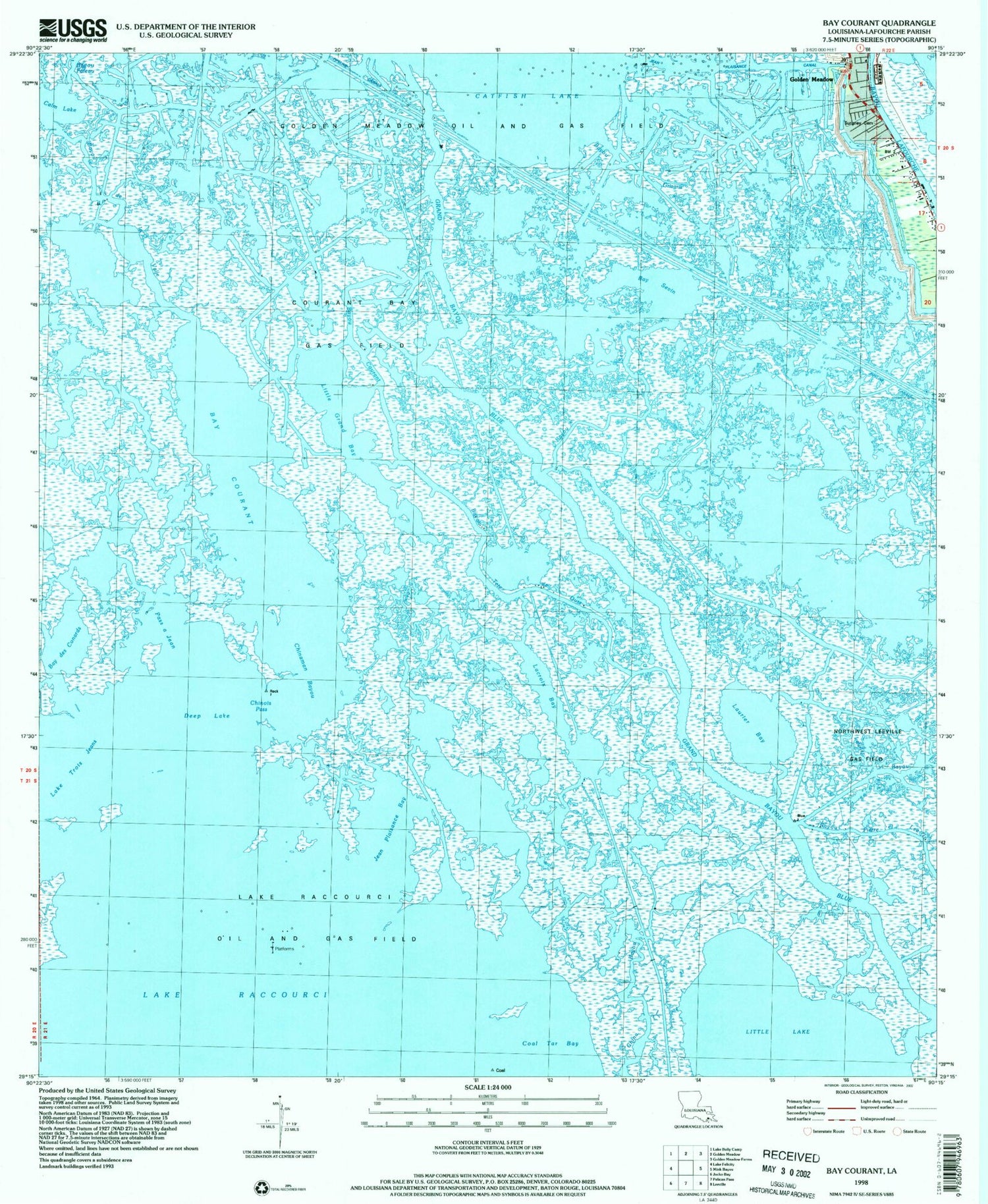
Historical USGS topographic quad map of Bay Courant in the state of Louisiana. Map scale may vary for some years, but is generally around 1:24,000. Print size is approximately 24" x 27"
This quadrangle is in the following counties: Lafourche.
The map contains contour lines, roads, rivers, towns, and lakes. Printed on high-quality waterproof paper with UV fade-resistant inks, and shipped rolled.
Contains the following named places: Bay Courant, Bay des Conards, Bay Sevin, Bayou Courant, Bayou de la Valle, Bayou Grisgris, Bayou Pierre Et Lee, Bayou Sevin, Bayou Tete De Ours, Calm Lake, China Bayou, Chinaman Bayou, Chinois Pass, Courant Bay Gas Field, Deep Lake, Golden Meadow Oil and Gas Field, Grand Bayou Blue, Jean Plaisance Bay, Jean Plaisance Canal, Lacroix Bay, Lake Raccourci Oil and Gas Field, Lake Trois Jeans, Laurier Bay, Laurier Bayou, Little Grand Bay, Northwest Leeville Gas Field, Pass a Jean, Surgney Cemetery