MyTopo
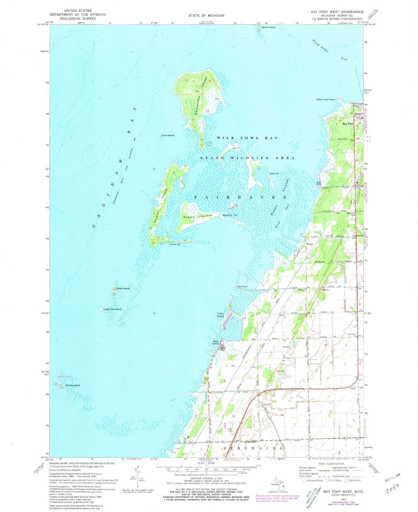
Classic USGS Bay Port West Michigan 7.5'x7.5' Topo Map
Couldn't load pickup availability
Historical USGS topographic quad map of Bay Port West in the state of Michigan. Map scale may vary for some years, but is generally around 1:24,000. Print size is approximately 24" x 27"
This quadrangle is in the following counties: Huron.
The map contains contour lines, roads, rivers, towns, and lakes. Printed on high-quality waterproof paper with UV fade-resistant inks, and shipped rolled.
Contains the following named places: Bay Port Cemetery, Bay Port Police Department, Bayside Estates Mobile Home Park, Blind Pass, Boxcar Cut, Community of Christ Church, Defoe Island, Duck Island, Dynamite Cut, Fairhaven Church, Fairhaven Township Fire Department, Faith Bible Church, Great Fire of 1881 Historical Marker, Heisterman Island, Henne Drain, Lone Tree Island, Maisou Island, Middle Grounds, Middle Grounds Island, North Island, Pitchers Reef, Rose Island, Rush Cut, Sanford Brown Roadside Park, Shebeon Creek, Tarry Post Office, Tarry Station, Valley Island, Weale, Wild Fowl Bay State Park, Wild Fowl Point, WWMI-FM (Sebewaing)