
MyTopo
Classic USGS Bay Ronquille Louisiana 7.5'x7.5' Topo Map
Regular price
$16.95
Regular price
Sale price
$16.95
Unit price
per
Couldn't load pickup availability
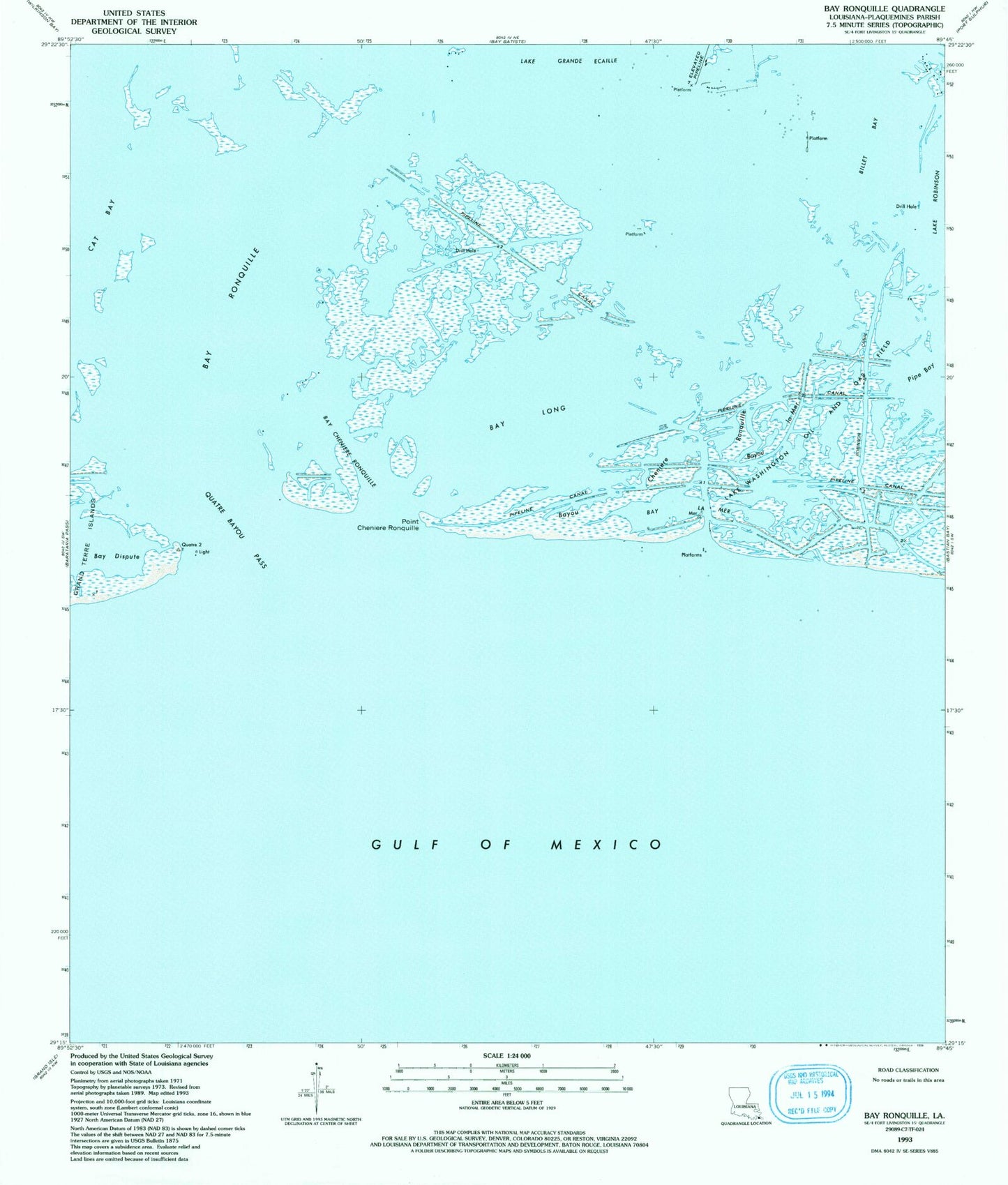
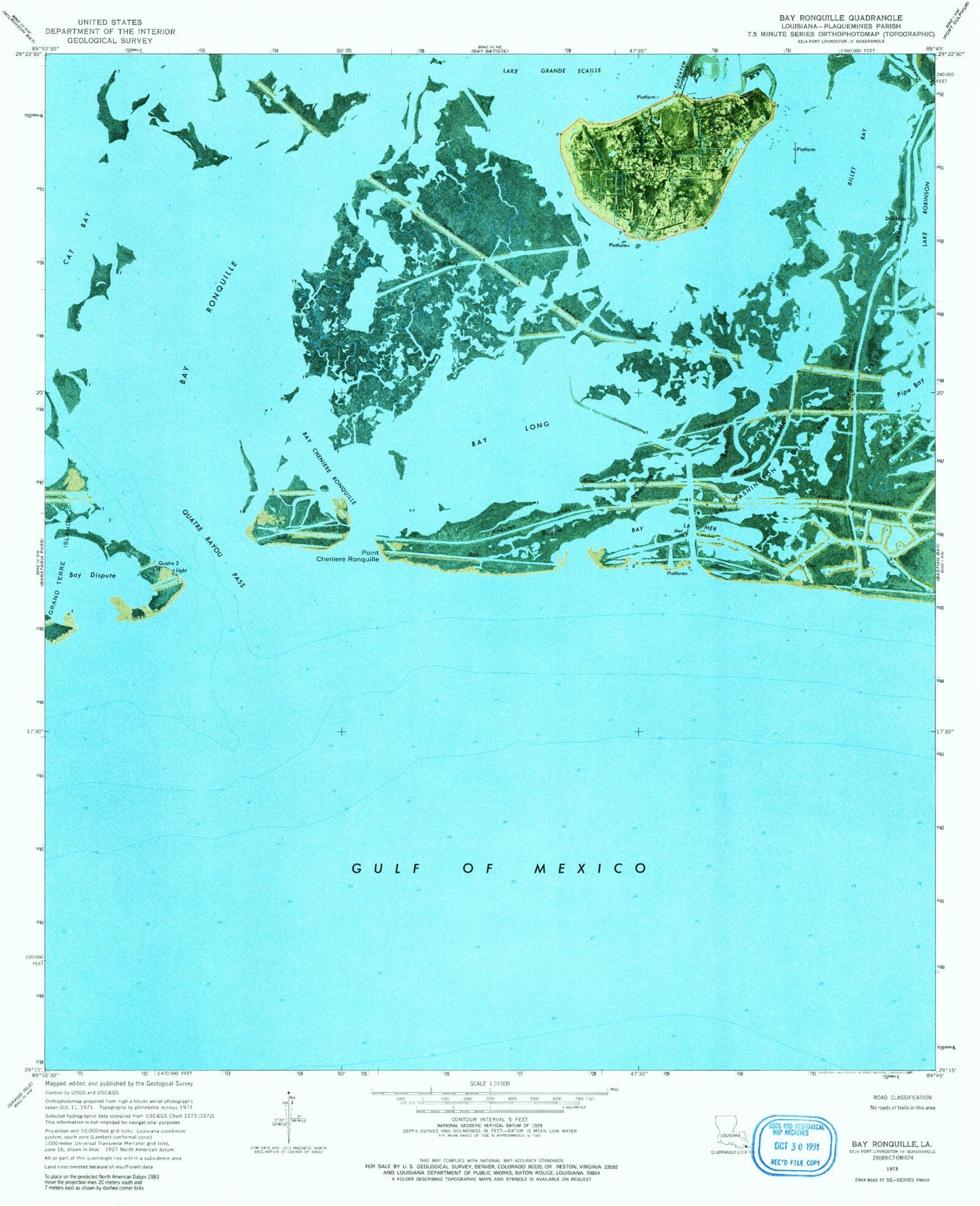
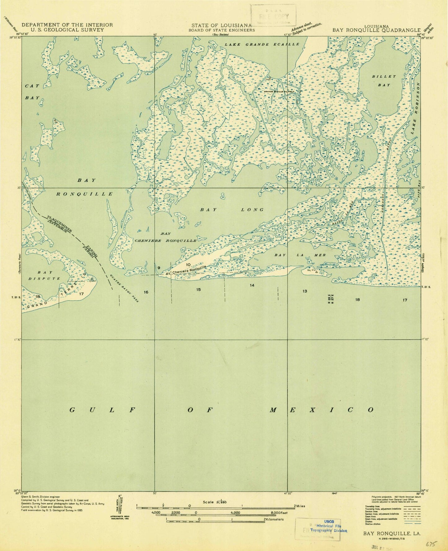
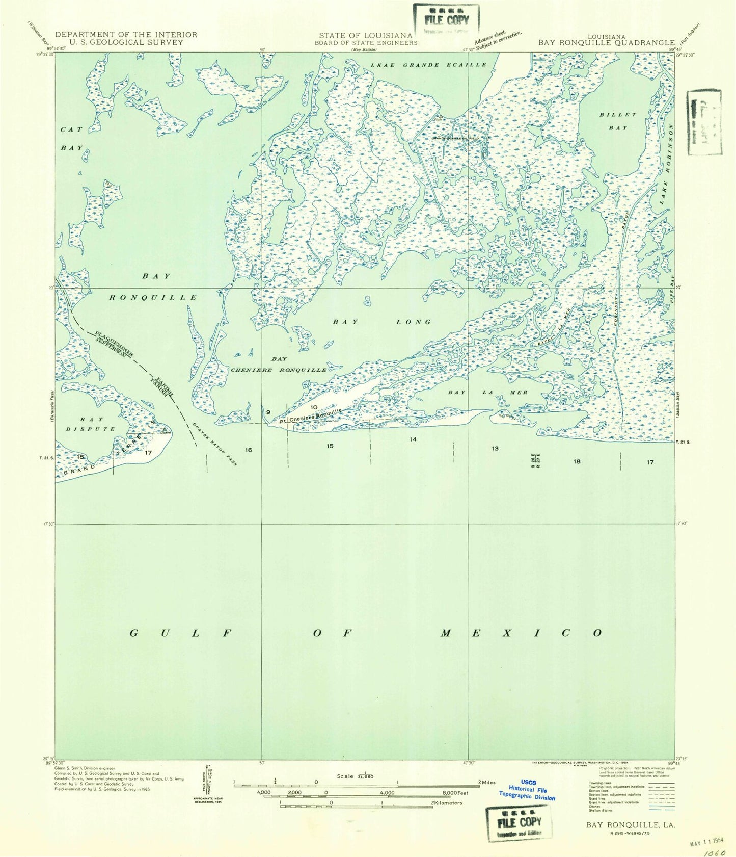
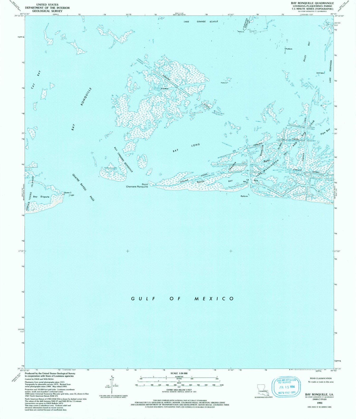
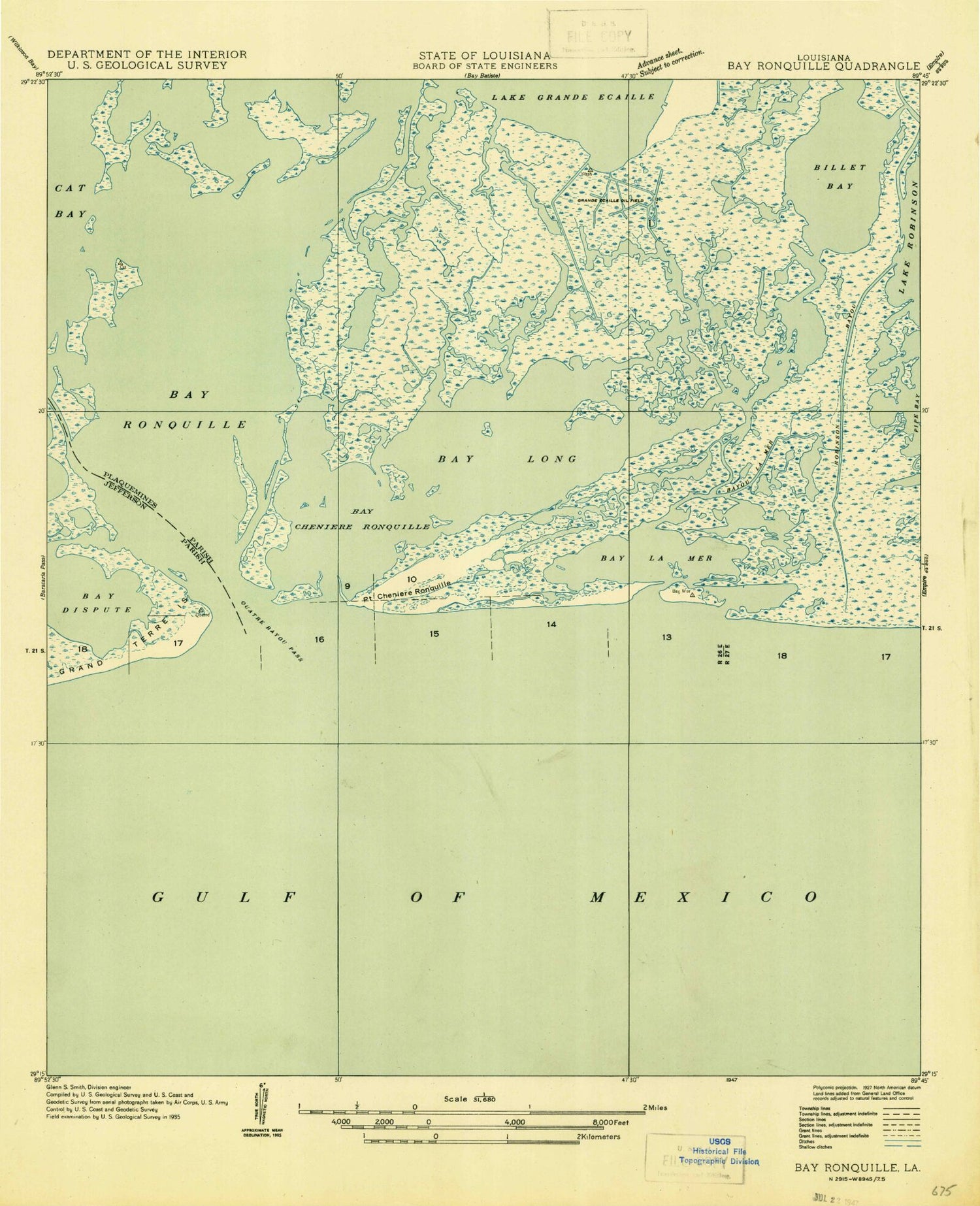
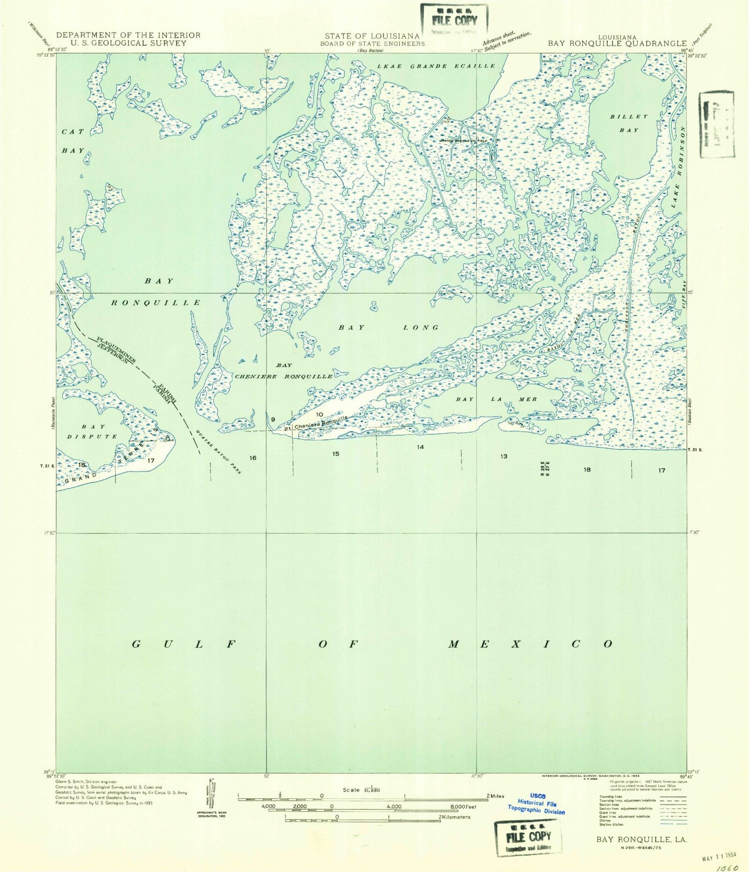
Historical USGS topographic quad map of Bay Ronquille in the state of Louisiana. Map scale may vary for some years, but is generally around 1:24,000. Print size is approximately 24" x 27"
This quadrangle is in the following counties: Plaquemines.
The map contains contour lines, roads, rivers, towns, and lakes. Printed on high-quality waterproof paper with UV fade-resistant inks, and shipped rolled.
Contains the following named places: Bay Cheniere Ronquille, Bay Dispute, Bay La Mer, Bay Long, Bay Ronquille, Bayou Cheniere Ronquille, Bayou la Mer, Billet Bay, Pipe Bay, Point Cheniere Ronquille, Quatre Bayou Pass