
MyTopo
Classic USGS Bay Tambour Louisiana 7.5'x7.5' Topo Map
Couldn't load pickup availability
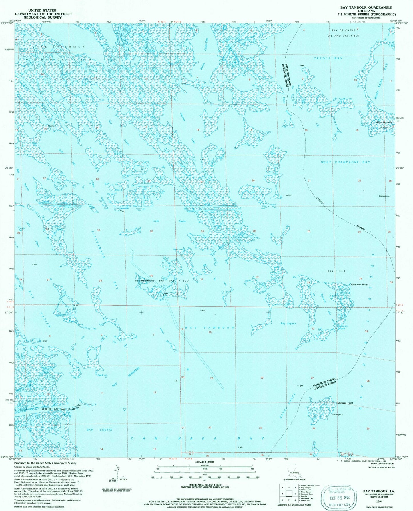
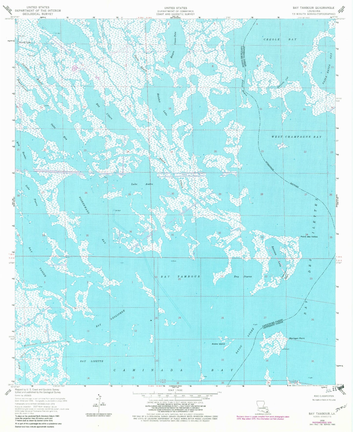
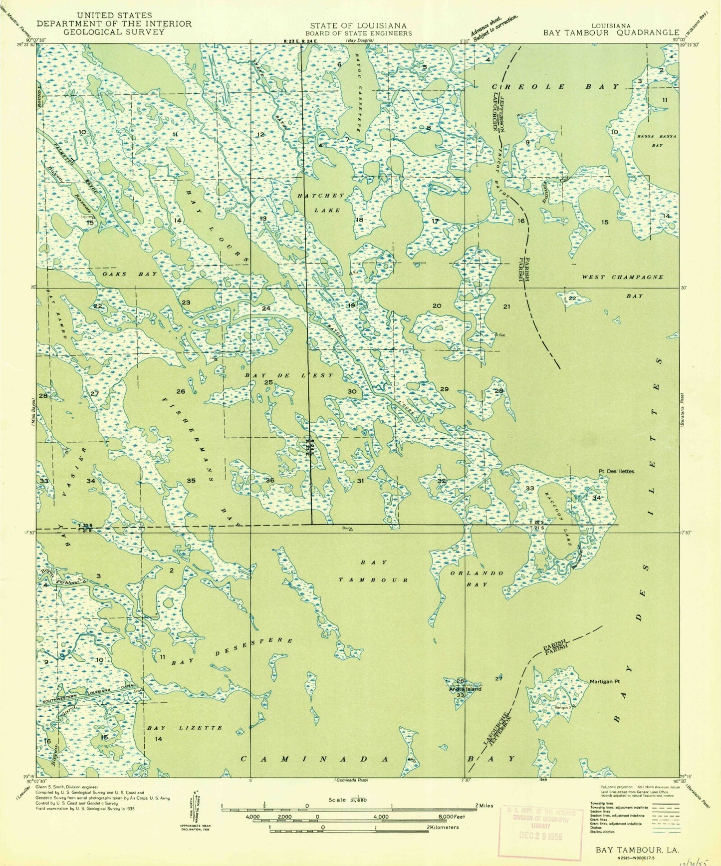
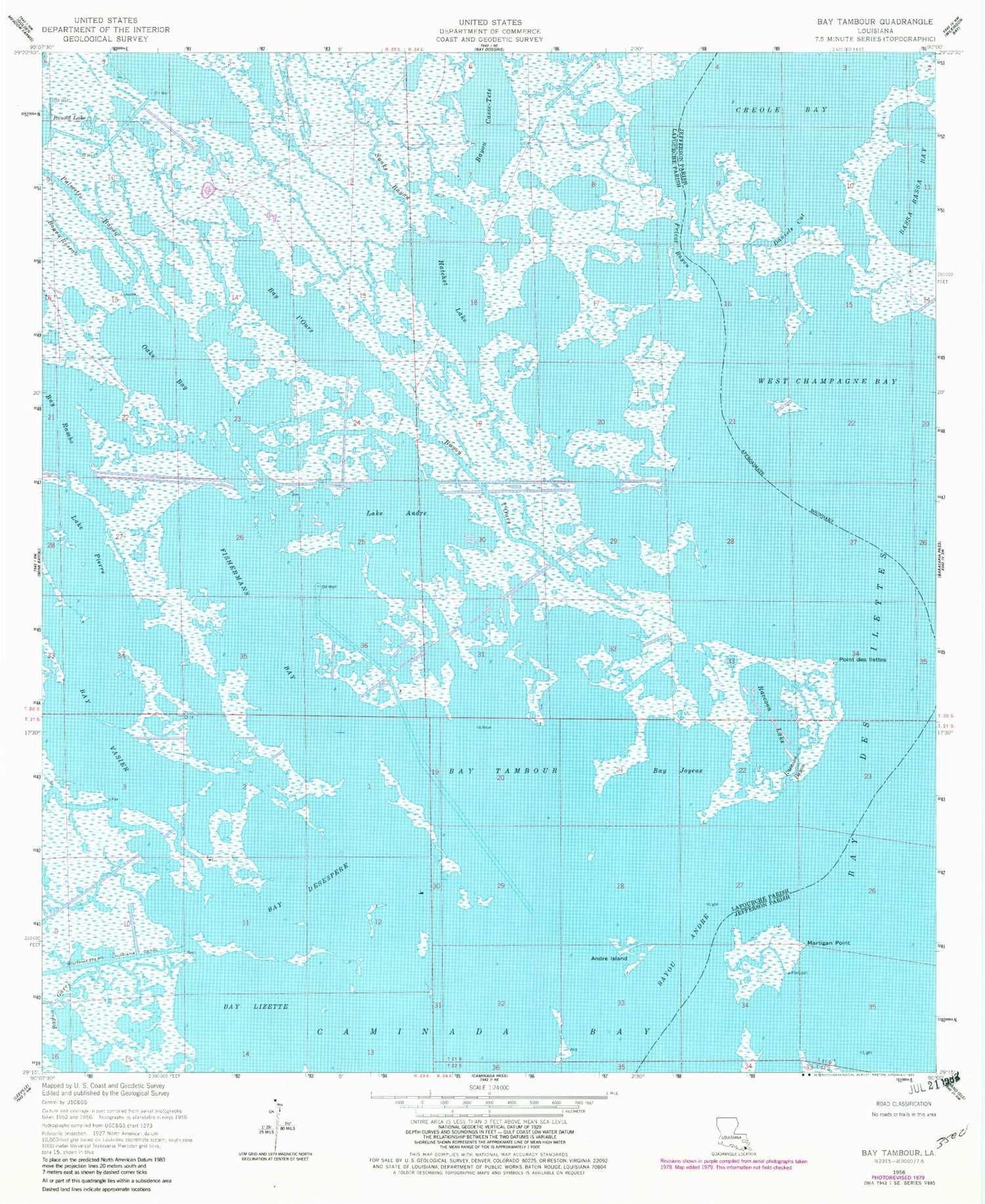
Historical USGS topographic quad map of Bay Tambour in the state of Louisiana. Map scale may vary for some years, but is generally around 1:24,000. Print size is approximately 24" x 27"
This quadrangle is in the following counties: Jefferson, Lafourche.
The map contains contour lines, roads, rivers, towns, and lakes. Printed on high-quality waterproof paper with UV fade-resistant inks, and shipped rolled.
Contains the following named places: Andre Island, Bay Desespere, Bay Joyeux, Bay Lizette, Bay l'Ours, Bay Tambour, Bay Vasier, Bayou Andre, Bayou Casse-Tete, Bayou Garci, Bayou l'Ours, Bayou Roseau, Caminada Bay, Creole Bay, Daniels Cut, Fishermans Bay, Fishermans Bay Gas Field, Fricot Bayou, Hatchet Lake, Lake Andre, Lake Pierre, Martigan Point, Oaks Bay, Palmetto Bayou, Point Des Ilettes, Raccoon Bayou, Raccoon Lake, Raccoon Lake Gas Field, Snake Bayou, West Champagne Bay