MyTopo
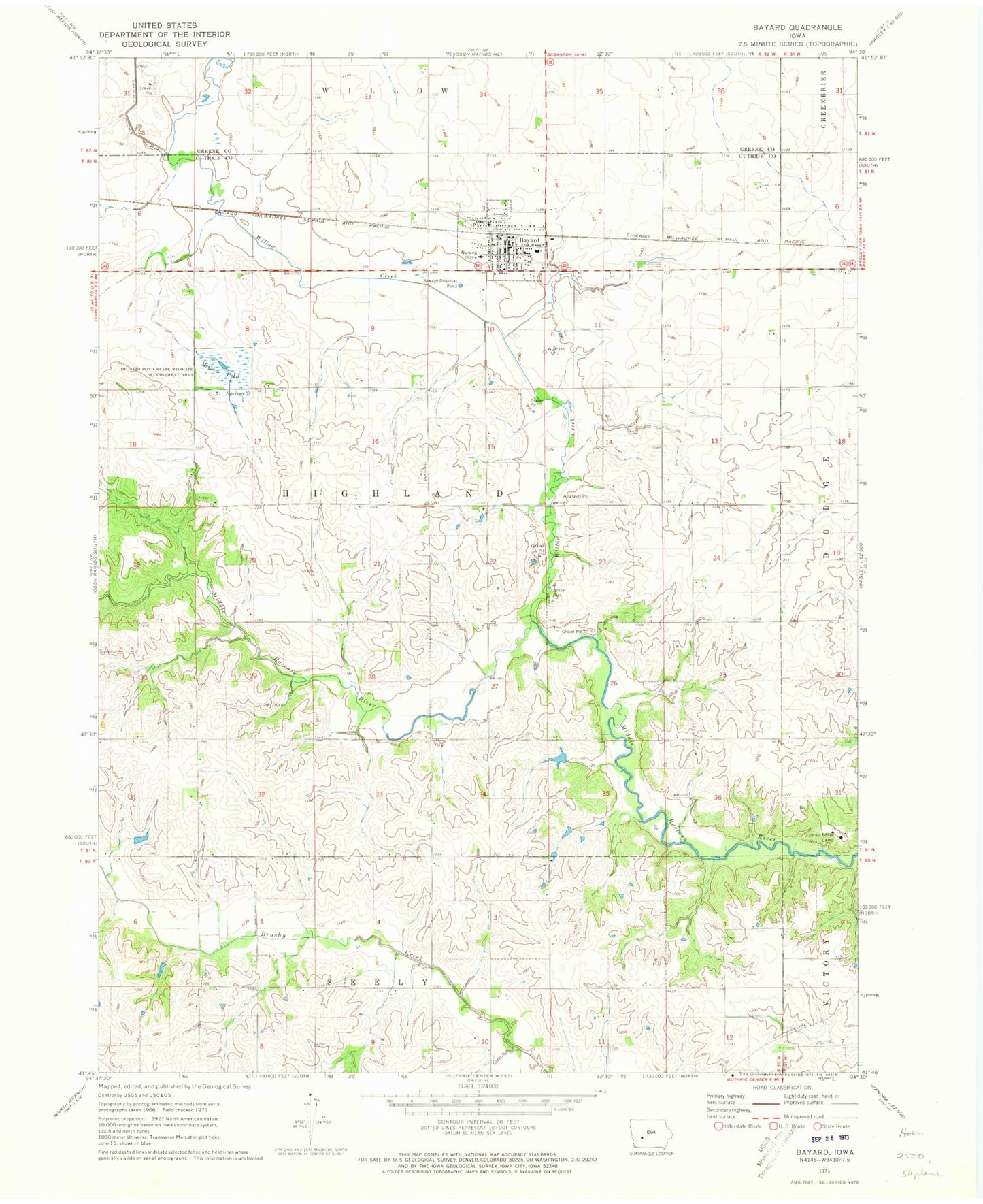
Classic USGS Bayard Iowa 7.5'x7.5' Topo Map
Couldn't load pickup availability
Historical USGS topographic quad map of Bayard in the state of Iowa. Map scale may vary for some years, but is generally around 1:24,000. Print size is approximately 24" x 27"
This quadrangle is in the following counties: Greene, Guthrie.
The map contains contour lines, roads, rivers, towns, and lakes. Printed on high-quality waterproof paper with UV fade-resistant inks, and shipped rolled.
Contains the following named places: Bayard, Bayard Community Center, Bayard Family Medicine Center, Bayard Fire Department and Ambulance Service, Bayard Library, Bayard Medical Clinic, Bayard Nursing and Rehabilitation Center, Bayard Police Department, Bayard Post Office, Bayard-Wichita United Methodist Church, Church of Christ, City of Bayard, Coon Rapids - Bayard School, Dodge, Dodge Post Office, Farmers Cooperative Company Elevator, Guthrie Grove Camp, Highland Cemetery, Jefferson Clinic, McCord Pond, McCord Pond State Wildlife Management Area, Saint Patrick's Church, Sutton Cemetery, Township of Highland, Van Ocker Cemetery, Willow Creek, ZIP Code: 50029