
MyTopo
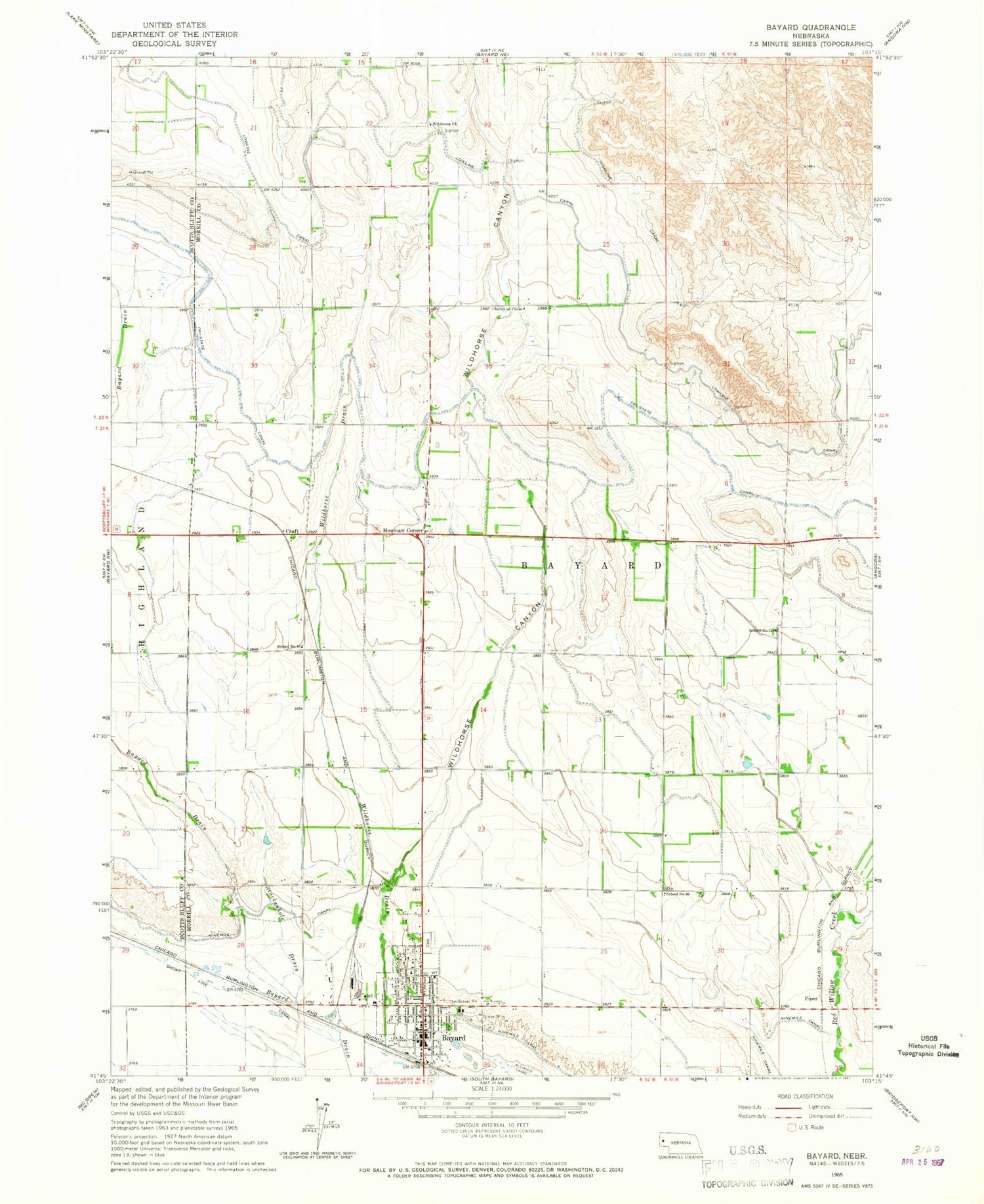
Classic USGS Bayard Nebraska 7.5'x7.5' Topo Map
Couldn't load pickup availability
Historical USGS topographic quad map of Bayard in the state of Nebraska. Map scale may vary for some years, but is generally around 1:24,000. Print size is approximately 24" x 27"
This quadrangle is in the following counties: Morrill, Scotts Bluff.
The map contains contour lines, roads, rivers, towns, and lakes. Printed on high-quality waterproof paper with UV fade-resistant inks, and shipped rolled.
Contains the following named places: Assembly of God Church, Assumption Greek Orthodox Church, Bayard, Bayard Chimney Rock Museum, Bayard Clinic, Bayard Elementary School, Bayard Fire and Rescue, Bayard Memorial Chapel, Bayard Police Department, Bayard Post Office, Bayard Public Library, Bayard Secondary School, Chimney Rock Clinic, Chimney Rock Golf Course, Chimney Rock Medical Center, Chimney Rock Villa Home, Church of Christ, City of Bayard, Community Bible Church, Craft, Davidson Dam, Davidson Reservoir, East Bayard Election Precinct, Hope Congregational Church, Kelley Bean Company Incorporated Elevator, Lowline Canal, Moomaw Corner, Mount Calvary Lutheran Church, Ninemile Canal, Piper, Sacred Heart Catholic Church, School Number 61, School Number 73, School Number 96, Short Line Canal, Stuckenhole Drain, Trinidad Bean and Elevator Company Elevator, United Church of Christ, United Methodist Church, Wildhorse Canyon, Wildhorse Church, Wildhorse Dam 14-A, Wildhorse Dam 5-A, Wildhorse Reservoir 14-A, Wildhorse Reservoir 5-A, ZIP Code: 69334


