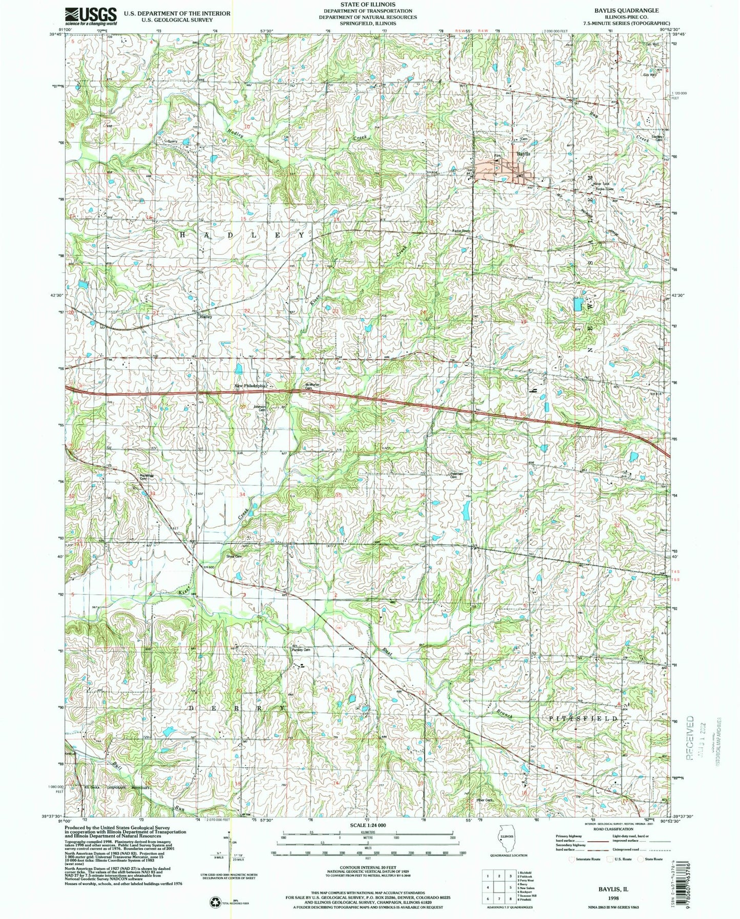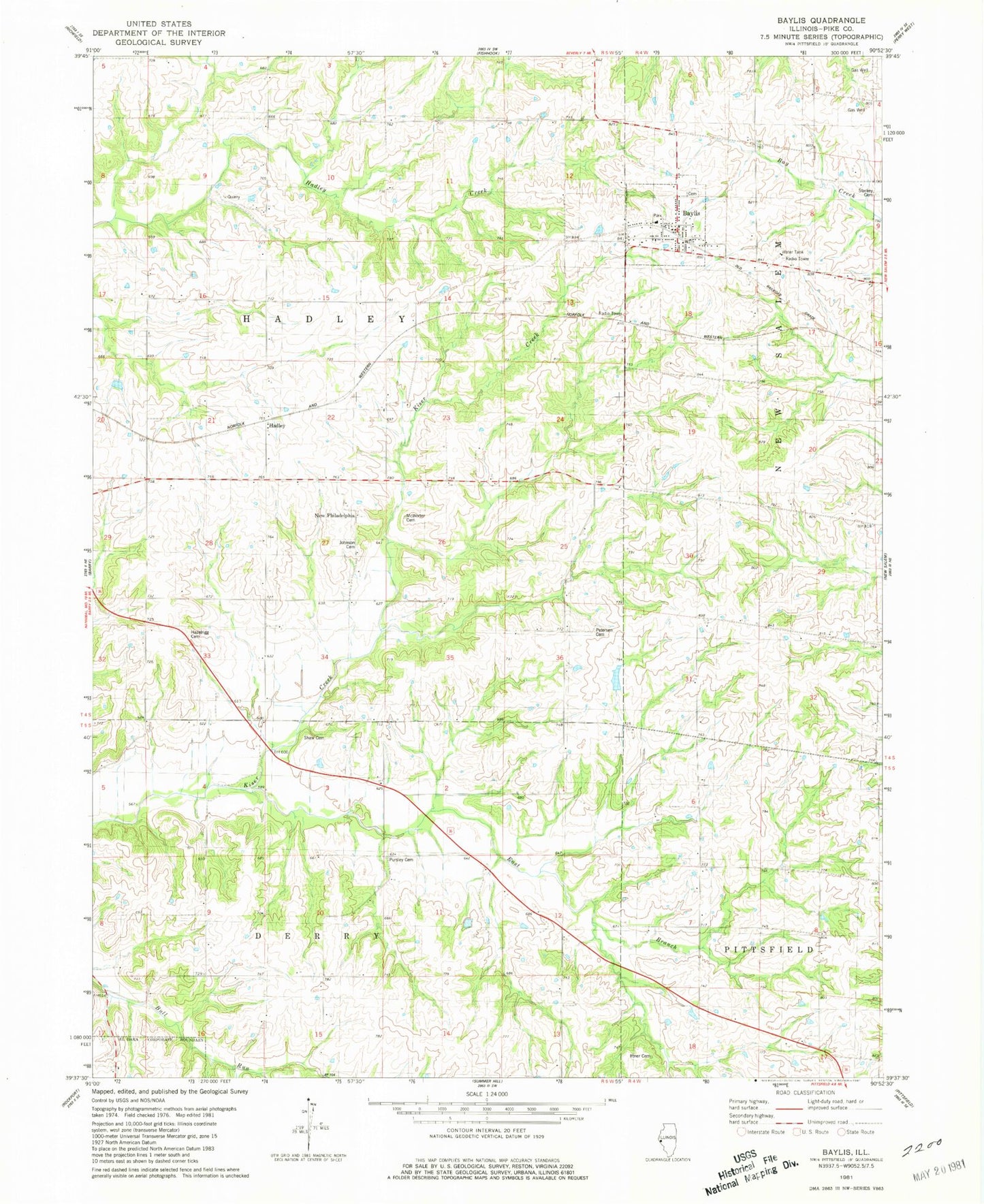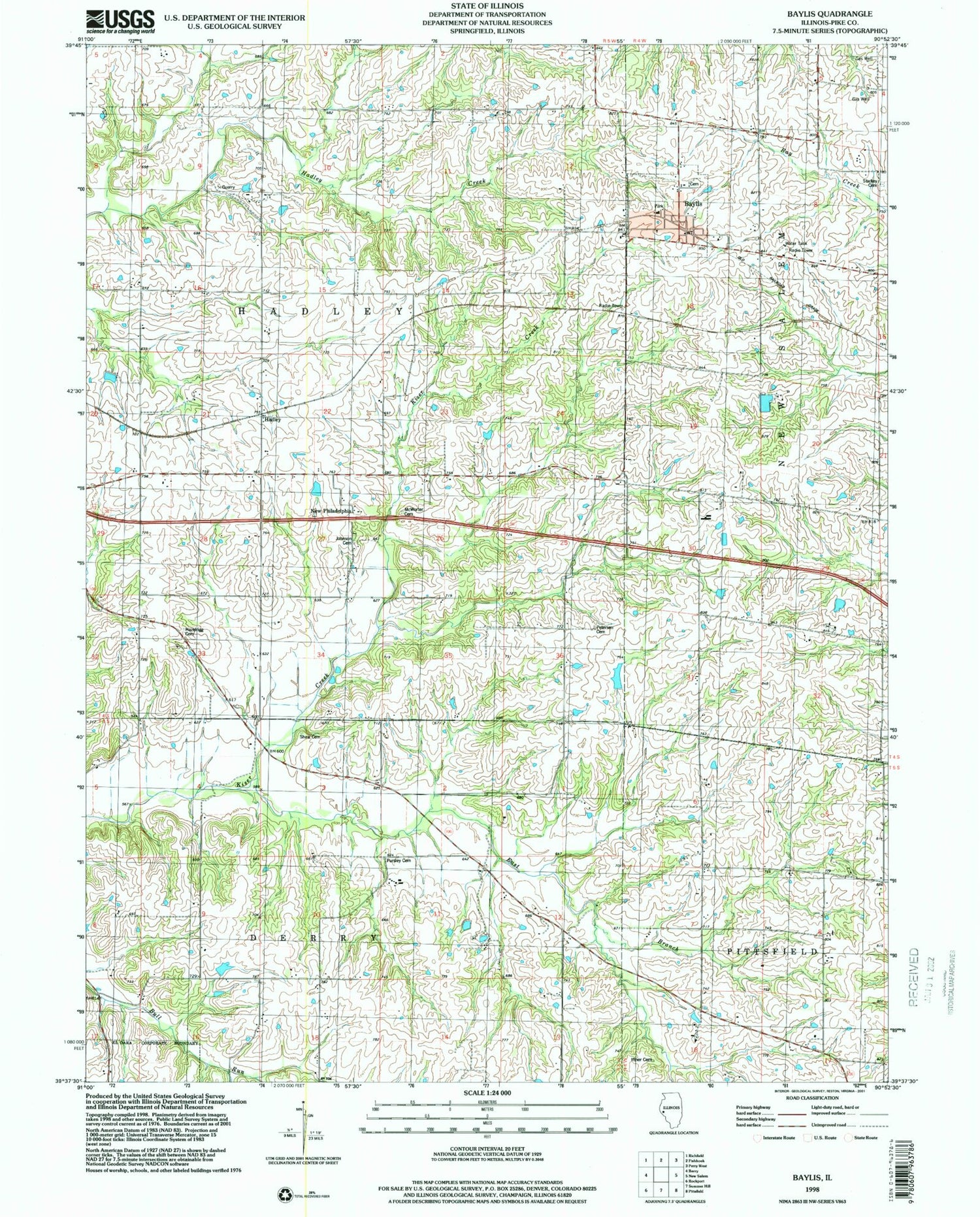
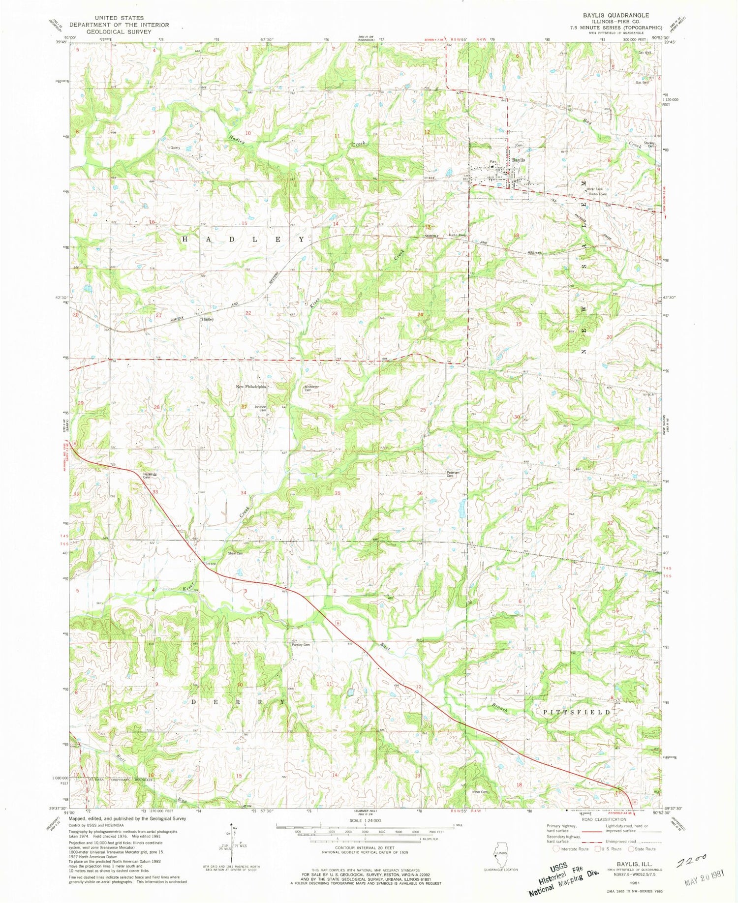
MyTopo
Classic USGS Baylis Illinois 7.5'x7.5' Topo Map
Couldn't load pickup availability
Historical USGS topographic quad map of Baylis in the state of Illinois. Map scale may vary for some years, but is generally around 1:24,000. Print size is approximately 24" x 27"
This quadrangle is in the following counties: Pike.
The map contains contour lines, roads, rivers, towns, and lakes. Printed on high-quality waterproof paper with UV fade-resistant inks, and shipped rolled.
Contains the following named places: Aberdeen School, Baylis, Baylis Cemetery, Baylis Fire Protection District, Baylis Post Office, Bethel School, Brawley - Iftner - Orr Cemetery, East Branch Kiser Creek, Farm Pond, Farm Pond Dam, Hadley, Hayes School, Hazelrigg Cemetery, Johnson Cemetery, Kirtwright School, McWorter Cemetery, Mount Carmel Church, New Philadelphia, Owls Nest School, Peterson Cemetery, Philadelphia School, Pleasant Valley School, Pursley Cemetery, Rising Spring Orchard Lake, Rising Spring Orchard Lake Dam, Shaw Cemetery, Shaw School, Starkey Cemetery, Township of Hadley, Village of Baylis, White School