MyTopo
Classic USGS Bayou Cocodrie Louisiana 7.5'x7.5' Topo Map
Couldn't load pickup availability
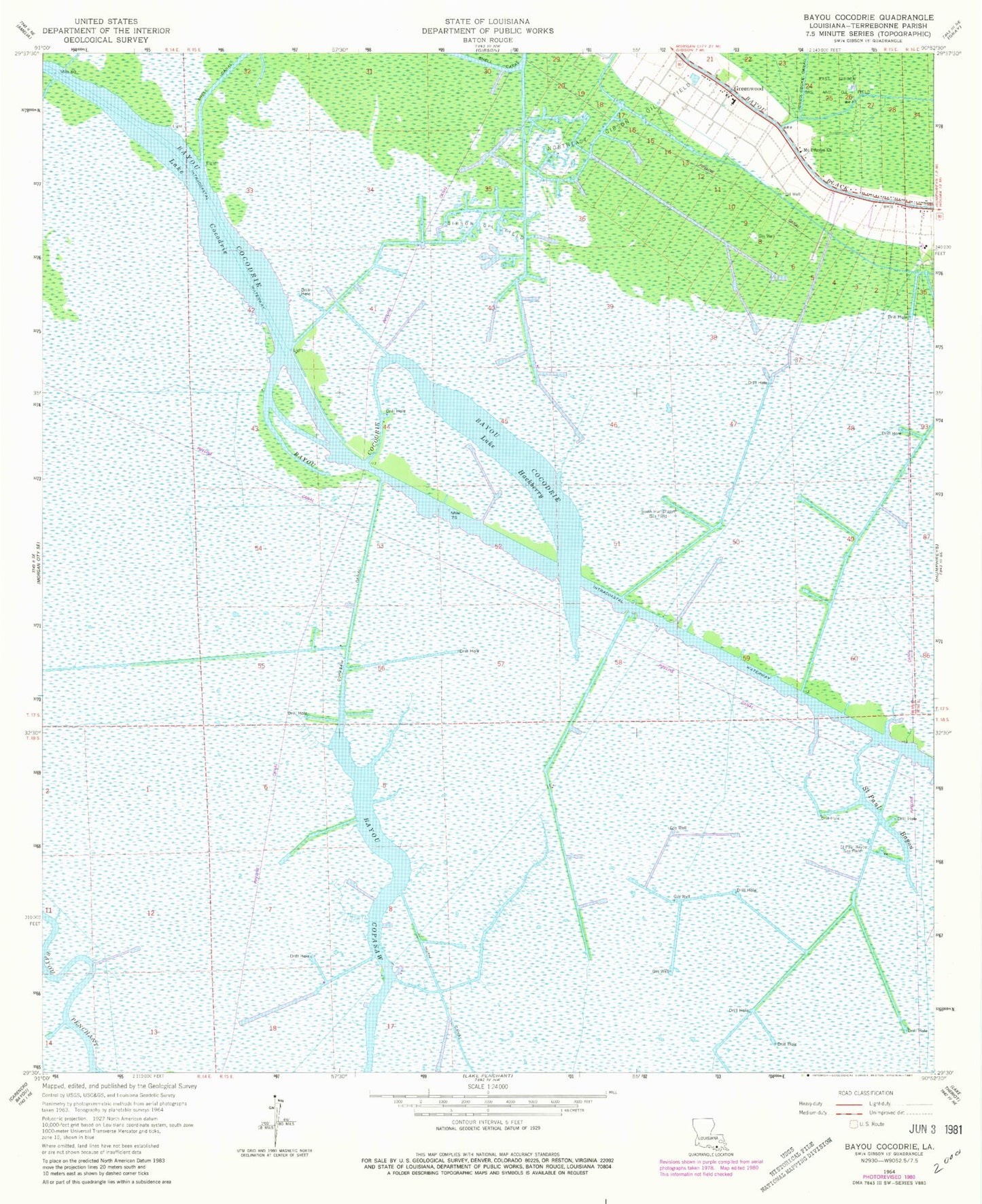
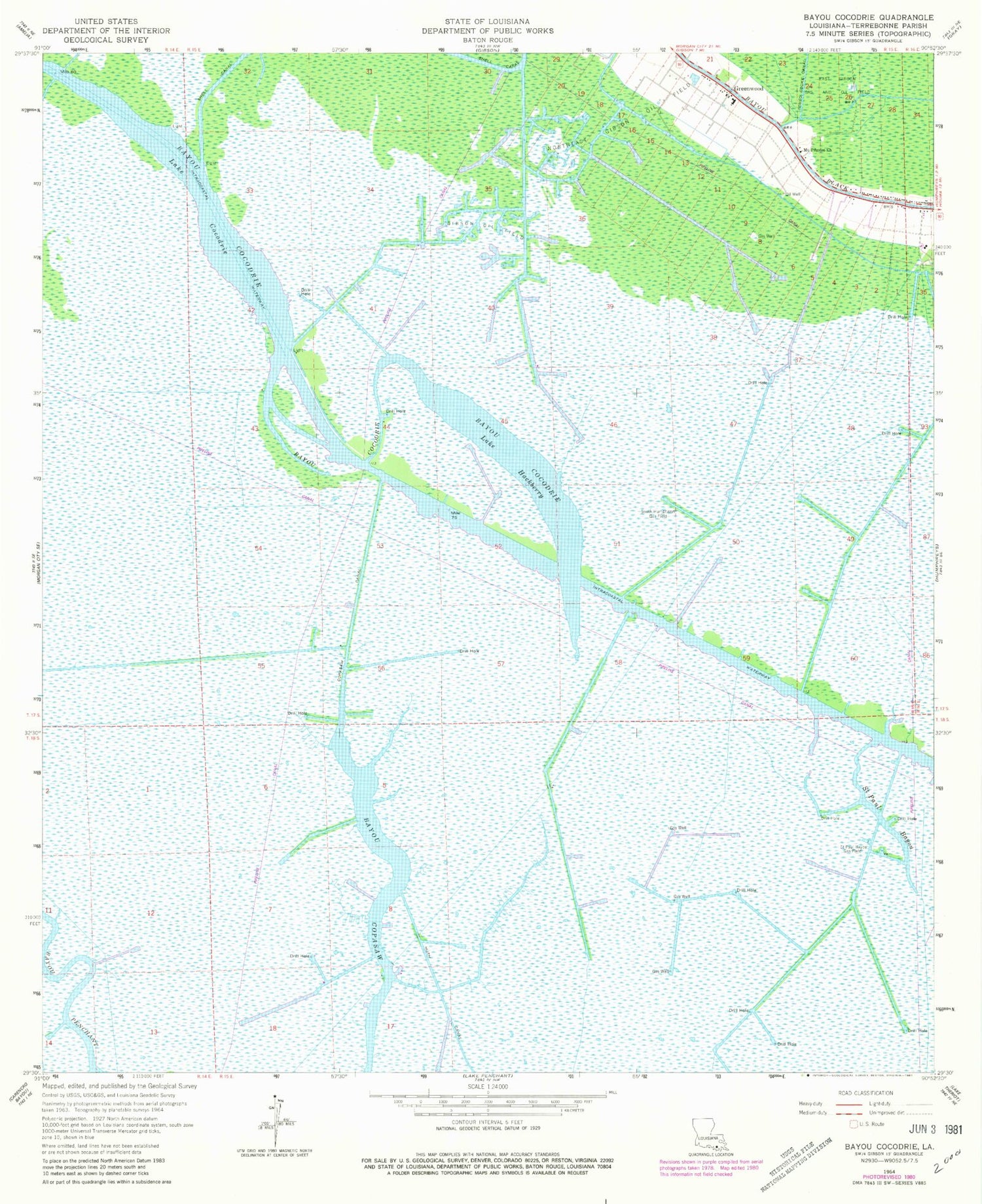
Historical USGS topographic quad map of Bayou Cocodrie in the state of Louisiana. Map scale may vary for some years, but is generally around 1:24,000. Print size is approximately 24" x 27"
This quadrangle is in the following counties: Terrebonne.
The map contains contour lines, roads, rivers, towns, and lakes. Printed on high-quality waterproof paper with UV fade-resistant inks, and shipped rolled.
Contains the following named places: Bayou Copasaw, Bayou Copasaw Gas Field, Copasaw Canal, East Gibson Gas and Oil Field, Gibson Oil Field, Greenwood, Greenwood Middle School, Huth Canal, Lake Cocodrie, Lake Hackberry, Mount Pilgrim Church, Northeast Gibson Oil Field, Saint Bayou Gas Field, Saint Paul Bayou, South Humphreys Gas Field