MyTopo
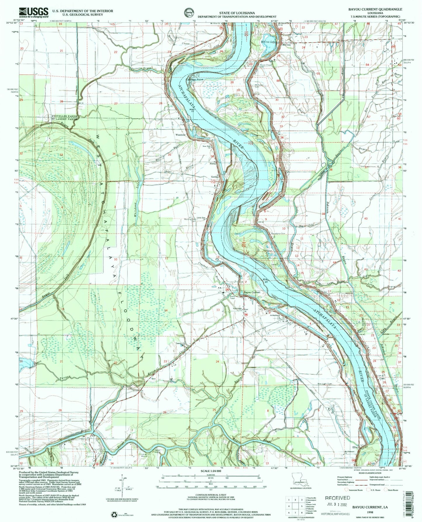
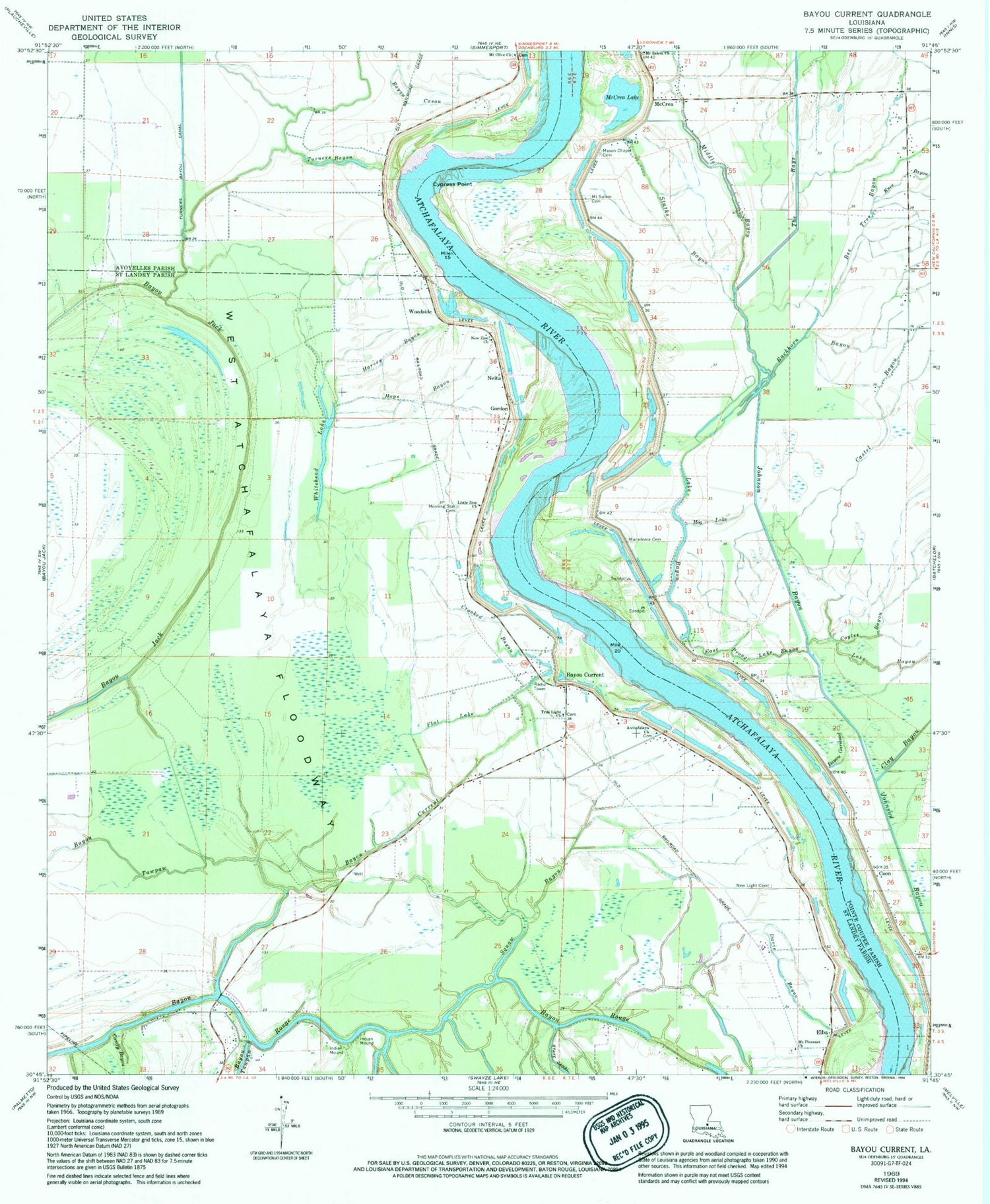
Classic USGS Bayou Current Louisiana 7.5'x7.5' Topo Map
Couldn't load pickup availability
Historical USGS topographic quad map of Bayou Current in the state of Louisiana. Map scale may vary for some years, but is generally around 1:24,000. Print size is approximately 24" x 27"
This quadrangle is in the following counties: Avoyelles, Pointe Coupee, St. Landry.
The map contains contour lines, roads, rivers, towns, and lakes. Printed on high-quality waterproof paper with UV fade-resistant inks, and shipped rolled.
Contains the following named places: Atchafalaya Cemetery, Atchafalaya Church, Barberton Landing, Bayou Current, Bayou Garwood, Bayou Tawpaw, Bee Tree Bayou, Buckhorn Bayou, Burlong Landing, Castel Bayou, Coon, Coyles Bayou, Crooked Bayou, Cypress Point, Davis Bayou, Delano, East Prong Lake Bayou, Elba, Elba Oil Field, Fairfield Landing, Flat Lake, Gordon, Greens Lake, Harvey Bayou, Hog Lake, Hops Bayou, Johnson Bayou, Knee Bayou, Lake Bayou, Lake Bayou School, Little Zion Church, Macedonia Cemetery, Mason Chapel, Mason Chapel Cemetery, McCrea, McCrea Lake, Middle Bayou, Morning Star Cemetery, Mount Olive Cemetery, Mount Olive Church, Mount Pleasant Cemetery, Mount Pleasant Church, Mount Salem Cemetery, Mount Salem Church, Neita, New Light Cemetery, New Light Church, New Zion Church, Pointe Coupee Church, Quinton Oil Field, Somers, Squaw Bayou, Starks Bayou, Suna, The Bays, True Light Church, Turners Bayou, Ward One, Webb, West Atchafalaya Floodway, Whitehead Lake, Woodside, Woodside School, ZIP Code: 71353