MyTopo
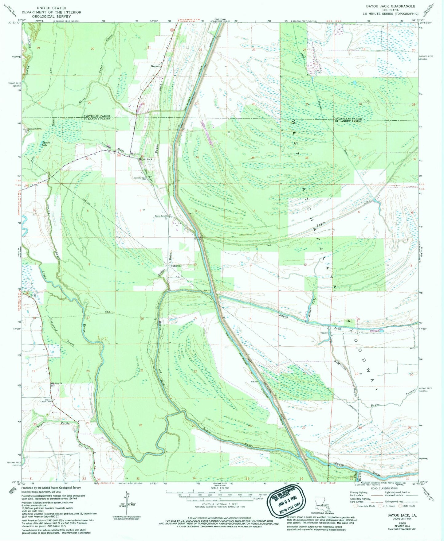
Classic USGS Bayou Jack Louisiana 7.5'x7.5' Topo Map
Couldn't load pickup availability
Historical USGS topographic quad map of Bayou Jack in the state of Louisiana. Map scale may vary for some years, but is generally around 1:24,000. Print size is approximately 24" x 27"
This quadrangle is in the following counties: Avoyelles, St. Landry.
The map contains contour lines, roads, rivers, towns, and lakes. Printed on high-quality waterproof paper with UV fade-resistant inks, and shipped rolled.
Contains the following named places: Alabama Bayou, Apostolic Cemetery, Apostolic Church, Bayou Des Glaises Diversion Channel, Bayou Jack, Bayou Jack Church, Bayou Tawpaw, Black Water Bayou, Cason Cemetery, Dunns Lake, Fish Bayou, Horsehead Bayou, Indian Lake, Jims Bayou, Keller Lake, McMillian Bayou, Montcrief Gas Field, Mount Olive Cemetery, Mount Olive Church, North Bayou Jack Oil Field, Nugent, Spring Bayou, Spring Bluff Cemetery, Spring Bluff Church, Taterville, Telac Bayou, Trevassar Bayou, Veazie, Wards Lake