
MyTopo
Classic USGS Bayou Lucien Louisiana 7.5'x7.5' Topo Map
Regular price
$16.95
Regular price
Sale price
$16.95
Unit price
per
Couldn't load pickup availability
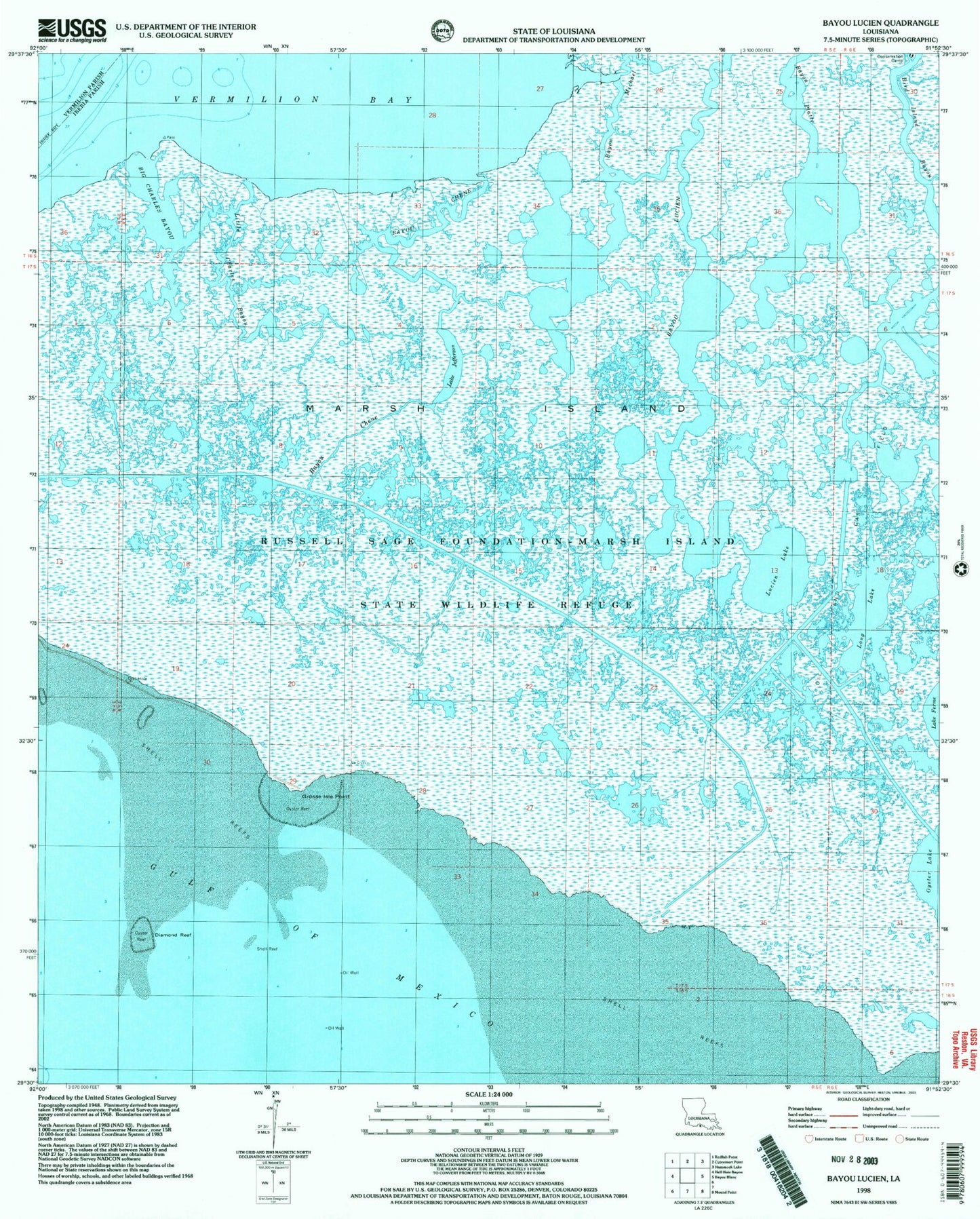
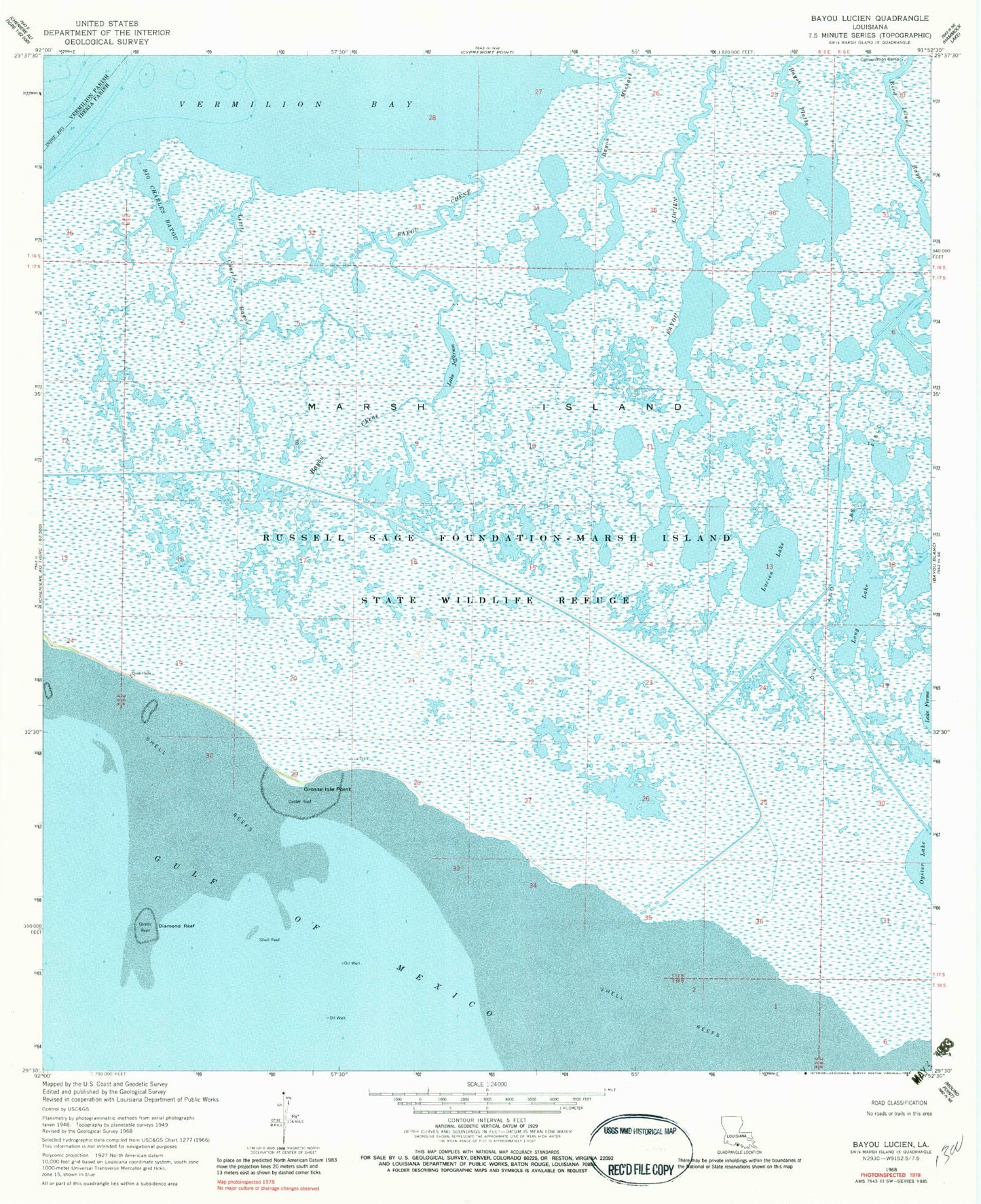
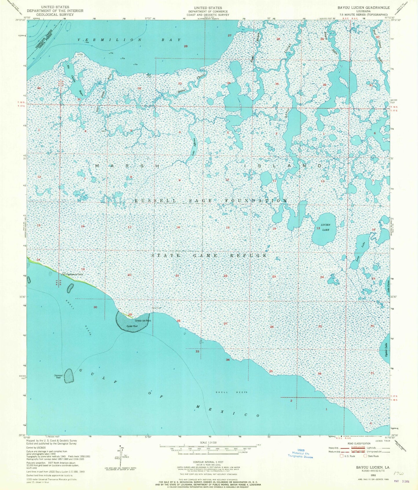
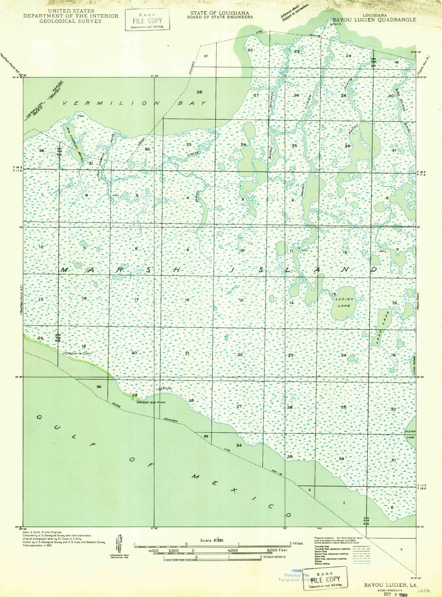
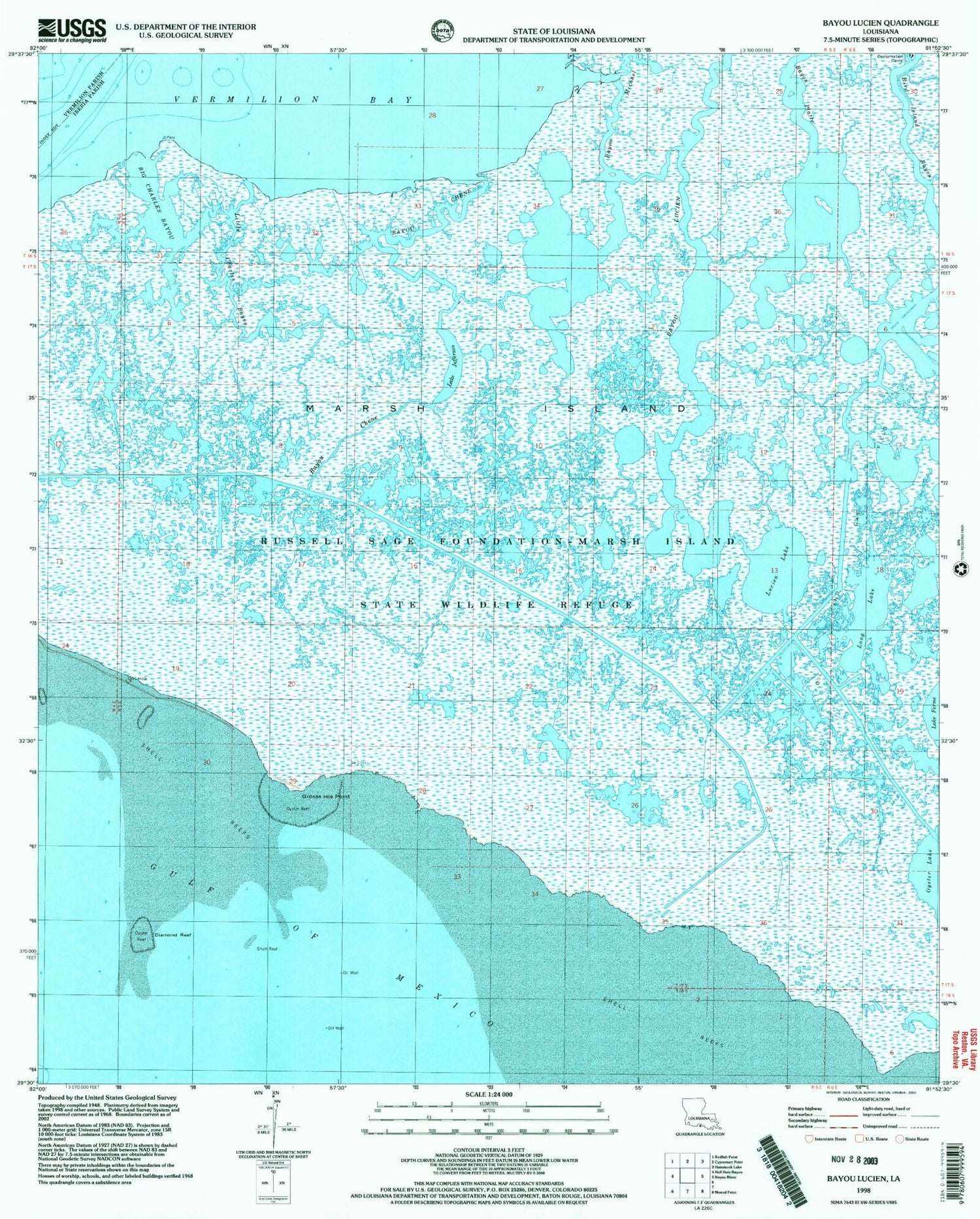
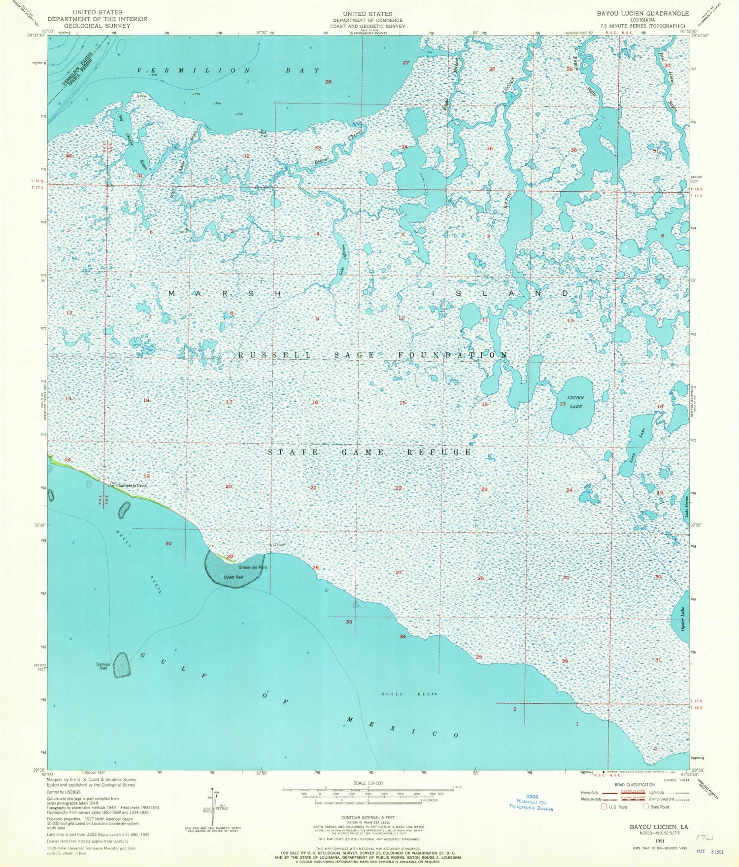
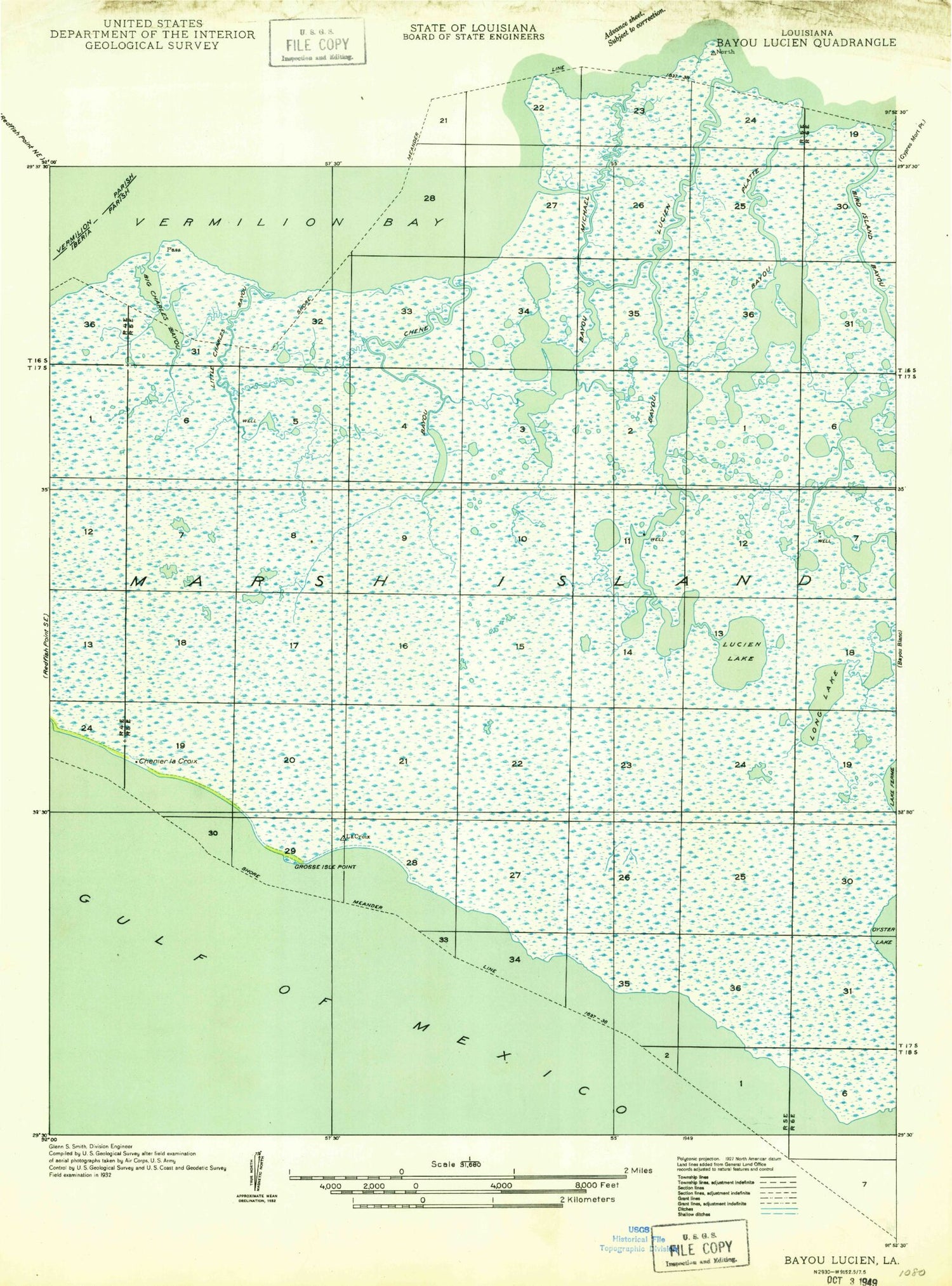
Historical USGS topographic quad map of Bayou Lucien in the state of Louisiana. Map scale may vary for some years, but is generally around 1:24,000. Print size is approximately 24" x 27"
This quadrangle is in the following counties: Iberia, Vermilion.
The map contains contour lines, roads, rivers, towns, and lakes. Printed on high-quality waterproof paper with UV fade-resistant inks, and shipped rolled.
Contains the following named places: Bayou Chene, Bayou Lucien, Bayou Michael, Bayou Platte, Big Charles Bayou, Bird Island Bayou, Diamond Reef, Grosse Isle Point, Lake Ferme Gas Field, Lake Jefferson, Little Charles Bayou, Long Lake, Lucien Lake