MyTopo
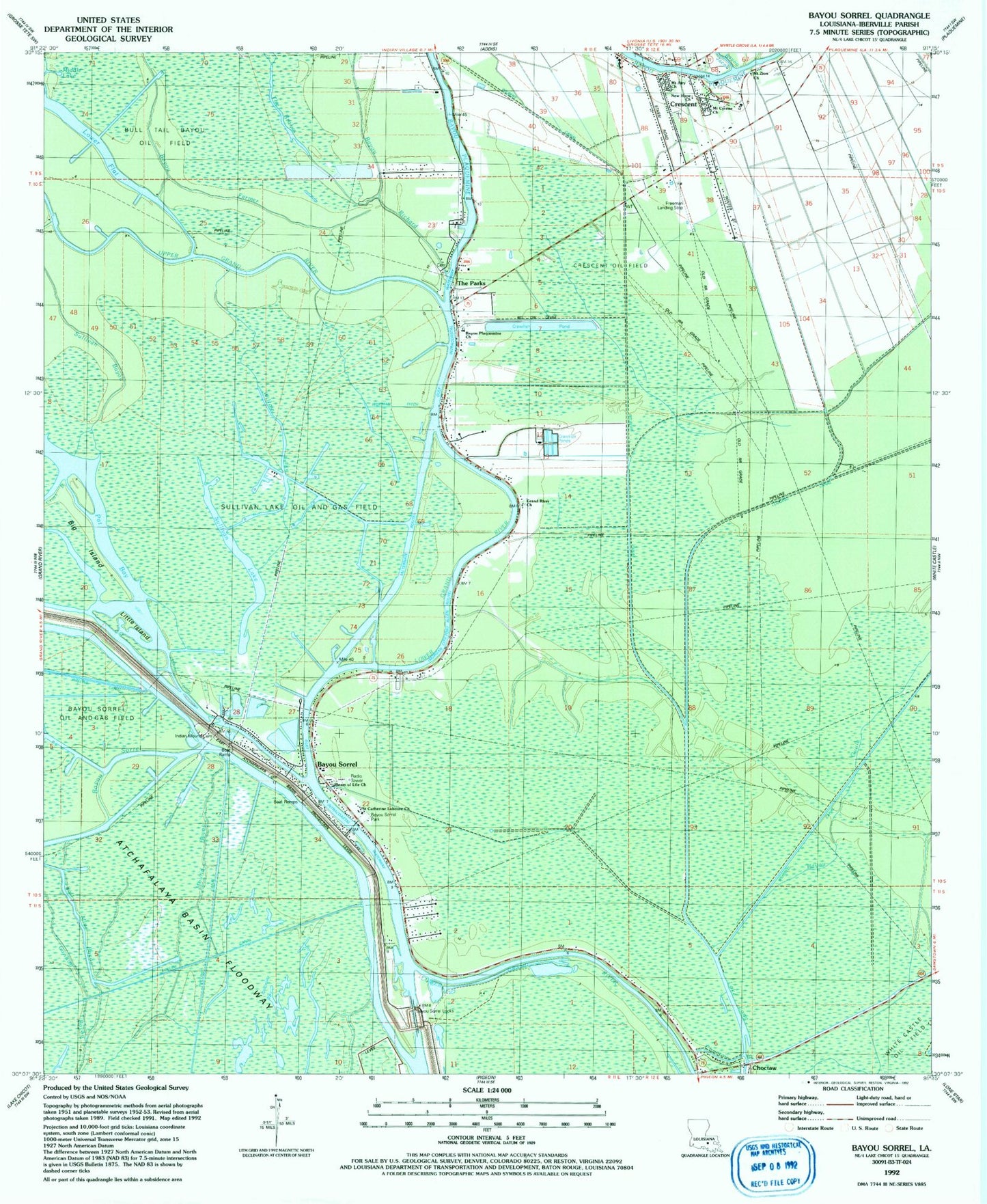
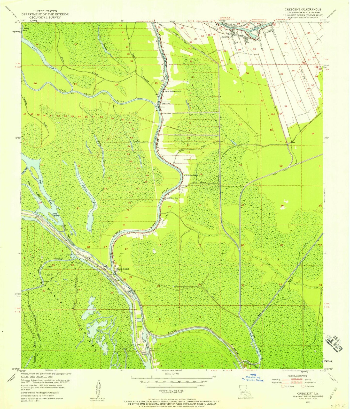
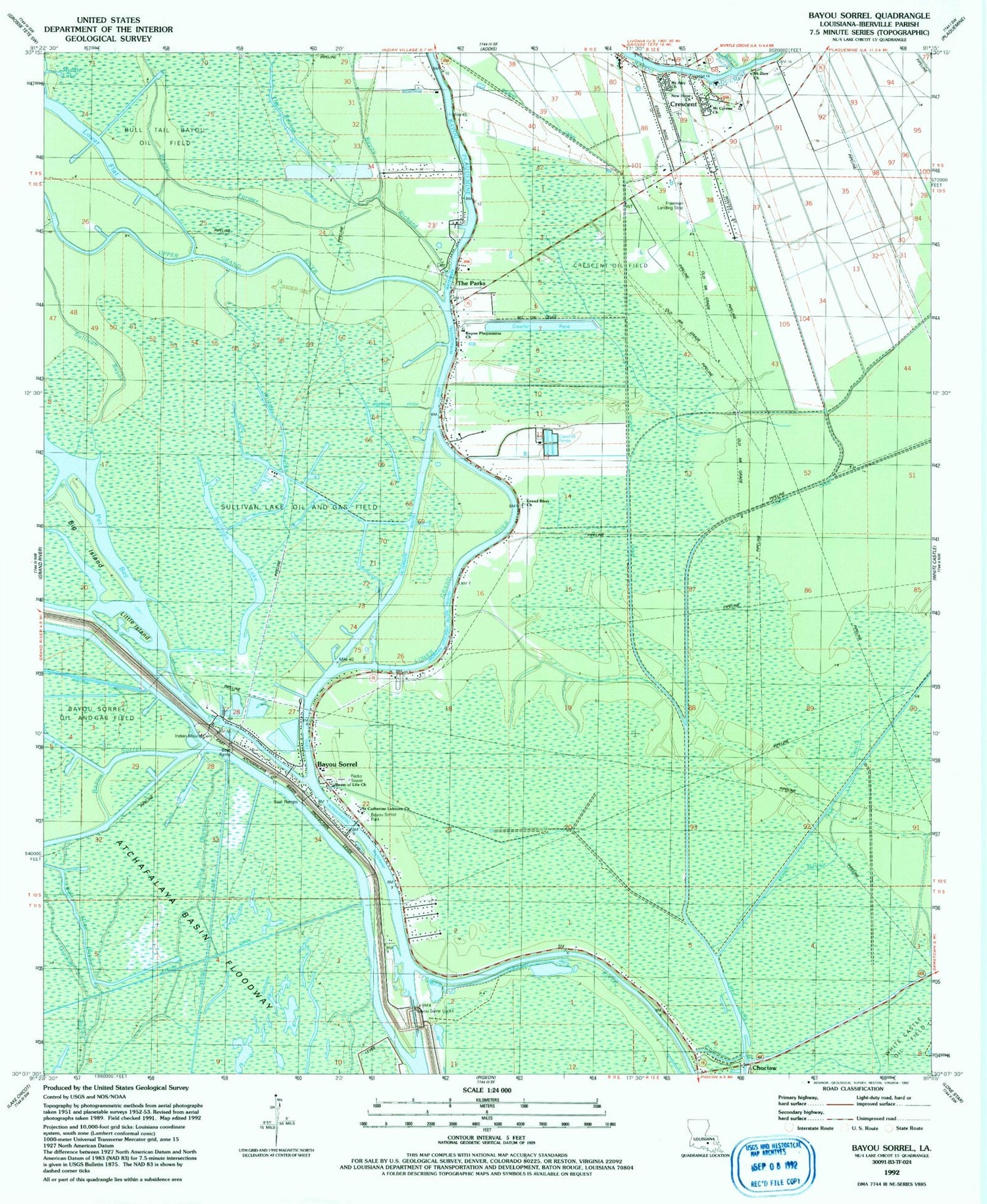
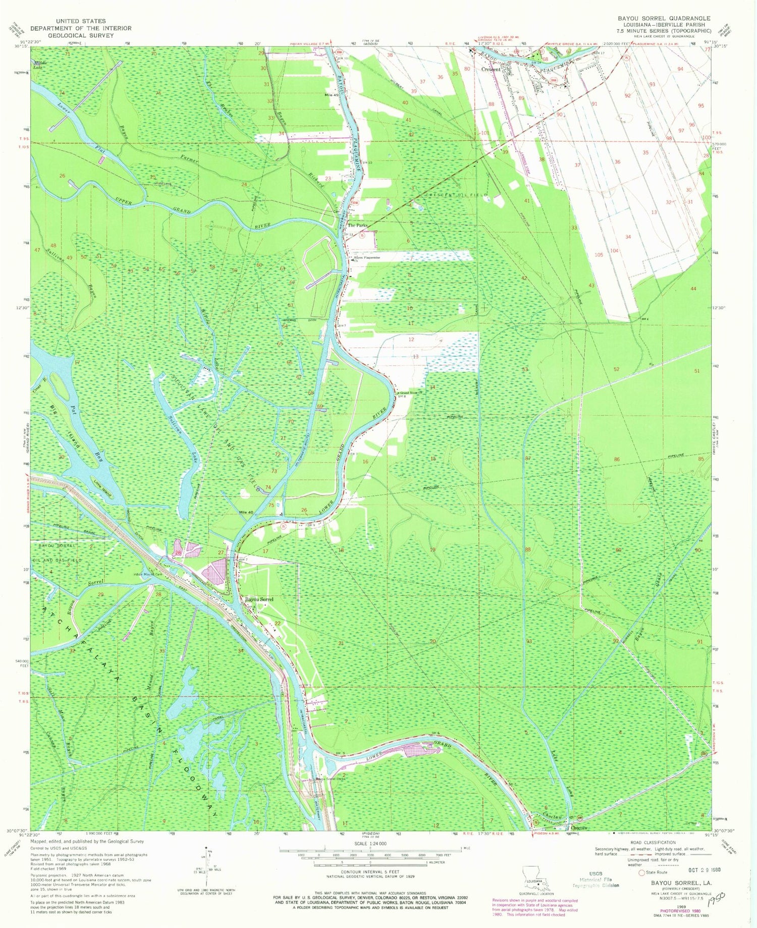
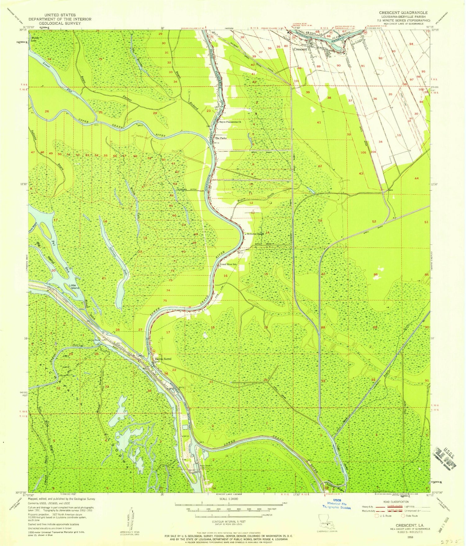
Classic USGS Bayou Sorrel Louisiana 7.5'x7.5' Topo Map
Couldn't load pickup availability
Historical USGS topographic quad map of Bayou Sorrel in the state of Louisiana. Map scale may vary for some years, but is generally around 1:24,000. Print size is approximately 24" x 27"
This quadrangle is in the following counties: Iberville.
The map contains contour lines, roads, rivers, towns, and lakes. Printed on high-quality waterproof paper with UV fade-resistant inks, and shipped rolled.
Contains the following named places: Bayou Farmer, Bayou Goula, Bayou Jacob, Bayou Plaquemine, Bayou Plaquemine Baptist Church, Bayou Richard, Bayou Sorrel, Bayou Sorrel Baptist Church, Bayou Sorrel Boat Landing, Bayou Sorrel Fire Department, Bayou Sorrel Locks, Bayou Sorrel Park, Beam of Life Church, Big Island, Bull Tail Bayou Oil Field, C M Zito Multipurpose Center, Choctaw, Crescent, Crescent Census Designated Place, Crescent Elementary School, Crescent Oil Field, Cross Bayou, Faith Tabernacle Church, Freeman Landing Strip, Grand River Church, Grand River Gas Field, Gulf Intracoastal Waterway, Indian Mound Cemetery, Jack Miller Store, Lake Long, Little Island, Middle Lake, Mound Bayou, Mound Ditch, Mount Airy Baptist Church, Mount Cyrene Baptist Church, Mount Zion Baptist Church, Mount Zion Church, Murrell Canal, New Hope Assembly of God Church, Parish Governing Authority District 10, Pat Bay, Saint Ann Church, Saint Catherine Laboure Church, Salt Mine Bayou, Sullivan Lake, Sullivan Lake Oil and Gas Field, The Brakes, The Parks, Upper Grand River, Ward Eight, White Castle Oil Field, Wilberts Canal, Willow Lake, Wiseman Ditch, ZIP Code: 70764