MyTopo
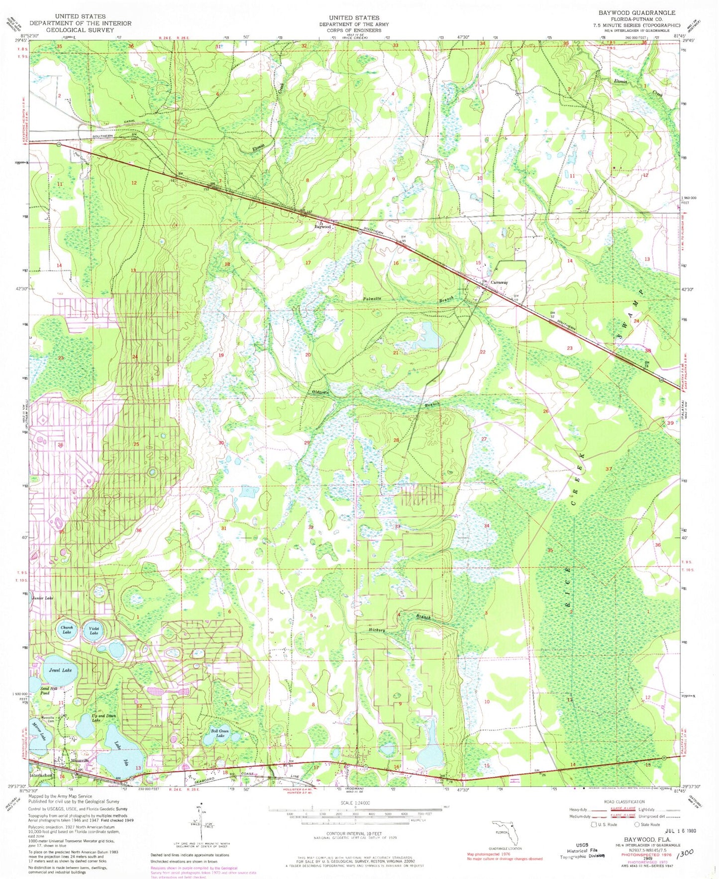
Classic USGS Baywood Florida 7.5'x7.5' Topo Map
Couldn't load pickup availability
Historical USGS topographic quad map of Baywood in the state of Florida. Map scale may vary for some years, but is generally around 1:24,000. Print size is approximately 24" x 27"
This quadrangle is in the following counties: Putnam.
The map contains contour lines, roads, rivers, towns, and lakes. Printed on high-quality waterproof paper with UV fade-resistant inks, and shipped rolled.
Contains the following named places: Baywood, Boll Green Lake, Carraway, Church Lake, First Baptist Church, Hickory Branch, Hollister Forestry Station, Hollister Post Office, Hollister Volunteer Fire Department, Interlachen Lake Estates Volunteer Fire Department Station 17, Interlachen-Florahome Division, Jewel Lake, Lake Ida, Lake Virginia, Macedonia Missionary Baptist Church, Mannville, Manville Substation Clay Electric Co-op, Mary Elizabeth Cemetery, Mary Elizabeth Church, Mei - Wun Cemetery, Mirror Lake, Naomi Cemetery, Naomi Church, Oldtown Branch, Palmetto Branch, Pine Lawn Cemetery, Q I Roberts Middle School, Rice Creek Swamp, Sand Hill Pond, Seventh Day Adventist Church, Up and Down Lake, Violet Lake, William Panton Grant