MyTopo
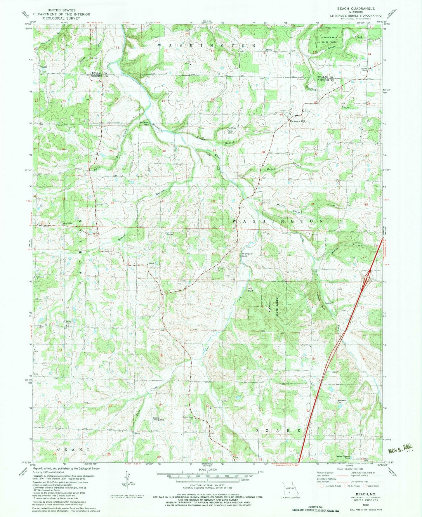
Classic USGS Beach Missouri 7.5'x7.5' Topo Map
Couldn't load pickup availability
Historical USGS topographic quad map of Beach in the state of Missouri. Map scale may vary for some years, but is generally around 1:24,000. Print size is approximately 24" x 27"
This quadrangle is in the following counties: Dallas, Webster.
The map contains contour lines, roads, rivers, towns, and lakes. Printed on high-quality waterproof paper with UV fade-resistant inks, and shipped rolled.
Contains the following named places: Antioch Church, Beach, Beckner Field, Bethel Church, Callaway Bluff, Dermott, East Fork Niangua River, Forkners Hill, Full Gospel Church, Givins Branch, Goose Creek, Graves School, Greer Creek, Hagan Branch, Hawk Pond Branch, Haymes Chapel, Hollis Branch, Independence School, Jameson Bluff, Jameson School, Marlin Branch, Marlin Cemetery, Marlin School, McElwain Cemetery, Mill Bluff, Miller School, Mission Home Church, Pack School, Plank School, Saint Luke, Saint Luke Church, Saint Luke School, Saint Paul Lutheran Cemetery, Sand Spring School, Sarah Branch, Shady Grove Church, Shady Grove School, Sparkle Brook School, Thompson Bluff, Thorpe, Township of Washington, Warden Chapel, West Fork Niangua River