MyTopo
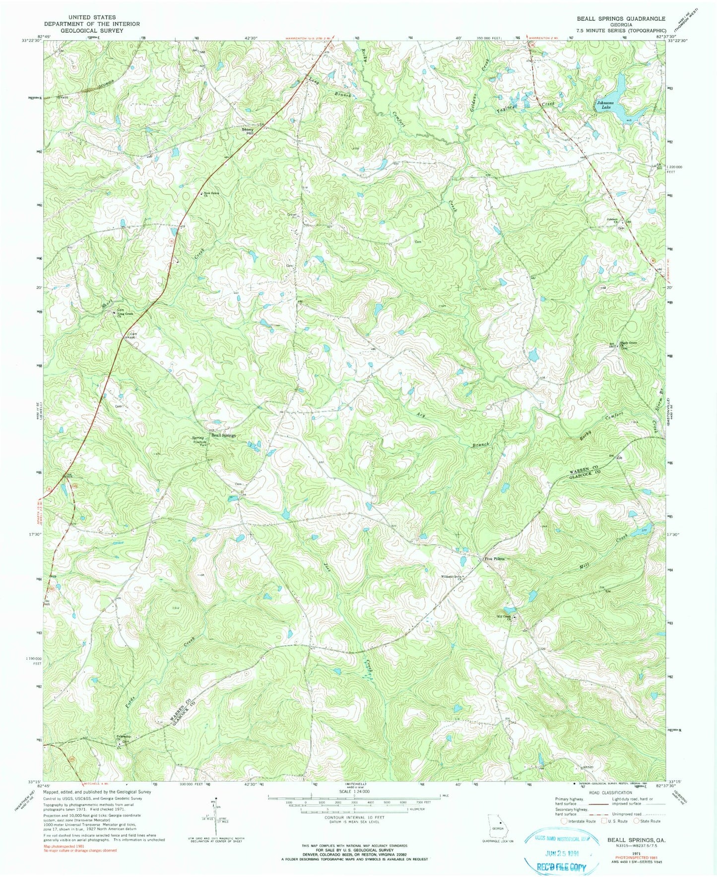
Classic USGS Beall Springs Georgia 7.5'x7.5' Topo Map
Couldn't load pickup availability
Historical USGS topographic quad map of Beall Springs in the state of Georgia. Map scale may vary for some years, but is generally around 1:24,000. Print size is approximately 24" x 27"
This quadrangle is in the following counties: Glascock, Warren.
The map contains contour lines, roads, rivers, towns, and lakes. Printed on high-quality waterproof paper with UV fade-resistant inks, and shipped rolled.
Contains the following named places: Acy Branch, Baker - Brinkly Cemetery, Beall - Baker Cemetery, Beall Springs, Blume, Cason Cemetery, Downs, Fellowship Cemetery, Fellowship Church, Five Points, Four Points, Fowler Cemetery, Goldens Creek, Johnson Cemetery, Johnson Church, Johnsons Lake, Johnsons Lake Dam, Kinsey Cemetery, Lewis Cemetery, Long Branch, Long Creek Cemetery, Long Creek Church, Martha Ellen English Cemetery, McCrary Cemetery, Mill Creek Cemetery, Mill Creek Church, New Salem Cemetery, New Salem Church, Norris Division, Pate Cemetery, Sally Grove Cemetery, Shady Grove Church, Shelton Cemetery, Shurley Cemetery, Stony Hill, Storm Branch, Taylors Creek, Warren County Fire Department Beall Springs Station, Williams Grove Cemetery, Williams Grove Church, Williford Cemetery, ZIP Code: 30828