MyTopo
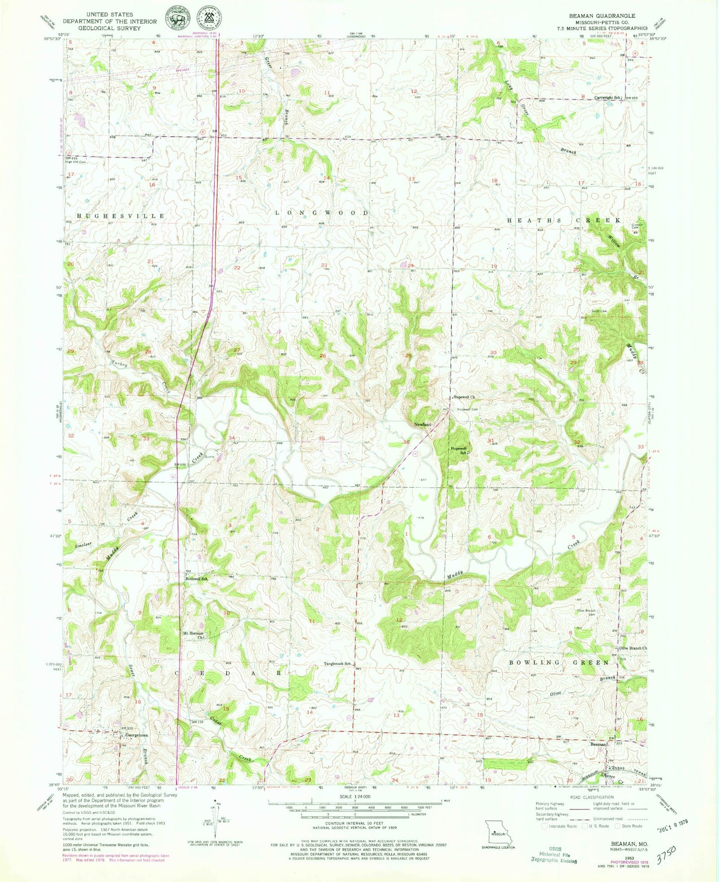
Classic USGS Beaman Missouri 7.5'x7.5' Topo Map
Couldn't load pickup availability
Historical USGS topographic quad map of Beaman in the state of Missouri. Map scale may vary for some years, but is generally around 1:24,000. Print size is approximately 24" x 27"
This quadrangle is in the following counties: Pettis.
The map contains contour lines, roads, rivers, towns, and lakes. Printed on high-quality waterproof paper with UV fade-resistant inks, and shipped rolled.
Contains the following named places: Beaman, Bothwell School, Cartwright School, Cedar Creek, Clopton Cemetery, Fire District 1 Station 4 Pettit County, Fristoe School, Georgetown, High Hill Cemetery, Hopewell Cemetery, Hopewell Church, Hopewell School, Mount Herman Church, Newland, Old Bob Scott Cemetery, Olive Branch Cemetery, Olive Branch Church, Olive Branch School, Pearl River, Pettis County Fire District 1 Station 6, Smelser Creek, Sunnymede School, Tanglenook School, Thornleigh, Township of Cedar, Turkey Creek, Woodland School, ZIP Code: 65334