MyTopo
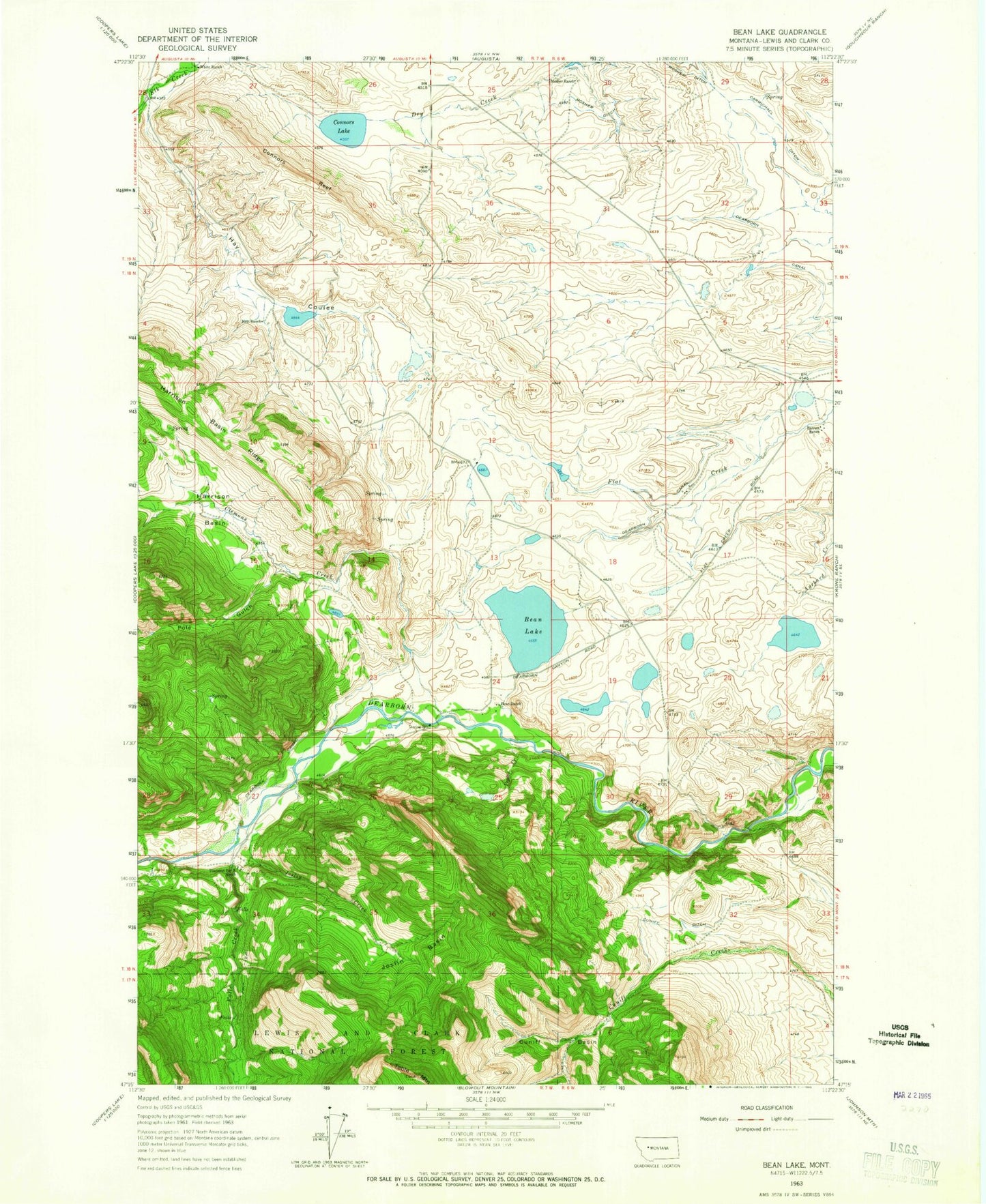
Classic USGS Bean Lake Montana 7.5'x7.5' Topo Map
Couldn't load pickup availability
Historical USGS topographic quad map of Bean Lake in the state of Montana. Map scale may vary for some years, but is generally around 1:24,000. Print size is approximately 24" x 27"
This quadrangle is in the following counties: Lewis and Clark.
The map contains contour lines, roads, rivers, towns, and lakes. Printed on high-quality waterproof paper with UV fade-resistant inks, and shipped rolled.
Contains the following named places: Barrett Ranch, Bean Lake, Bean Lake Campground, Bean Lake Dam, Bean Lake Fishing Access Site, Bean Ranch, Carmichael Ditch, Clemons, Clemons Creek, Clemons Post Office, Clemons School, Connors Lake, Connors Reef, Cuniff Basin, Cuniff Ditch, Dearborn Canal, Dearborn River High Bridge, Diamond Bar X Ranch, Falls Creek, Harrison Basin, Harrison Basin Ridge, Hay Coulee, Joslin Basin, Joslin Creek, Mosher Ranch, Nett Ranch, Pole Gulch, Poplar Creek, Table Mountain, White Ranch