
MyTopo
Classic USGS Bean Lake Nebraska 7.5'x7.5' Topo Map
Couldn't load pickup availability
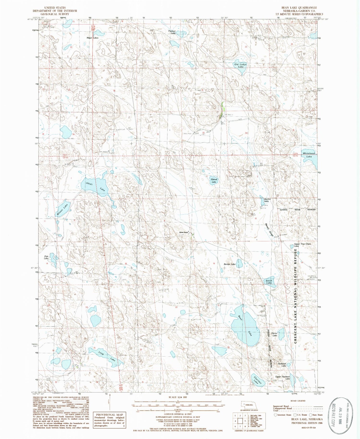
Historical USGS topographic quad map of Bean Lake in the state of Nebraska. Map scale may vary for some years, but is generally around 1:24,000. Print size is approximately 24" x 27"
This quadrangle is in the following counties: Garden.
The map contains contour lines, roads, rivers, towns, and lakes. Printed on high-quality waterproof paper with UV fade-resistant inks, and shipped rolled.
Contains the following named places: Alkali Lake, Avery Ranch, Bean Lake, Border Lake, Charleys Lake, Drain Ranch, Eldred Lake, Eldred Ranch, Long Lake, M Peterson Ranch, Martin Lake, Meyer Lakes, Old Ladys Lake, Perrin Lake, Pyle Lake, Ramelli Slough, Redhead Lake, Smith Lake, Trainor Lake, Upper Harrison Lake, Upper Tree Claim Lake, Whitehead Lake, Wilson Lake


