MyTopo
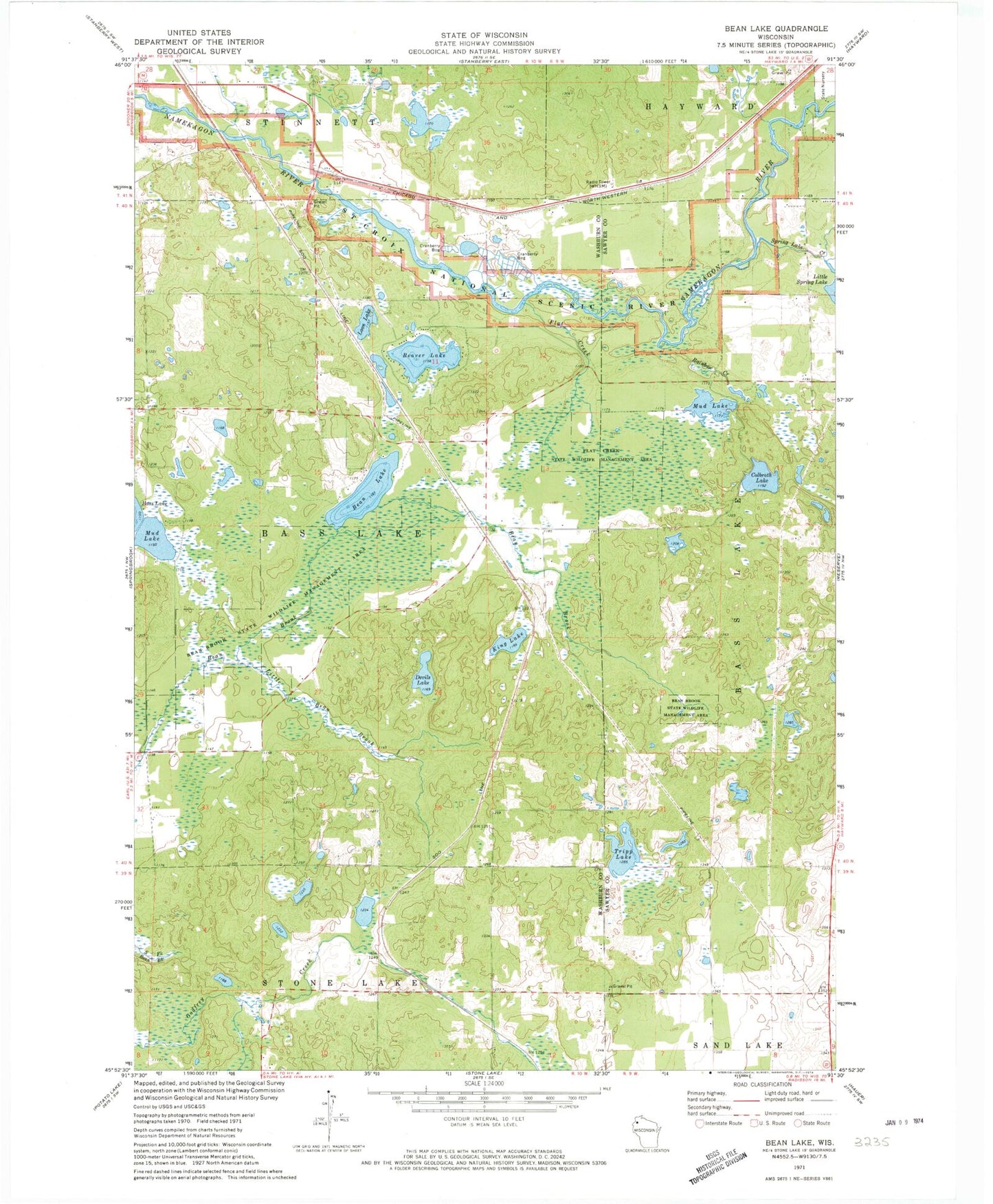
Classic USGS Bean Lake Wisconsin 7.5'x7.5' Topo Map
Couldn't load pickup availability
Historical USGS topographic quad map of Bean Lake in the state of Wisconsin. Typical map scale is 1:24,000, but may vary for certain years, if available. Print size: 24" x 27"
This quadrangle is in the following counties: Sawyer, Washburn.
The map contains contour lines, roads, rivers, towns, and lakes. Printed on high-quality waterproof paper with UV fade-resistant inks, and shipped rolled.
Contains the following named places: Bean Brook State Wildlife Management Area, Bean Lake, Beaver Lake, Colbroth Lake, Devils Lake, Flat Creek, Flat Creek State Wildlife Management Area, King Lake, Little Bean Brook, Little Spring Lake, Loon Lake, Mud Lake, Mud Lake, Rainbow Creek, Spring Lake Creek, Tripp Lake, WHSM-AM (Hayward), WHSM-FM (Hayward), Town of Bass Lake, Jordon School (historical), Brownlee School (historical), Edgewood School (historical), Stinnett School (historical), Saint Croix National Scenic Riverway, Stress Pit