MyTopo
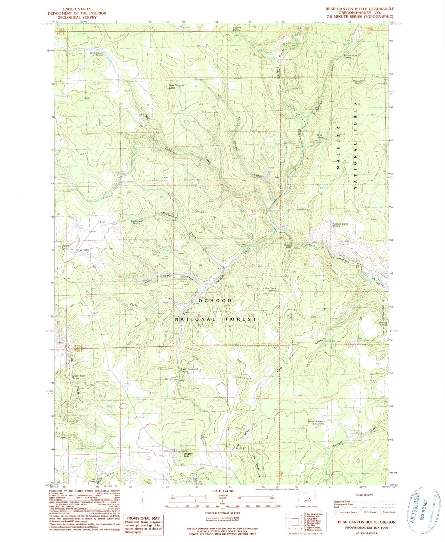
Classic USGS Bear Canyon Butte Oregon 7.5'x7.5' Topo Map
Couldn't load pickup availability
Historical USGS topographic quad map of Bear Canyon Butte in the state of Oregon. Map scale may vary for some years, but is generally around 1:24,000. Print size is approximately 24" x 27"
This quadrangle is in the following counties: Harney.
The map contains contour lines, roads, rivers, towns, and lakes. Printed on high-quality waterproof paper with UV fade-resistant inks, and shipped rolled.
Contains the following named places: Alder Creek, Alder Creek Spring, Bear Canyon Butte, Bear Canyon Creek, Beaver Rock Spring, Buck Spring Reservoir, Buckboard Creek, Buckboard Spring, Corbett Cabin, Cow Canyon, Cow Hollow, Cow Hollow Spring, Coyote Spring, Dipping Vat Spring, Emigrant Butte, Emigrant Recreation Site, Falls Recreation Site, Foundation Creek, Foundation Spring, Garrett Basin Spring, Horsehead Spring, Little Emigrant Creek, Little Emigrant Spring, Lost Guard Creek, Lost Guard Spring, Lost Spring, Parker Creek, Rainbow Campground, Roaring Spring, Rock Spring, Spring Canyon Creek