MyTopo
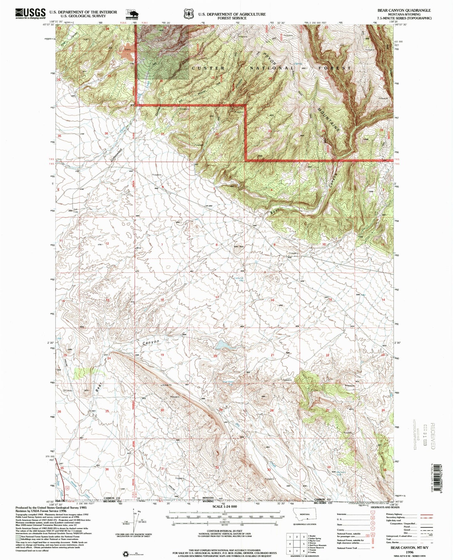
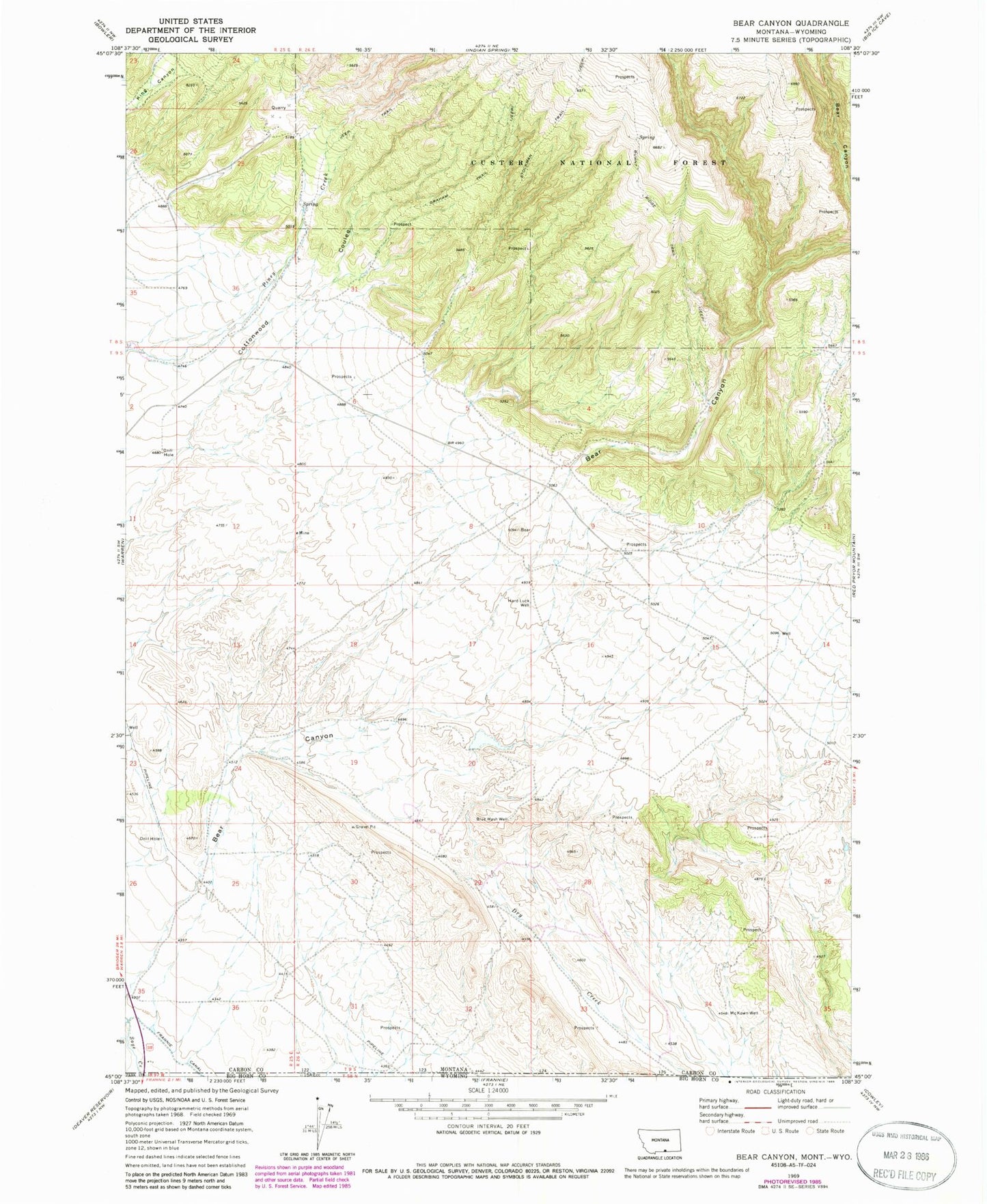
Classic USGS Bear Canyon Montana 7.5'x7.5' Topo Map
Regular price
$16.95
Regular price
Sale price
$16.95
Unit price
per
Couldn't load pickup availability
Historical USGS topographic quad map of Bear Canyon in the state of Montana. Typical map scale is 1:24,000, but may vary for certain years, if available. Print size: 24" x 27"
This quadrangle is in the following counties: Big Horn, Carbon, Park.
The map contains contour lines, roads, rivers, towns, and lakes. Printed on high-quality waterproof paper with UV fade-resistant inks, and shipped rolled.
Contains the following named places: Bear Creek, Blue Wash Well, Burnt Ridge Trail, Graham Trail, Hard Luck Well, McKnown Well, Piney Creek Trail, Stockman Trail, Southside Detention Dam, 09S26E20DDCC01 Well, 09S26E15CAAC01 Well, 09S25E13DAAD01 Well, 09S26E09DACB01 Well, 08S25E25AACB01 Well