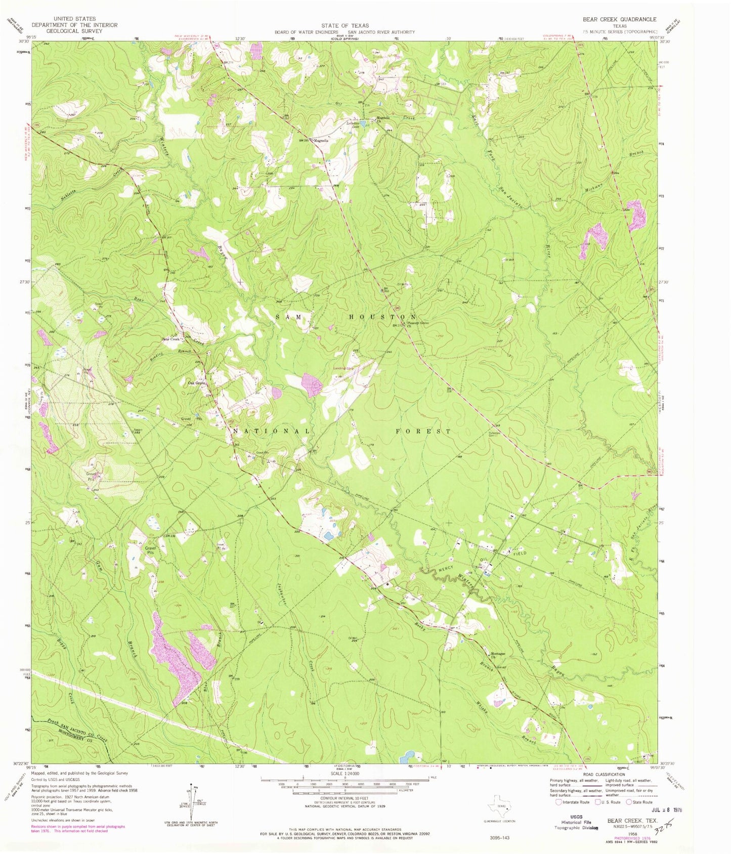
MyTopo
Classic USGS Bear Creek Texas 7.5'x7.5' Topo Map
Couldn't load pickup availability
Historical USGS topographic quad map of Bear Creek in the state of Texas. Typical map scale is 1:24,000, but may vary for certain years, if available. Print size: 24" x 27"
This quadrangle is in the following counties: Montgomery, San Jacinto.
The map contains contour lines, roads, rivers, towns, and lakes. Printed on high-quality waterproof paper with UV fade-resistant inks, and shipped rolled.
Contains the following named places: Bear Creek, Bear Creek, Blue Branch, Boggy Creek, Bradley Branch, Hickman Branch, Letbetter Lake, Magnolia, Magnolia Church, Mercy Oil Field, Montague Church, Nebletts Creek, Oak Grove, Oil Creek, Pleasant Grove Church, Purkerson Cemetery, Rocky Branch, Lake Magnolia, San Jacipto Work Center, Lake Baygall, Shell Hunter Camp, Bass Breeze Ranch Airport, Williams Lake Dam, Williams Lake, Howard Lake Dam, Howard Lake, Shepherd-Evergreen Division, Bear Creek Volunteer Fire Department, San Jacinto County Constable's Office Precinct 3