MyTopo
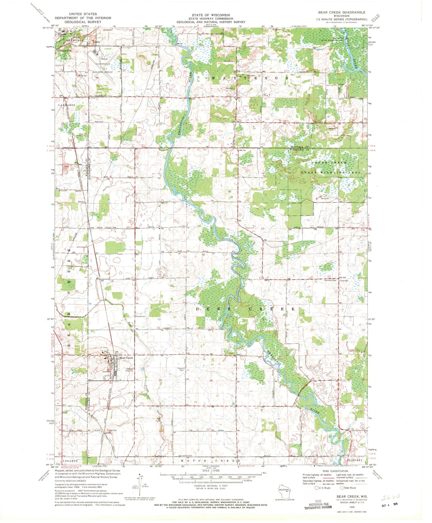
Classic USGS Bear Creek Wisconsin 7.5'x7.5' Topo Map
Couldn't load pickup availability
Historical USGS topographic quad map of Bear Creek in the state of Wisconsin. Map scale may vary for some years, but is generally around 1:24,000. Print size is approximately 24" x 27"
This quadrangle is in the following counties: Outagamie, Waupaca.
The map contains contour lines, roads, rivers, towns, and lakes. Printed on high-quality waterproof paper with UV fade-resistant inks, and shipped rolled.
Contains the following named places: Bear Creek, Bear Creek Corners, Bear Creek Elementary School, Bear Creek Fire Department, Bear Creek Police Department, Bear Creek Post Office, Clintonville Municipal Airport, Clintonville Wastewater Treatment Plant, Clover Lawn School, Clovernook School, Coffee Bridge School, Danish Cemetery, Deer Creek State Wildlife Area, Elder Row School, Evangeline School, Meadow Grove School, Pigeon River, Restland Cemetery, Saint Catherine Cemetery, Saint Marys Grade School, Schewe Airport, Silver Creek, Town of Deer Creek, Village of Bear Creek, WFCL-AM (Clintonville), WJMQ-FM (Clintonville)