MyTopo
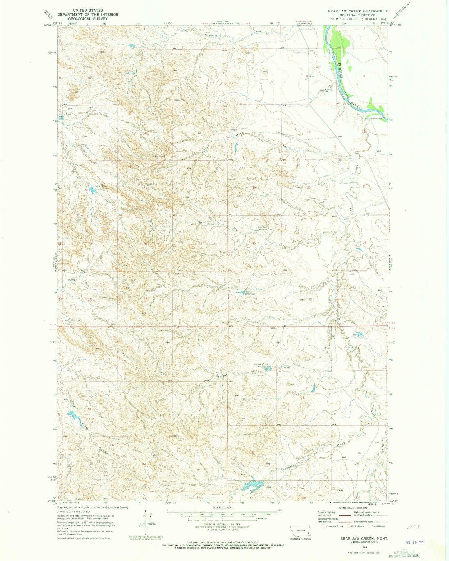
Classic USGS Bear Jaw Creek Montana 7.5'x7.5' Topo Map
Couldn't load pickup availability
Historical USGS topographic quad map of Bear Jaw Creek in the state of Montana. Map scale may vary for some years, but is generally around 1:24,000. Print size is approximately 24" x 27"
This quadrangle is in the following counties: Custer.
The map contains contour lines, roads, rivers, towns, and lakes. Printed on high-quality waterproof paper with UV fade-resistant inks, and shipped rolled.
Contains the following named places: 03N52E12BD__01 Well, 03S52E13CCC_01 Well, 04N52E01DDBD01 Well, 04N52E16AADD01 Well, 04N53E21BAA_01 Well, 04N53E30ACBA01 Well, Ash Creek, Bear Jaw Creek, Bear Jaw Windmill, Corral Creek Reservoir, Corral Creek Well, E Hardy Number 2 Dam, Kitty Spring Creek, Leidholt Reservoir Dam, Monarch Creek, Morgan Creek, Morgan Creek Reservoir, Willie Reservoir