MyTopo
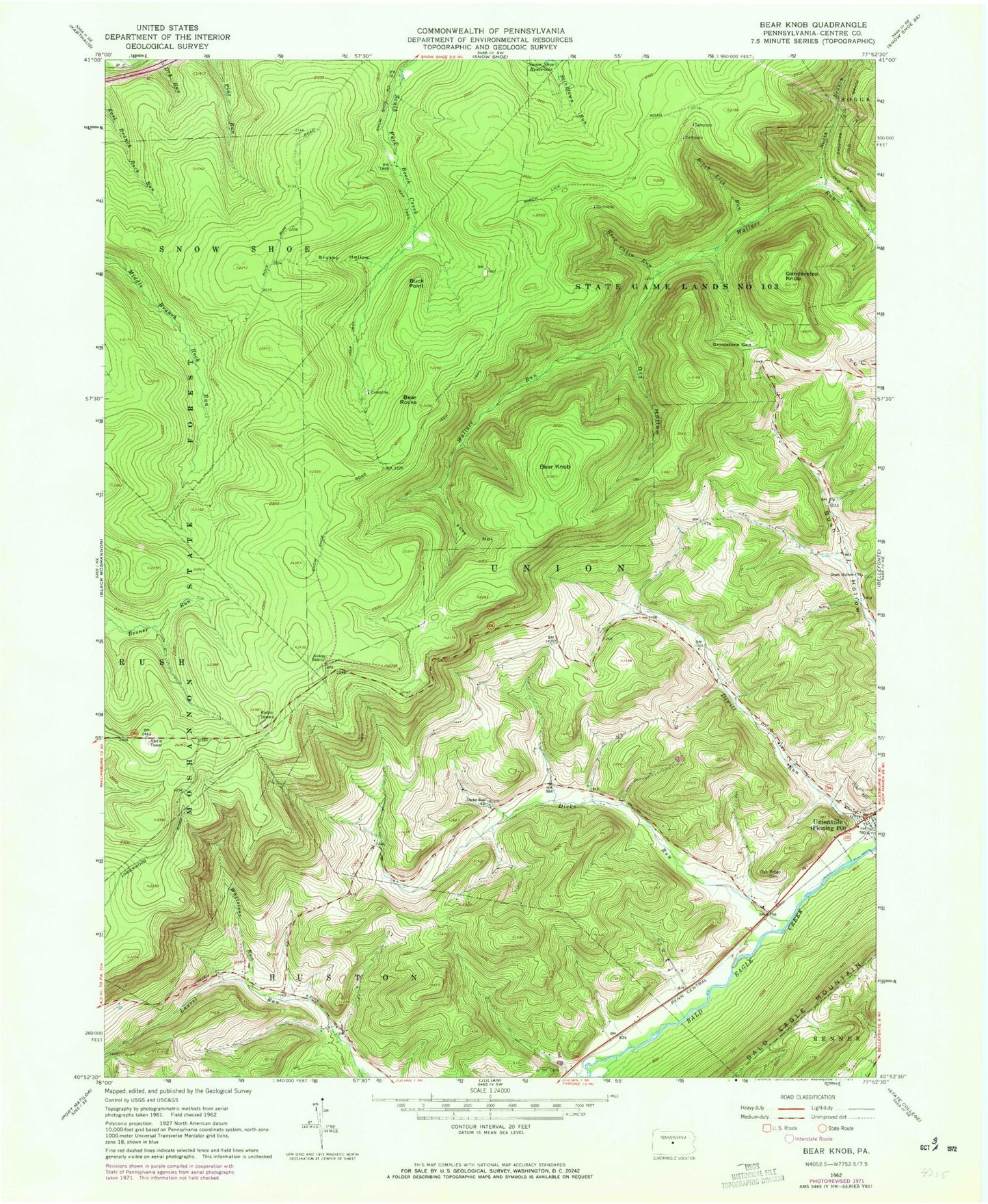
Classic USGS Bear Knob Pennsylvania 7.5'x7.5' Topo Map
Couldn't load pickup availability
Historical USGS topographic quad map of Bear Knob in the state of Pennsylvania. Map scale may vary for some years, but is generally around 1:24,000. Print size is approximately 24" x 27"
This quadrangle is in the following counties: Centre.
The map contains contour lines, roads, rivers, towns, and lakes. Printed on high-quality waterproof paper with UV fade-resistant inks, and shipped rolled.
Contains the following named places: Bear Knob, Bear Rocks, Belleview School, Birch Lick Run, Borough of Unionville, Brushy Hollow, Buck Point, Bush Hollow Cemetery, Bush Hollow Church, Dicks Run, Dick's Run Advent Church Cemetery, Dicks Run Church, Dry Hollow, Eagle Creek, Eagle Creek Census Designated Place, Eagle Ridge Gliderport, Fleming Post Office, Foxy Hollow, Ganderstep Knob, Grindstone Gap, Julian Cemetery, North Branch Wallace Run, Oak Ridge Cemetery, Rattlesnake Mountain Farm, Ridge Soaring Airport, Rock Cabin Run, State Game Lands Number 103, Township of Union, Unionville, Unionville Cemetery, WGMR-FM (Tyrone), Whetstone Run, ZIP Codes: 16835, 16844, 16874