MyTopo
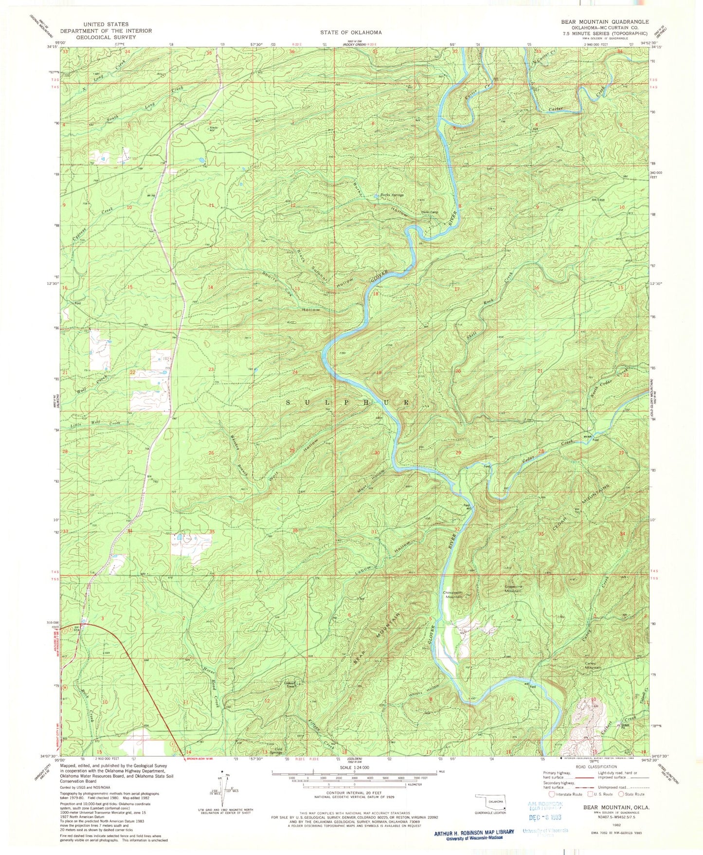
Classic USGS Bear Mountain Oklahoma 7.5'x7.5' Topo Map
Couldn't load pickup availability
Historical USGS topographic quad map of Bear Mountain in the state of Oklahoma. Map scale may vary for some years, but is generally around 1:24,000. Print size is approximately 24" x 27"
This quadrangle is in the following counties: McCurtain.
The map contains contour lines, roads, rivers, towns, and lakes. Printed on high-quality waterproof paper with UV fade-resistant inks, and shipped rolled.
Contains the following named places: Bear Mountain, Black Sulphur Hollow, Burks Hollow, Burks Springs, Camp Glover, Caney Creek, Caney Mountain, Carter Creek, Cedar Creek, Chinquapin Mountain, Cold Springs, Dierks Camp, Grapevine Mountain, Lebow Hollow, Meat Hollow, North Carter Creek, North Cedar Creek, Shell Rock Creek, Shorty Cox Hollow, Tidwell Creek, Township of Sulphur, Whisky Branch, Whisky Hollow, Wolf Hollow, ZIP Code: 74766