MyTopo
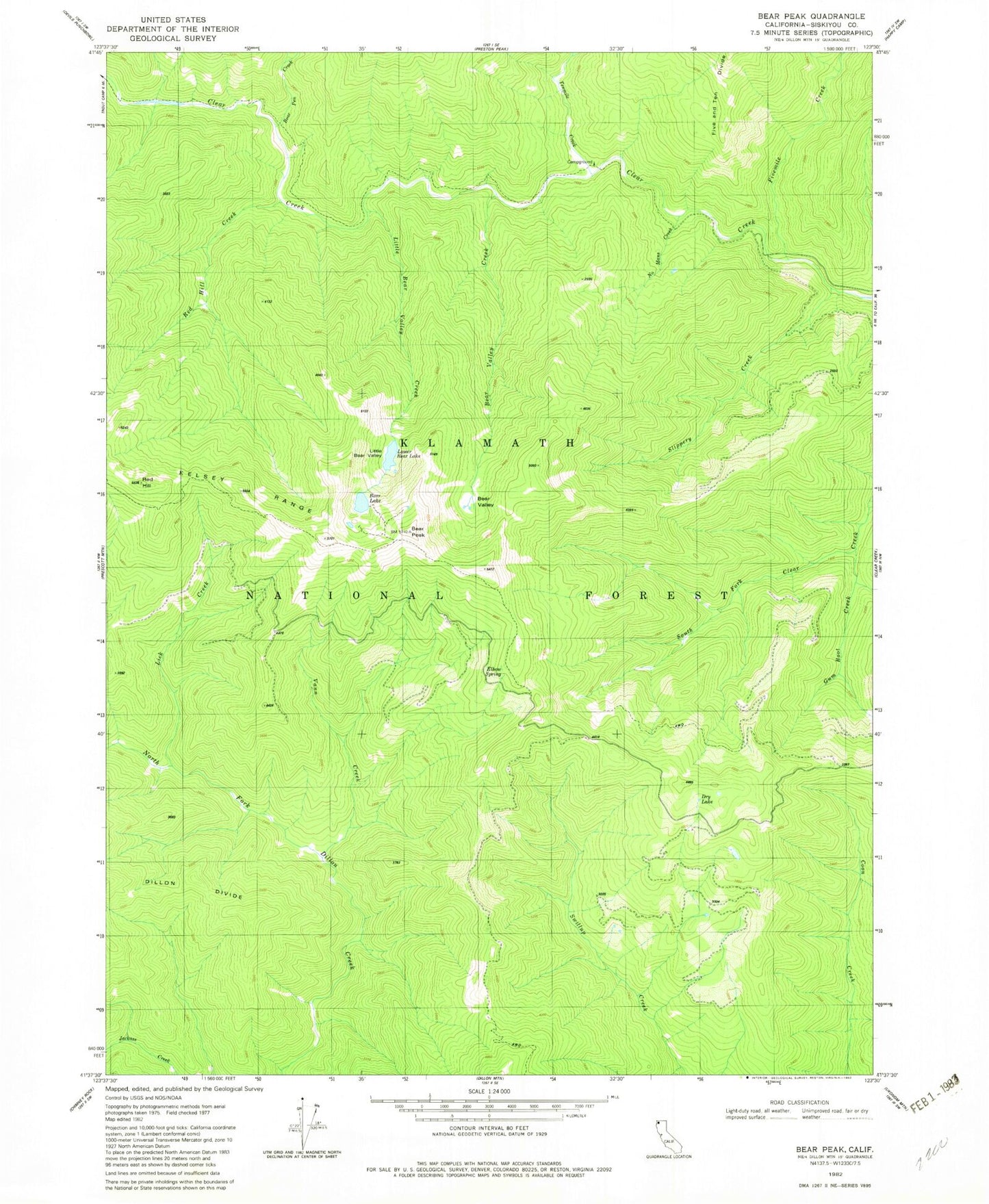
Classic USGS Bear Peak California 7.5'x7.5' Topo Map
Couldn't load pickup availability
Historical USGS topographic quad map of Bear Peak in the state of California. Map scale may vary for some years, but is generally around 1:24,000. Print size is approximately 24" x 27"
This quadrangle is in the following counties: Siskiyou.
The map contains contour lines, roads, rivers, towns, and lakes. Printed on high-quality waterproof paper with UV fade-resistant inks, and shipped rolled.
Contains the following named places: Bear Lake, Bear Peak, Bear Pen Creek, Bear Valley, Bear Valley Creek, Dry Lake, Elbow Spring, Fivemile Creek, Gum Boot Creek, Kelsey Trail, Lick Creek, Little Bear Valley, Little Bear Valley Creek, Lower Bear Lake, No Mans Creek, Red Hill, Red Hill Creek, Slippery Creek, Tenmile Creek, Vann Creek