MyTopo
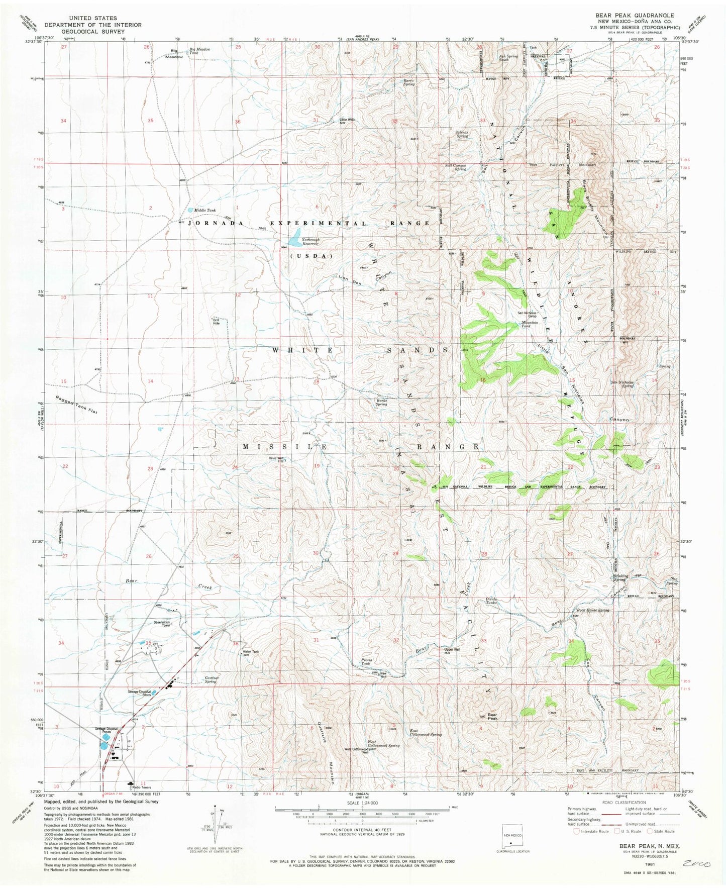
Classic USGS Bear Peak New Mexico 7.5'x7.5' Topo Map
Couldn't load pickup availability
Historical USGS topographic quad map of Bear Peak in the state of New Mexico. Map scale may vary for some years, but is generally around 1:24,000. Print size is approximately 24" x 27"
This quadrangle is in the following counties: Do��a Ana.
The map contains contour lines, roads, rivers, towns, and lakes. Printed on high-quality waterproof paper with UV fade-resistant inks, and shipped rolled.
Contains the following named places: Ash Spring, Bear Peak, Big Brushy Mountain, Big Meadow, Big Meadow Tank, Burke Spring, Burro Spring, Cox Canyon, Davis Tank, Davis Well, Divide Tanks, East Cottonwood Spring, Gardner Spring, Gravelly Ridges Artificial Revegetation Plot, Horse Tank, Johnson Space Center White Sands Test Facility Fire Department, Lion Den Canyon, Little Wells, Love Ranch Headquarters, Middle Tank, Mountain Tank, New Well, Peoria Tank, Quartz Mountain, Ragged Tank Flat, Rock House Spring, Salinas Spring, Salt Canyon, Salt Canyon Spring, San Nicholas Spring, Stinking Spring, Upper Well, West Cottonwood Spring, West Cottonwood Well, White Sands Division, White Sands Missile Range, White Sands Test Facility, Yarbrough Reservoir