MyTopo
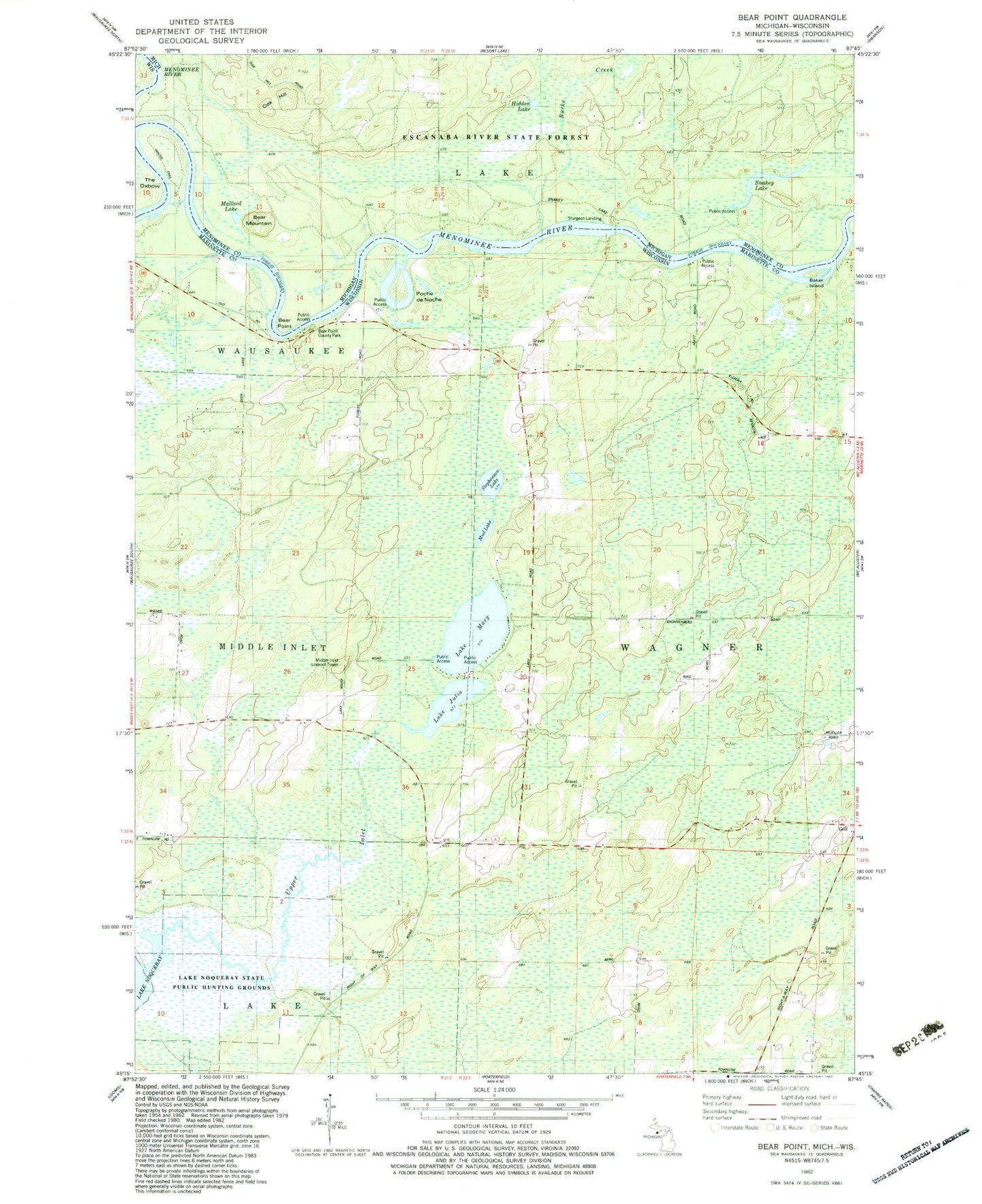
Classic USGS Bear Point Michigan 7.5'x7.5' Topo Map
Couldn't load pickup availability
Historical USGS topographic quad map of Bear Point in the states of Michigan, Wisconsin. Map scale may vary for some years, but is generally around 1:24,000. Print size is approximately 24" x 27"
This quadrangle is in the following counties: Marinette, Menominee.
The map contains contour lines, roads, rivers, towns, and lakes. Printed on high-quality waterproof paper with UV fade-resistant inks, and shipped rolled.
Contains the following named places: Baker Island, Bear Mountain, Bear Point, Bear Point County Park, Burke Creek, Goll, Hidden Lake, Lake Julia, Lake Mary, Lake Noquebay State Public Hunting Grounds, Lake Noquebay Wildlife Area 2WP1975 Dam, Little Poche De Noche, Mallard Lake, Middle Inlet Lookout Tower, Mud Lake, Oak Hill, Poche de Noche, Snakey Lake, Stephenson Lake, Sturgeon Landing, Upper Inlet