MyTopo
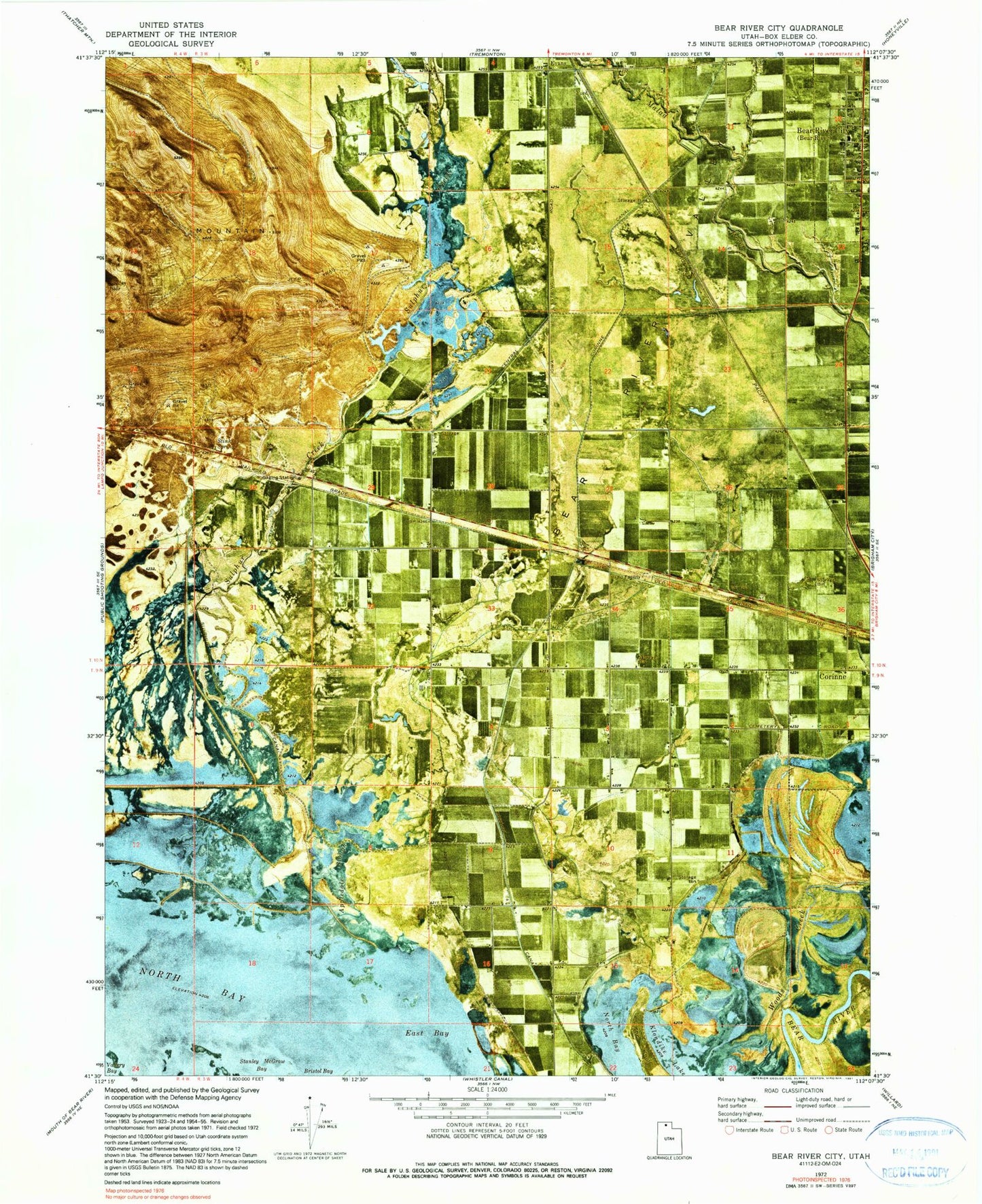
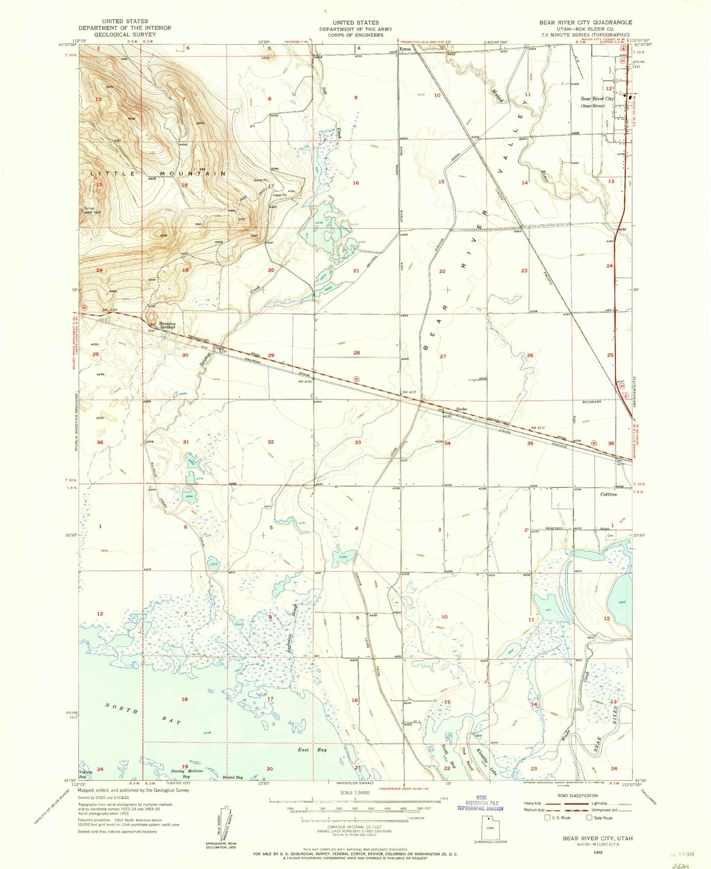
Classic USGS Bear River City Utah 7.5'x7.5' Topo Map
Couldn't load pickup availability
Historical USGS topographic quad map of Bear River City in the state of Utah. Map scale may vary for some years, but is generally around 1:24,000. Print size is approximately 24" x 27"
This quadrangle is in the following counties: Box Elder.
The map contains contour lines, roads, rivers, towns, and lakes. Printed on high-quality waterproof paper with UV fade-resistant inks, and shipped rolled.
Contains the following named places: Appledale Slough, Bear River City, Bear River City Post Office, Bear River Valley, Century Elementary School, Corinne Cemetery, East Bay, Evans, Ford, Klondike Lake, Little Mountain, North Bay, Stanley McGraw Bay, Stinking Springs, Sulphur Creek, Sulphur Creek Canal, The Knoll, Tremonton Division, ZIP Code: 84301