
MyTopo
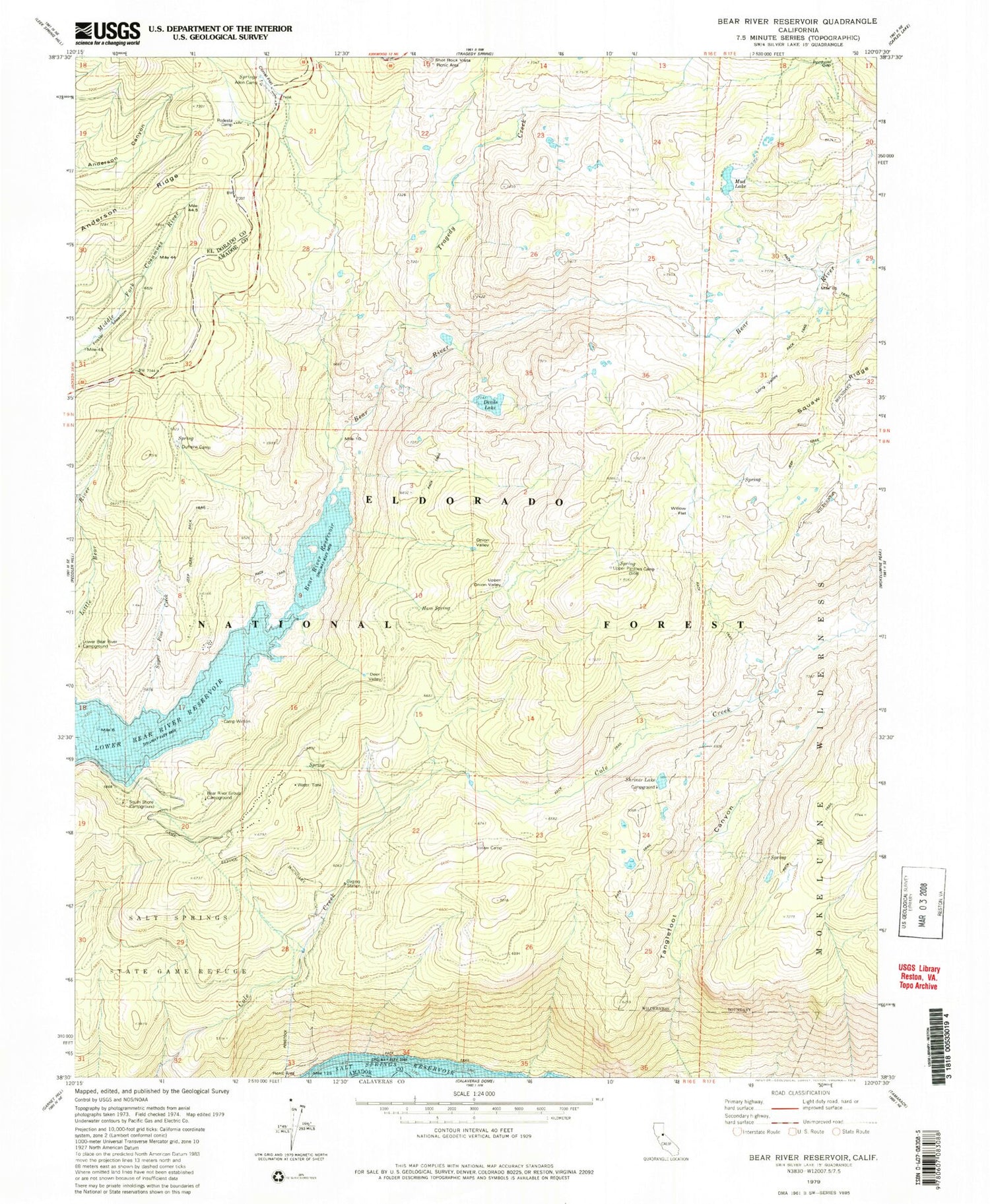
Classic USGS Bear River Reservoir California 7.5'x7.5' Topo Map
Couldn't load pickup availability
Historical USGS topographic quad map of Bear River Reservoir in the state of California. Typical map scale is 1:24,000, but may vary for certain years, if available. Print size: 24" x 27"
This quadrangle is in the following counties: Amador, Calaveras, El Dorado.
The map contains contour lines, roads, rivers, towns, and lakes. Printed on high-quality waterproof paper with UV fade-resistant inks, and shipped rolled.
Contains the following named places: Corral Flat, Allen Camp, Anderson Ridge, Bear River Reservoir, Camp Winton, Cole Creek Cabin, Corral Flat, Deer Valley, Devils Lake, Dufrene Camp, Ham Spring, Long Valley, Lower Bear River Reservoir, Mud Lake, Onion Valley, Podesta Camp, Shriner Lake, Sugar Pine Creek, Tragedy Creek, Upper Pardoes Camp, Votaw Camp, Willow Flat, Shriner Lake Campground, Shot Rock Vista Campground, Salt Springs Campground, Shot Rock Vista Scenic Viewpoint, LDS Camp, Salt Springs Recreation Site, Bear River 97-061 Dam, Bear River Group Campground, Porthole Gap, Shot Rock Vista Picnic Area, South Shore Campground, Upper Onion Valley, Foster Meadow


