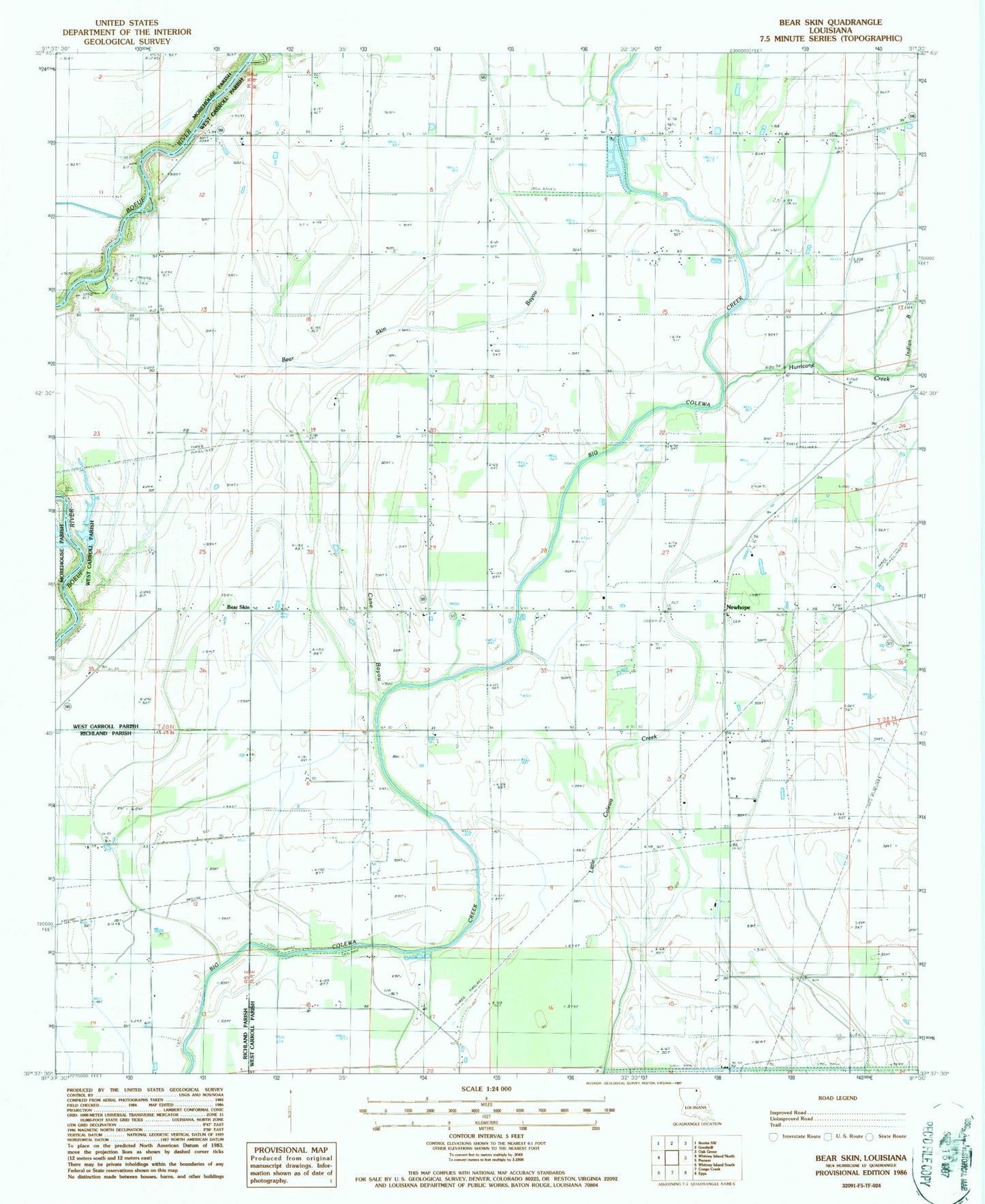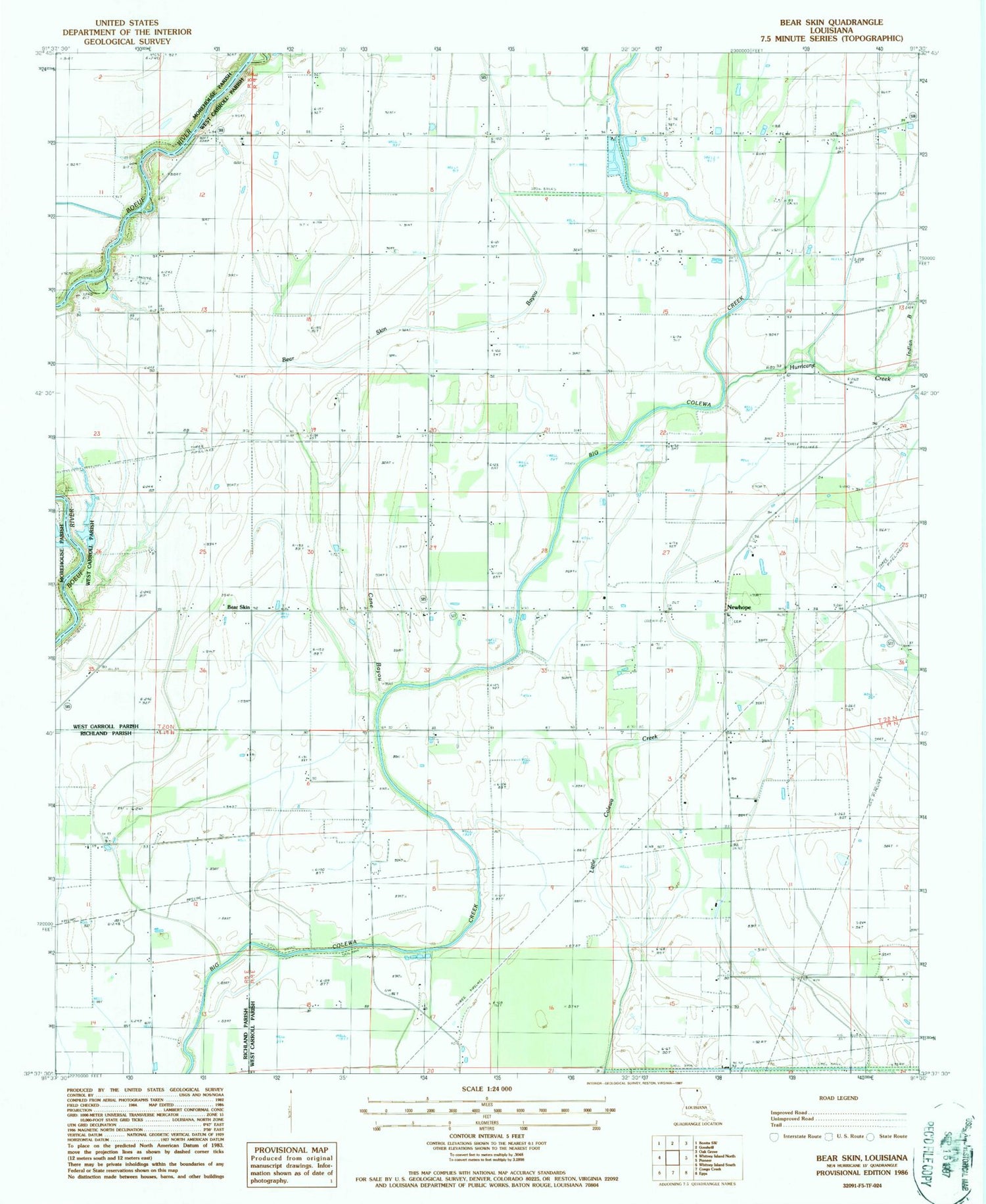
MyTopo
Classic USGS Bear Skin Louisiana 7.5'x7.5' Topo Map
Regular price
$16.95
Regular price
Sale price
$16.95
Unit price
per
Couldn't load pickup availability
Historical USGS topographic quad map of Bear Skin in the state of Louisiana. Map scale may vary for some years, but is generally around 1:24,000. Print size is approximately 24" x 27"
This quadrangle is in the following counties: Morehouse, Richland, West Carroll.
The map contains contour lines, roads, rivers, towns, and lakes. Printed on high-quality waterproof paper with UV fade-resistant inks, and shipped rolled.
Contains the following named places: Assembly of God Church, Bear Skin, Bear Skin Bayou, Cane Bayou, Clear Lake Church, Colewa Church, Hurricane Creek, Indian Bayou, Midway Church, New Prospect Church, Newhope, Parish Governing Authority District A, Shady Grove Church, ZIP Code: 71266