MyTopo
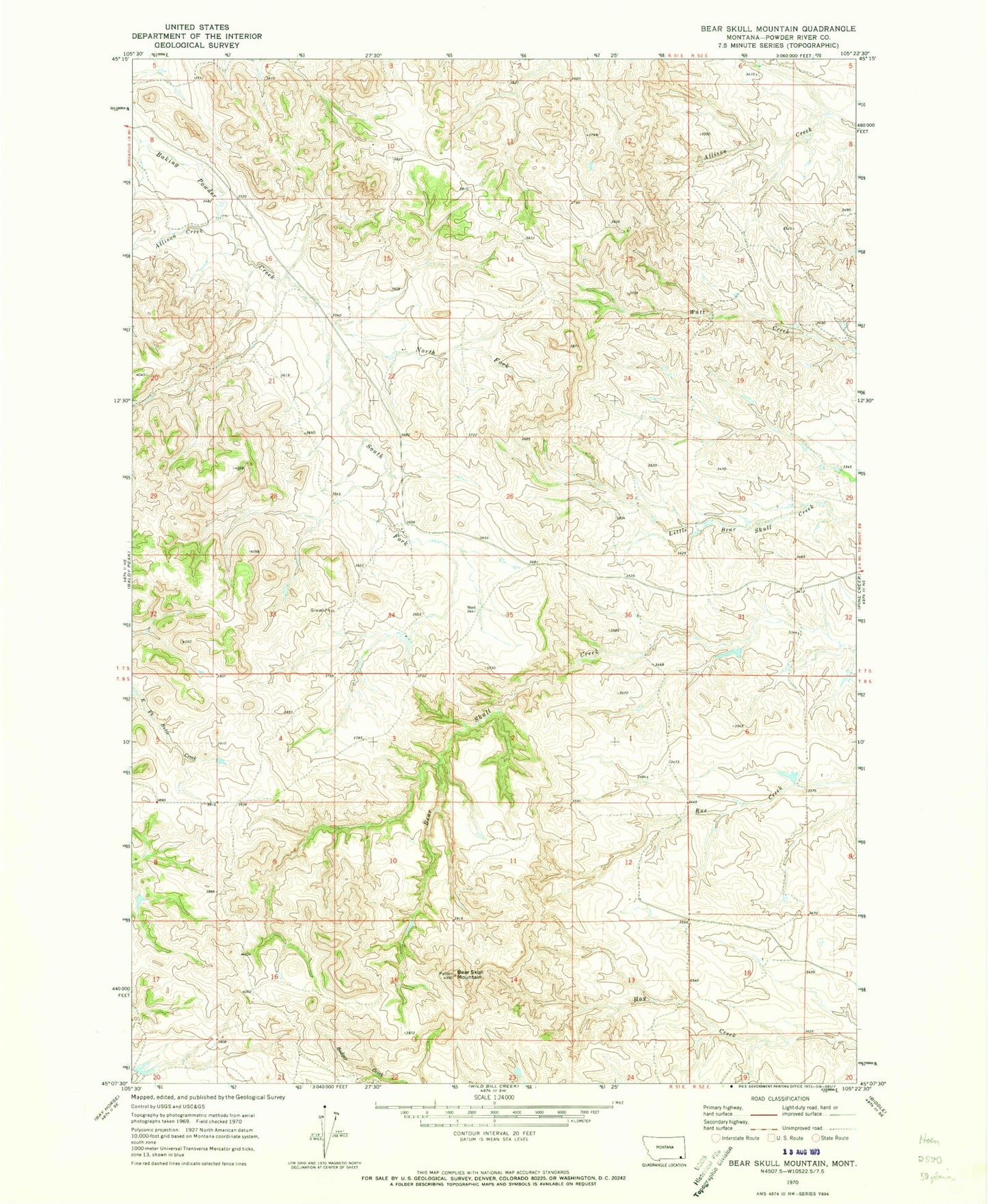
Classic USGS Bear Skull Mountain Montana 7.5'x7.5' Topo Map
Regular price
$16.95
Regular price
Sale price
$16.95
Unit price
per
Couldn't load pickup availability
Historical USGS topographic quad map of Bear Skull Mountain in the state of Montana. Map scale is 1:24000. Print size is approximately 24" x 27"
This quadrangle is in the following counties: Powder River.
The map contains contour lines, roads, rivers, towns, and lakes. Printed on high-quality waterproof paper with UV fade-resistant inks, and shipped rolled.
Contains the following named places: 07S51E27BBDA01 Well, 07S51E34DBDB01 Well, 08S51E01DCDB01 Well, 08S51E12DCBB01 Well, Allison Creek, Bear Skull Mountain, North Fork Baking Powder Creek, South Fork Baking Powder Creek