MyTopo
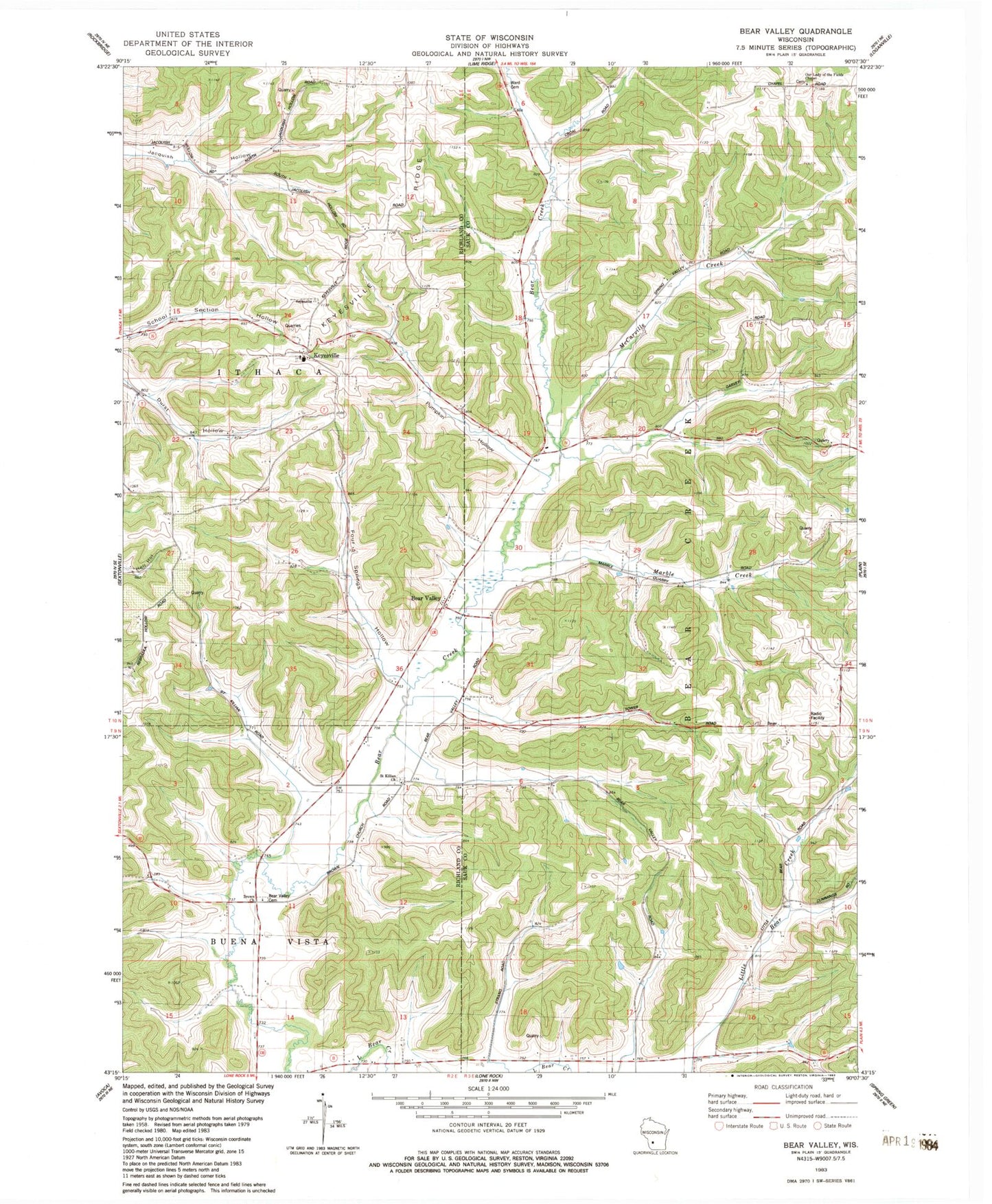
Classic USGS Bear Valley Wisconsin 7.5'x7.5' Topo Map
Couldn't load pickup availability
Historical USGS topographic quad map of Bear Valley in the state of Wisconsin. Map scale may vary for some years, but is generally around 1:24,000. Print size is approximately 24" x 27"
This quadrangle is in the following counties: Richland, Sauk.
The map contains contour lines, roads, rivers, towns, and lakes. Printed on high-quality waterproof paper with UV fade-resistant inks, and shipped rolled.
Contains the following named places: Bear Creek School, Bear Creek Sedge Meadow State Natural Area, Bear Valley, Bear Valley Cemetery, Bear Valley Dairy Farm, Big Spring Farm, Bogus Hollow Run, Brown Church, Castle Rock Farm, Cold Spring Farm, Durst Stock Farm, Evergreen Stock and Dairy Farm, Fairlawn Stock Farm, Fairview Dairy Farm, Four Springs Hollow, Four Springs Stock Farm, Golden Willow Stock Farm, Greenhecks Homestead, Hickory Grove Farm, Keyesville, Keyesville Ridge, Lindencroft Stock and Dairy Farm, Louis's Fruit Farm, Maple Cottage Farm, Marble Creek, McCarville Creek, Oakwood Fruit Farm, Orchard Grove Farm, Our Lady of the Fields Chapel, Pleasant Hill Farm, Pumpkin Hollow, Rich Valley Stock Farm, Saint Kilians Cemetery, Saint Killian Church, Saint Marys Cemetery, School Number 12, School Number 2, Shady Bluff Stock Farm, Springdale Dairy Farm, Sunnylawn Stock Farm, Sunrise Stock Farm, The Glen, Town of Bear Creek, Trout Brook Farm, Valleyview Stock Farm, Ward Cemetery, Wiedenfelds Homestead