MyTopo
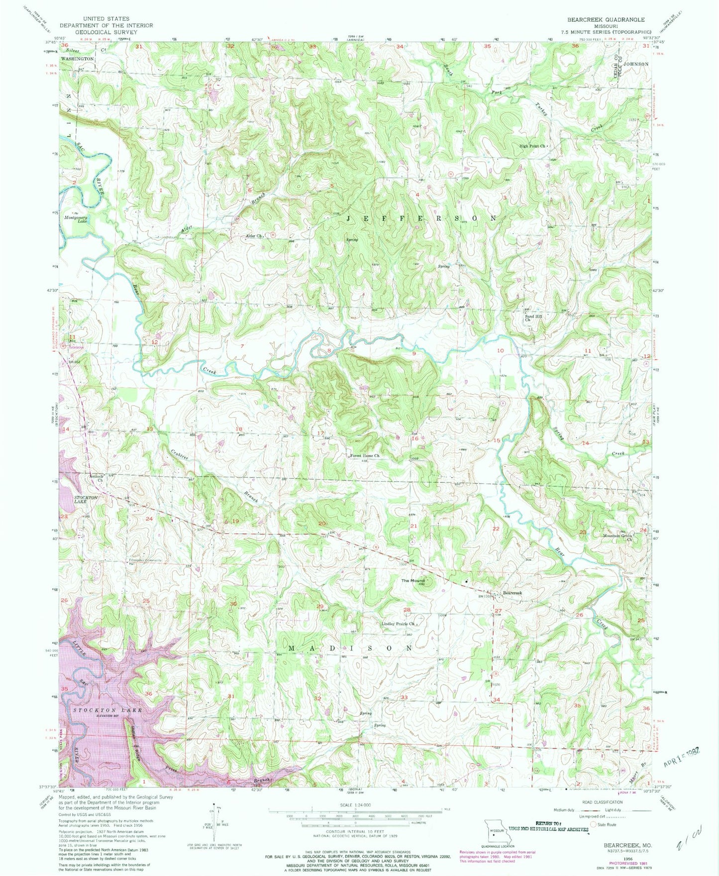
Classic USGS Bearcreek Missouri 7.5'x7.5' Topo Map
Couldn't load pickup availability
Historical USGS topographic quad map of Bearcreek in the state of Missouri. Map scale may vary for some years, but is generally around 1:24,000. Print size is approximately 24" x 27"
This quadrangle is in the following counties: Cedar, Polk.
The map contains contour lines, roads, rivers, towns, and lakes. Printed on high-quality waterproof paper with UV fade-resistant inks, and shipped rolled.
Contains the following named places: Alder Branch, Alder Church, Alder School, Antioch Church, Bear Creek, Bearcreek, Crabtree Branch, El Dorado School, Forest Home Church, Friendship Community Hall, High Point Church, High Point School, Indian Ridge, Lindley Prairie Cemetery, Lindley Prairie Church, Mollie, Montgomery Lake, Montgomery School, Mountain Grove Church, Owens Mill, Price Branch, Red Hill School, Sand Hill Church, Spring Creek, The Mound, Township of Jefferson, Truitt Lake, Truitt Lake Dam