MyTopo
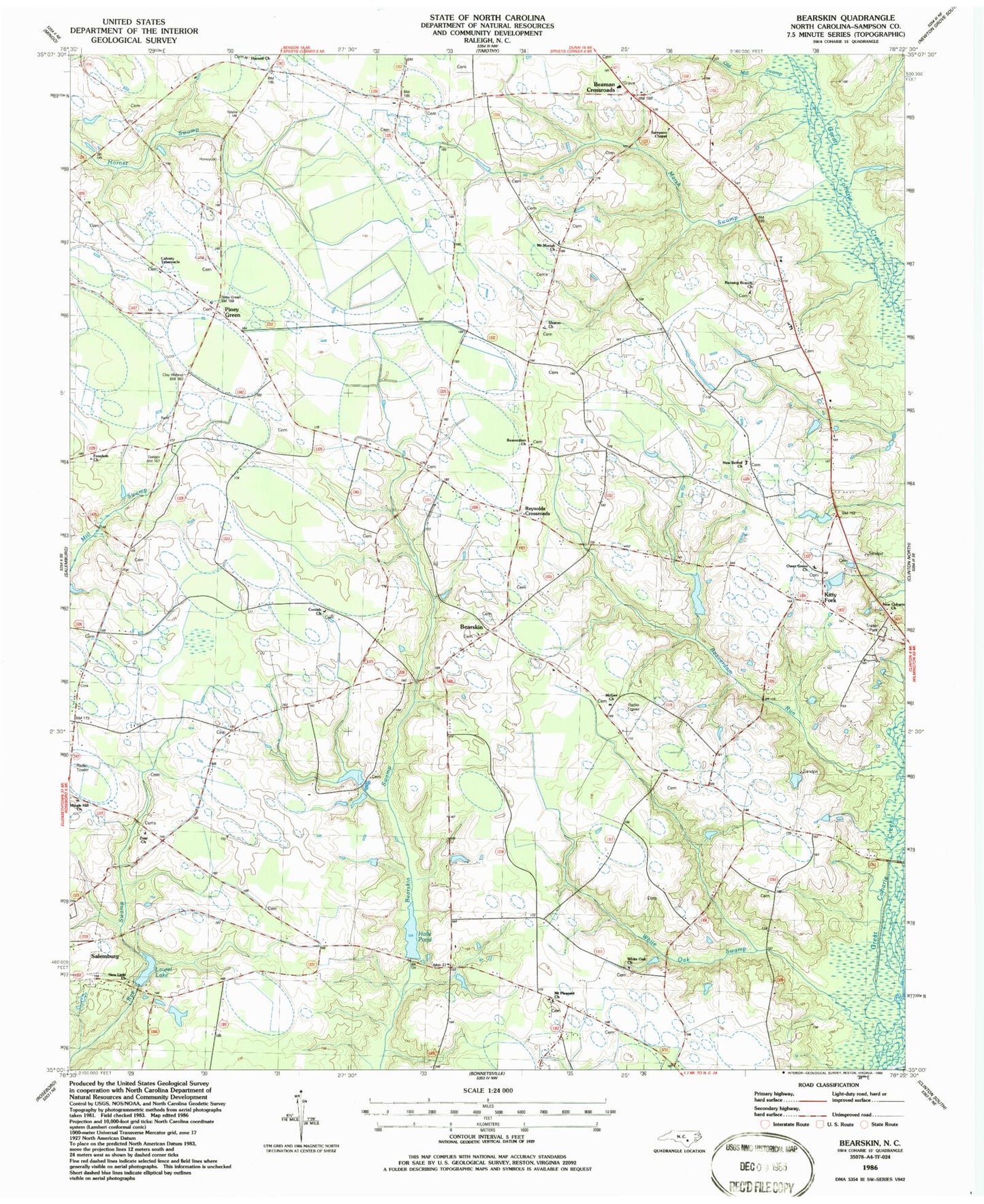
Classic USGS Bearskin North Carolina 7.5'x7.5' Topo Map
Couldn't load pickup availability
Historical USGS topographic quad map of Bearskin in the state of North Carolina. Map scale may vary for some years, but is generally around 1:24,000. Print size is approximately 24" x 27"
This quadrangle is in the following counties: Sampson.
The map contains contour lines, roads, rivers, towns, and lakes. Printed on high-quality waterproof paper with UV fade-resistant inks, and shipped rolled.
Contains the following named places: Beaman Crossroads, Bearskin, Bearskin Missionary Baptist Church, Beaverdam Church, Beaverdam Run, Bellevoir School, Calvary Tabernacle, Corinth Church, Freedom Church, Halls Pond, Harnett Church, Herring Volunteer Fire and Rescue, Kitty Fork, Laurel Lake, Laurel Lake Dam, Marsh Swamp, McGee Church, Mingle Hill Church, Mount Moriah Church, Mount Pleasant Church, New Bethel Church, New Coharie Church, New Light Church, Old Mill Swamp, Owen Grove Church, Piney Green, Piney Green Church, Reynolds Crossroads, Running Branch Church, Sampson Chapel, Sharon Church, Township of Belvoir, Township of Herring, Township of Honeycutt, White Oak Church, White Oak Swamp, Zoar Church, ZIP Code: 28385