MyTopo
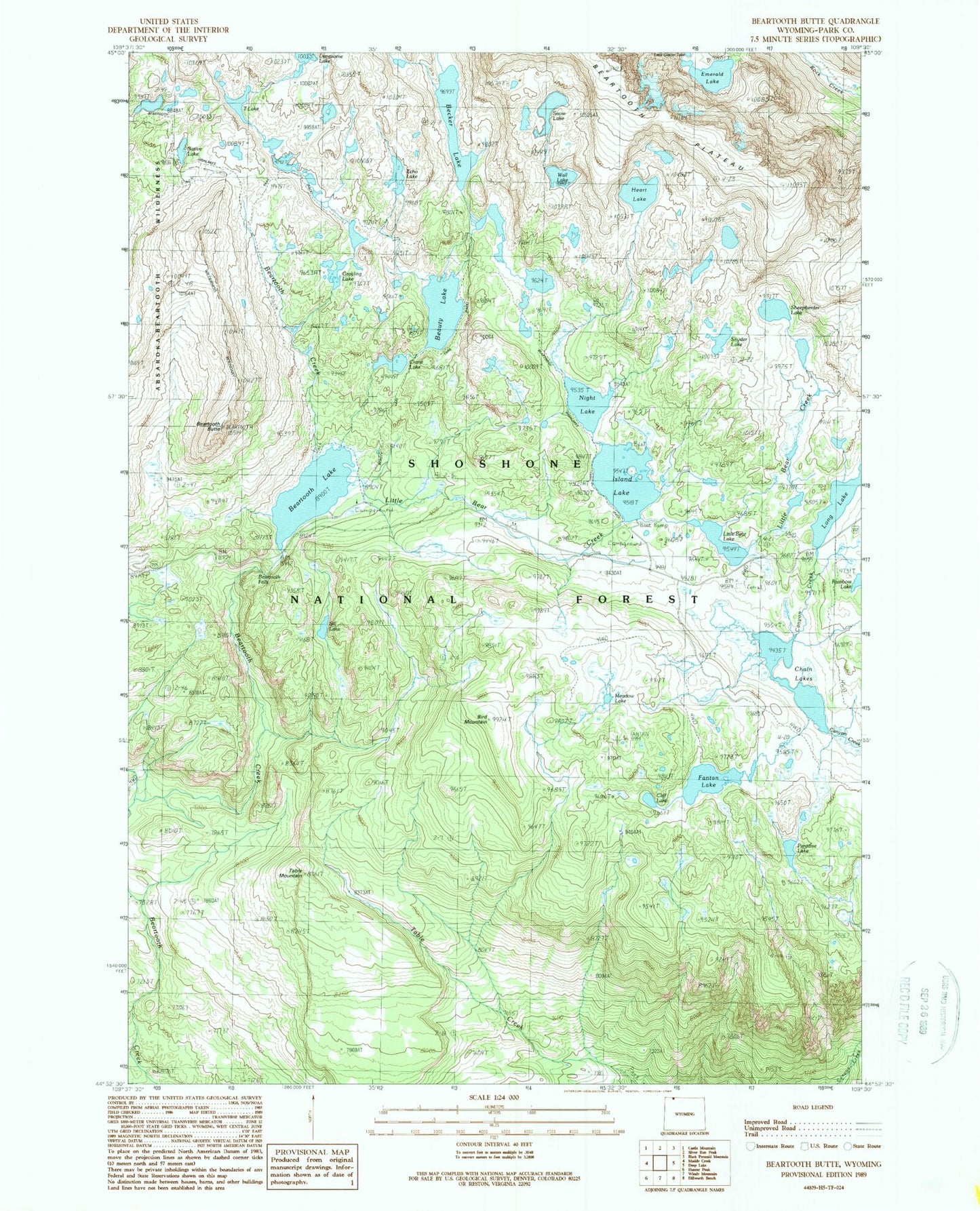
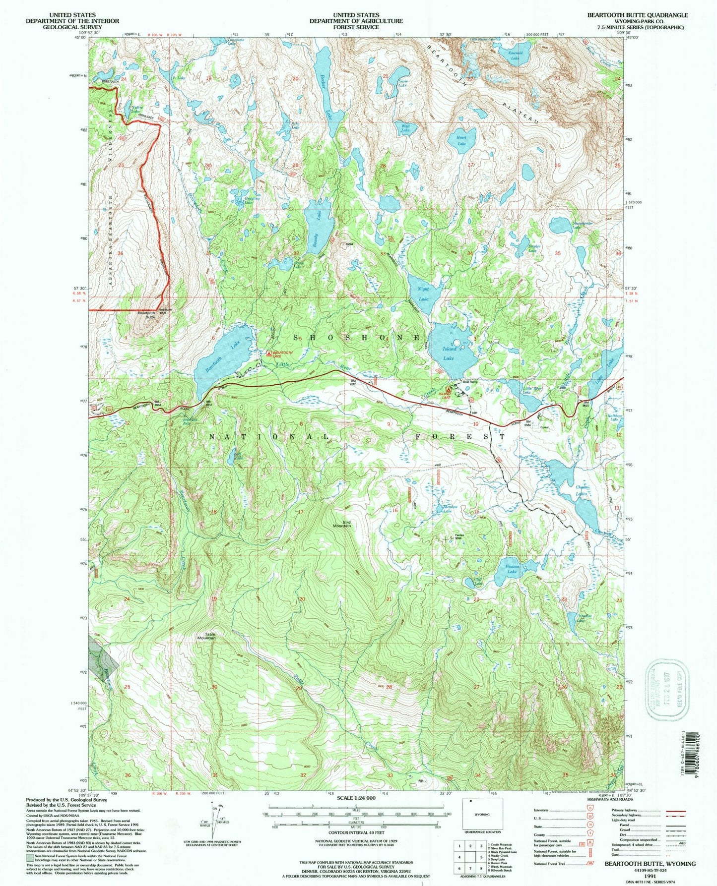
USGS Classic Beartooth Butte Wyoming 7.5'x7.5' Topo Map
Couldn't load pickup availability
Historical USGS topographic quad map of Beartooth Buttein the states of Wyoming, Montana. Scale: 1:24000. Print size: 24" x 27"
This quadrangle is in the following counties: Park.
The map contains contour lines, roads, rivers, towns, lakes, and grids including latitude / longitude and UTM / MGRS. Printed on high-quality waterproof paper with UV fade-resistant inks.
Contains the following named places: Beartooth Plateau, Beartooth Butte, Beartooth Falls, Beartooth Lake, Beartooth Lake Campground, Beartooth Plateau, Beauty Lake, Becker Lake, Bird Mountain, Chain Lakes, Cliff Lake, Crane Lake, Echo Lake, Emerald Lake, Fantan Lake, Grayling Lake, Island Lake, Island Lake Campground, Little Bear Creek, Little Bear Lake, Lonesome Lake, Long Lake, Meadow Lake, Native Lake, Night Lake, Paradise Lake, Rainbow Lake, Sheepherder Lake, Sill Lake, Snow Lake, Snyder Lake, T Lake, Table Mountain, Wall Lake, Beauty Lake Trail, Long Lake Campground, Beartooth Highlakes Trail, Heart Lake, Beartooth Plateau, Lonesome Lake