MyTopo
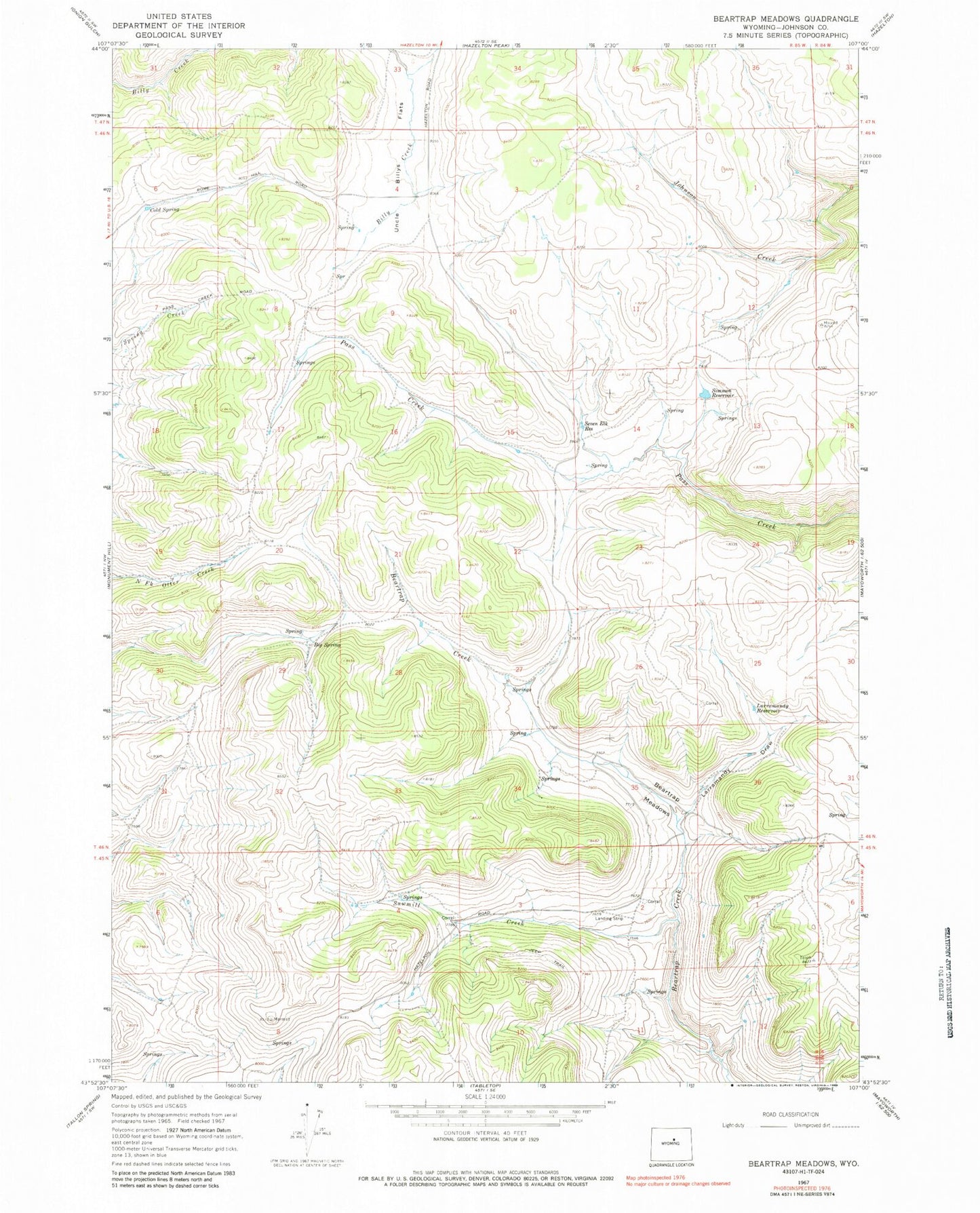
Classic USGS Beartrap Meadows Wyoming 7.5'x7.5' Topo Map
Regular price
$16.95
Regular price
Sale price
$16.95
Unit price
per
Couldn't load pickup availability
Historical USGS topographic quad map of Beartrap Meadows in the state of Wyoming. Map scale may vary for some years, but is generally around 1:24,000. Print size is approximately 24" x 27"
This quadrangle is in the following counties: Johnson.
The map contains contour lines, roads, rivers, towns, and lakes. Printed on high-quality waterproof paper with UV fade-resistant inks, and shipped rolled.
Contains the following named places: Beartrap Meadows, Big Spring, Eychaner Dam, Eychaner Reservoir, Larramandy Draw, Larramandy Reservoir, Sawmill Creek, Seven Elk Reservoir, Simmon Reservoir, Uncle Billys Flats