MyTopo
Classic USGS Bearwallow Mountain New Mexico 7.5'x7.5' Topo Map
Couldn't load pickup availability
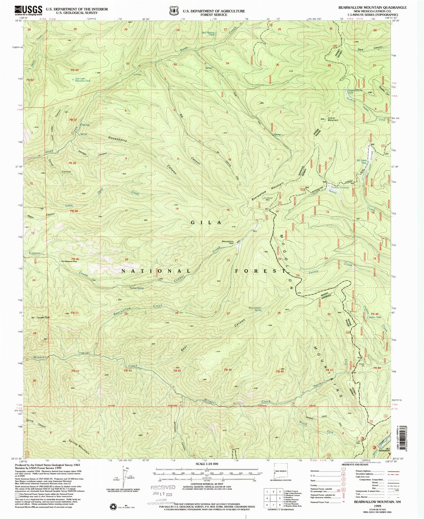
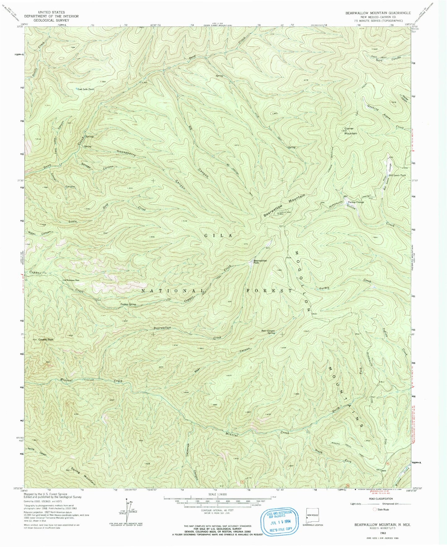
Historical USGS topographic quad map of Bearwallow Mountain in the state of New Mexico. Typical map scale is 1:24,000, but may vary for certain years, if available. Print size: 24" x 27"
This quadrangle is in the following counties: Catron.
The map contains contour lines, roads, rivers, towns, and lakes. Printed on high-quality waterproof paper with UV fade-resistant inks, and shipped rolled.
Contains the following named places: BS Canyon, BS Canyon Trail, Bear Canyon, Bear Canyon Spring, Bearwallow Creek, Bearwallow Park, Bill Lewis Cienega, Bill Lewis Tank, Cooney Peak, Corner Mountain, Corner Mountain Trail, Corral Canyon, D-K Well, Gooseberry Canyon, Lost Lake Canyon, Lost Lake Mountain Tank, Mineral Creek Trail, North Fork Mineral Creek, Old Waterman Place, Savage Canyon, South Fork Mineral Creek, Spring Mountain, Stub Trail, Turkey Cienega, Turkey Spring, Whitetail Canyon, Bearwallow Lookout, Hogwallow Pit Tank, Bull Pasture Tank, Indian Tank, Trailer Cabin, Bearwallow Mountain