
MyTopo
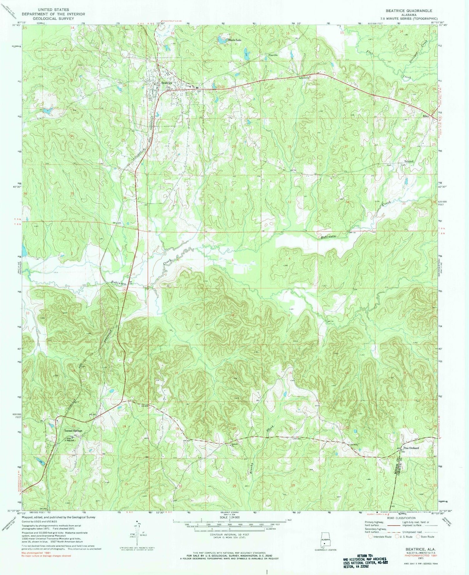
Classic USGS Beatrice Alabama 7.5'x7.5' Topo Map
Couldn't load pickup availability
Historical USGS topographic quad map of Beatrice in the state of Alabama. Map scale may vary for some years, but is generally around 1:24,000. Print size is approximately 24" x 27"
This quadrangle is in the following counties: Conecuh, Monroe.
The map contains contour lines, roads, rivers, towns, and lakes. Printed on high-quality waterproof paper with UV fade-resistant inks, and shipped rolled.
Contains the following named places: Antioch Baptist Church, Antioch Cemetery, Beatrice, Beatrice Elementary School, Beatrice Post Office, Beatrice Volunteer Fire Department, Cotey Branch, Greer Junior High School, J F Shields High School, Kalem, Lightwood Knot Branch, Nettles Store, Philadelphia Baptist Church, Philadelphia Cemetery, Pine Orchard, Pine Orchard Cemetery, Pine Orchard Methodist Church, Pine Orchard Volunteer Fire Department, Pineville, Pineville Cemetery, Pineville Methodist Cemetery, Riley, Savannah Cemetery, Steel Family Pond Dam, Steels Lake, Steels Lake Number One, Steels Lake Number One Dam, Stringer Creek, Sylvester Church, Town of Beatrice, Tunnel Springs, Turnbull, Turnbull Branch, Turnbull Cemetery


