MyTopo
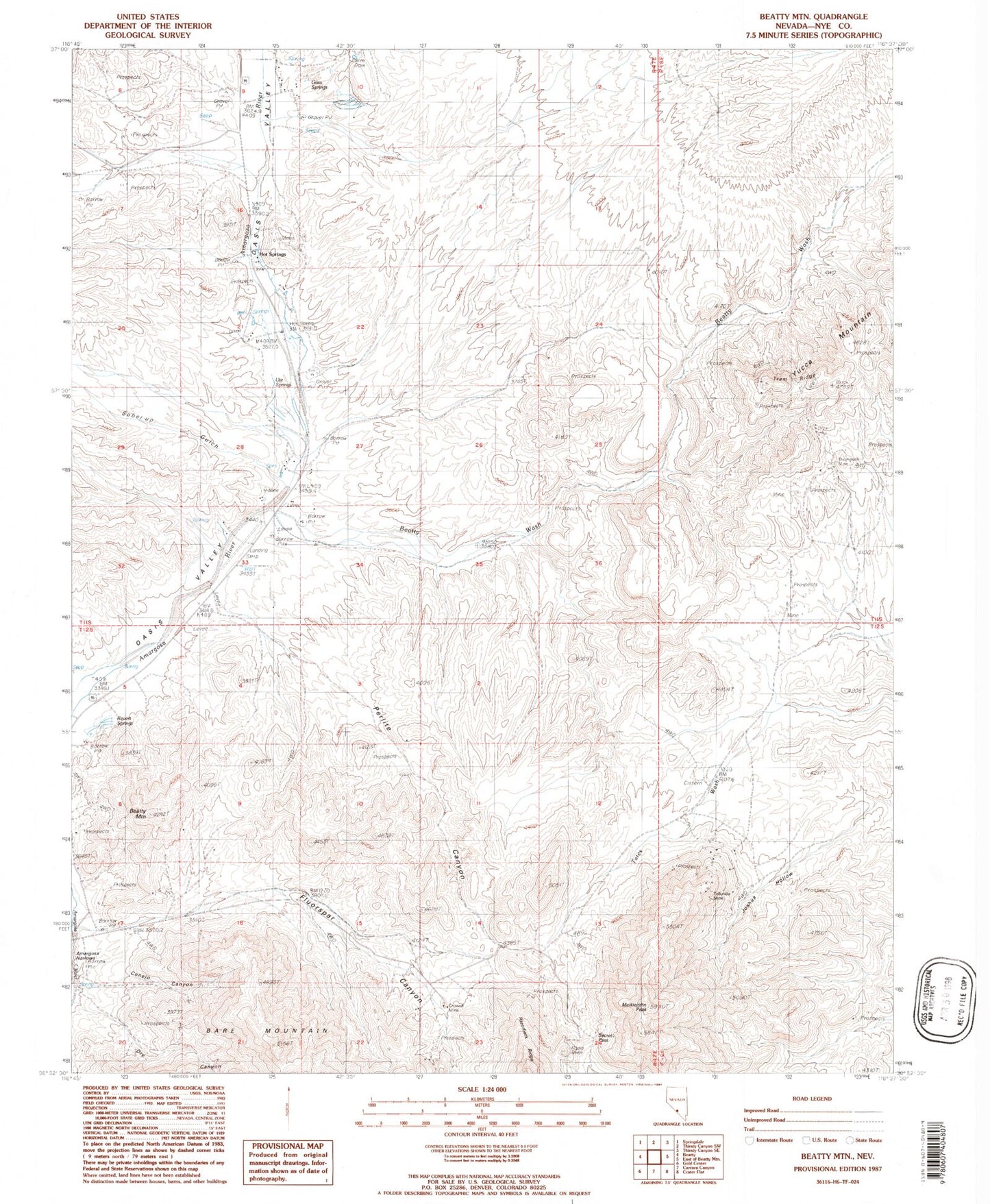
Classic USGS Beatty Mountain Nevada 7.5'x7.5' Topo Map
Couldn't load pickup availability
Historical USGS topographic quad map of Beatty Mountain in the state of Nevada. Map scale may vary for some years, but is generally around 1:24,000. Print size is approximately 24" x 27"
This quadrangle is in the following counties: Nye.
The map contains contour lines, roads, rivers, towns, and lakes. Printed on high-quality waterproof paper with UV fade-resistant inks, and shipped rolled.
Contains the following named places: Beatty Census Designated Place, Beatty Mountain, Beatty Springs, Beatty Wash, Burrell Hot Spring, Conejo Canyon, Crowell Mine, Daisy Mine, Fluorine, Fluorine Post Office, Fluorspar Canyon, Frans Star Ranch Airport, Goss Springs, Harvey Mine, Hot Springs, Joshua Hollow, Meiklejohn Peak, Perlite Canyon, Revert Springs, Rider, Secret Pass, Silicon Mine, Sober-Up Gulch, Tates Wash, Telluride, Telluride Mine, Thompson Mine, Tip Top Mine, Tram Ridge, Trueba Ranch, Ute Springs, Vickies Star Ranch, ZIP Code: 89003