MyTopo
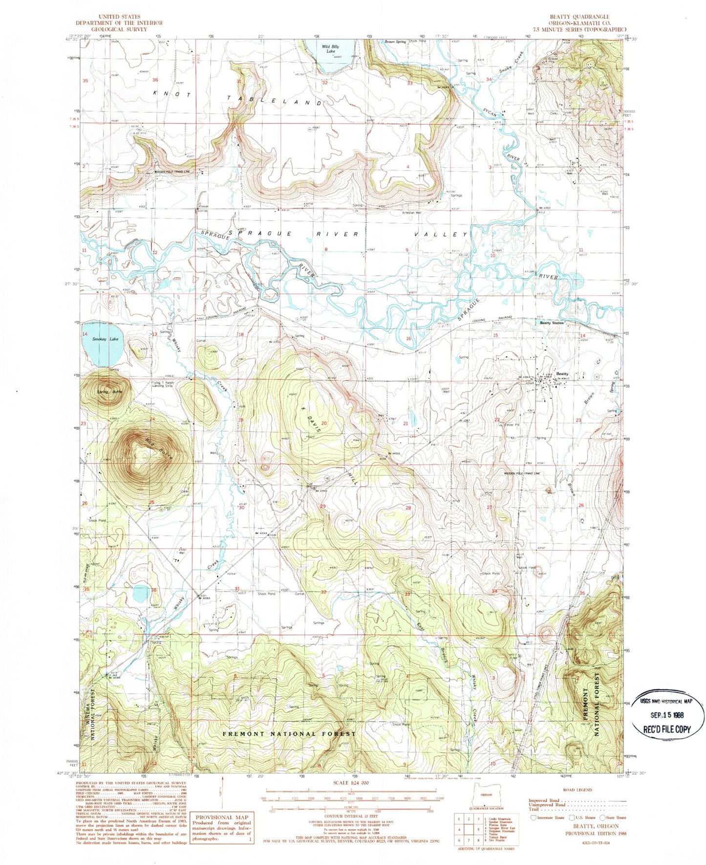
Classic USGS Beatty Oregon 7.5'x7.5' Topo Map
Couldn't load pickup availability
Historical USGS topographic quad map of Beatty in the state of Oregon. Map scale may vary for some years, but is generally around 1:24,000. Print size is approximately 24" x 27"
This quadrangle is in the following counties: Klamath.
The map contains contour lines, roads, rivers, towns, and lakes. Printed on high-quality waterproof paper with UV fade-resistant inks, and shipped rolled.
Contains the following named places: Beatty, Beatty Census Designated Place, Beatty Post Office, Beatty Station, Brown Creek, Bug Butte, Chief Schonchin Cemetery, Crater Lake Camp, East Branch Whisky Creek, Flying T Ranch Airport, Gunsight Well, K Davis Hill, Klamath Reservation, Lola K West Spring, Modoc Billy Creek, Paiute Cemetery, Smokey Lake, Snake Creek, Spring Butte, Spring Creek, Sycan, Sycan River, Whisky Creek, Wild Billy Airport, Williams Drain, ZIP Code: 97621